Tag: #jogle #endtoendtrail #thruhike #hiking

  • Up hill, down dale

    Up hill, down dale

    Day 42: Horton-in-Ribblesdale to Malham 

    ?  23.60km

    ?812m

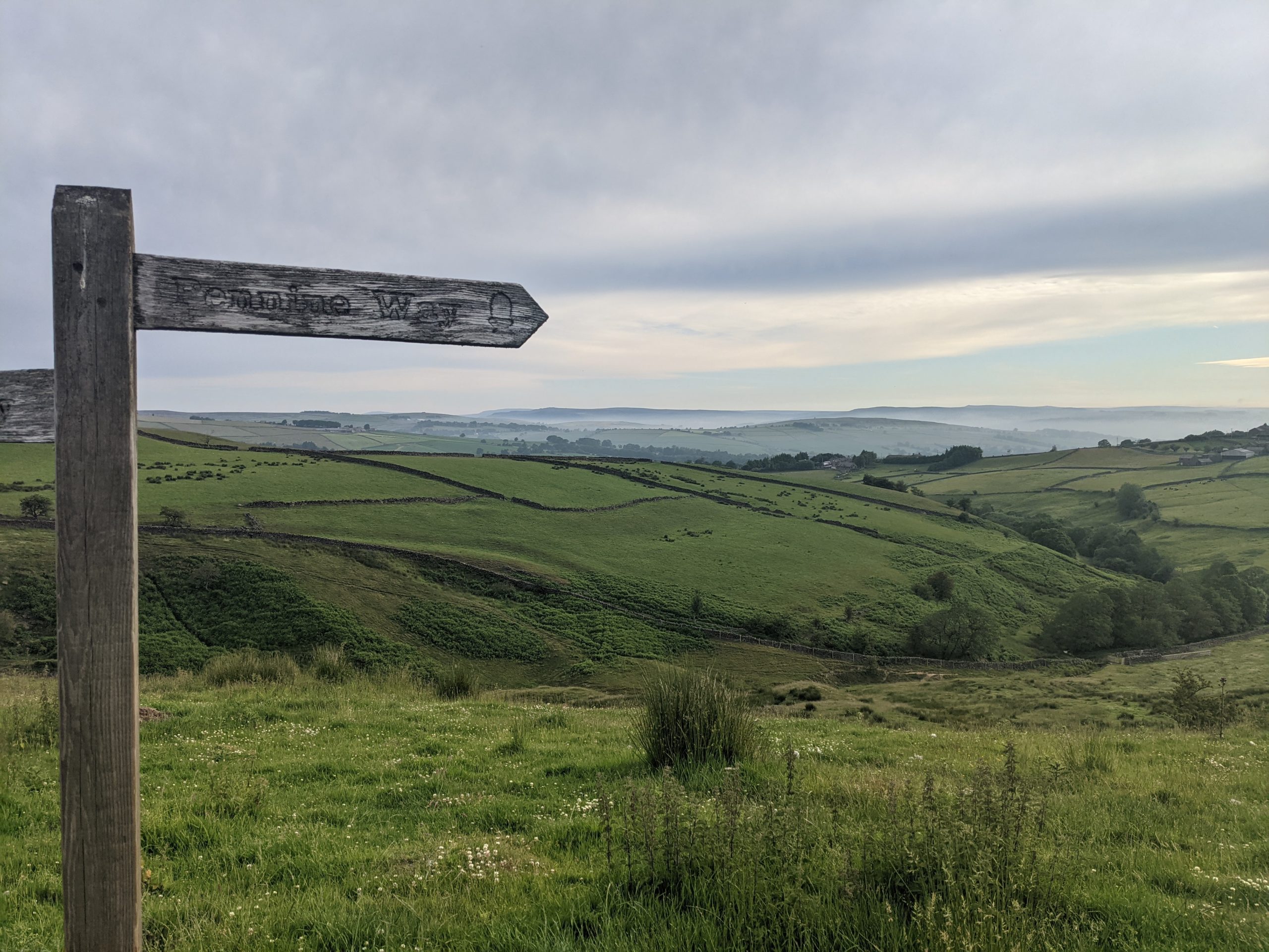
    Felt pretty hungry when I woke this morning, so gradually ate breakfast a bit at a time as we packed up.  Only felt able to eat a bit at a time, not huge appetite like normal, despite the hunger.  We got going at 0730 and left Malham for the long ascent to Pen-y-Ghent.  It was already warming up but we had a nice breeze to keep us cool on our way up.  The views back across the dales to where we had walked yesterday were pretty damn good! We passed quite a few people on Yorkshire 3 Peaks days out coming the opposite direction.  After the obligatory selfie at the trig point on top of Pen-y-Ghent, we started the descent which was much steeper than the route we had ascended, and soon left the the 3 Peaks route to continue on the Pennine Way where we hardly saw another soul until much later in the day.

    Pen-y-Ghent

    We crossed the valley and climbed up over Fountains Fell, great views again on either side as the cloud had continued to lift and it was getting warm and sweaty!

    We started to cross paths with other humans again at Malham Tarn, a National Trust area.  The foot traffic reached a crescendo at Malham Cove, with the jeans and trainers gang joining in, and we were just on a mission to get to camp now, both feeling pretty whacked.  Malham Cove was kinda cool, some interesting rock structures and impressive to see, but we didn’t feel like hanging around.

    We pitched and showered, then realised our camp spot had no mobile signal for the football later.  I discovered a spot with better signal on the other side of the field so we picked up the tent and moved house. ? We both felt like something cold to drink and eat as it had been a warm one, and found it just round the corner at Beck Hall in the form of lemonades and ice cream.  It was way over priced but we didn’t care!

    Back at the campsite we managed to watch England beat Germany although we were a good 30 seconds behind some D of E lads who were also watching, so we knew when goals went in before we saw them ?.  Had dinner, did the usual routines and zonked! ?

    Day 43: Malham to Cowling

    ?  30.19km

    ?754m

    The sun was shining right on the tent when alarms went off at 0600.  We were packed up and on the move by 0710, things already warming up and a nice day ahead.  I felt much better, my appetite and energy seemed to be back after a short hiatus the past couple of days. 

    We followed Malham Beck, then the River Aire for a few km and then across farmland, up hill, down dale, to Gargrave.  We passed a nice eclectic little cafe/sweet shop and stopped. It was 1000, nearly elevenses! ?‍♂️.  We had crumpet/teacake and coffe, got some sweets from the myriad of jars behind the counter, and I took an ice cream to go.

    Back on trail, the glorious weather continued (sure it’s hot but i’m not complaining!) as did the views.  We were entering Cravendale country and there sure were a lot of cows!  It was rolling Yorkshire countryside and we barely noticed the ascent and descent racking up.  There was also a nice section along a canal, much nicer than our prior canal path experiences on the trip.

    Funky bridge

    We crossed Elsack Moor, met two couples on the way, both excited by our journey and wishing us well.  The temptation of the pub in Lothersdale was almost too much but we continued up and down a couple of steep hills including Cowling Hill, and met another fellow hiker who was on the Pennine Way northbound. We chatted for a few minutes and discovered he had also planned to do the PCT this year, but had postponed to next year. Shortly after that we reached Squirrel Wood campsite in Cowling.

    Drone perspective
    Dales

    It’s a nice quiet campsite, walkers only.  The guy who owns it is a bit of a chatter so I’ve not investigated the ‘Bar’, I think it’s a honey pot trap and I might never get away.   It was getting late so we went halves on a £1, 5 min shower and then sorted dinner. I had a bit of a stretch whilst my gourmet noodles and cous cous ‘cooked’.

    Day 44: Cowling to Hebden Bridge (Old Chamber Farm Campsite)

    ?  28.83km

    ?798m

    We got going by 7, aiming to get to Hebden Bridge around lunch time, get some shopping, then continue 1 km or so to our campsite in the hope of having time to do some clothes washing and drying.  It was a nice morning again and promised to be another warm one.  We climbed out of the dale, on to the moor, and had great views back down with atmospheric haziness in the valley.  The top of Ickornshaw Moor was bleak, flat and brown, such a contrast to the green fields and meadows of the dales.

    Next up Withins Height, sharing some of the way with the Brontë Way, and passing a derelict farmhouse rumoured to be the inspiration for Wuthering Heights (apparently! ?‍♂️).

    We skirted Walshaw Dean Reservoirs and then followed Alcombden Water, later Hebden Water, all the way in to the busy town of Hebden Bridge. We’d had good paths much of the day and made good progress until we joined the path at Hebden Water which was narrow, rocky and undulating to begin with.  It settled down and improved, and was a nice walk along the river in a deep gorge with some shade from the woodland lining the river.

    In the end we made Hebden Bridge by around 1415, picked up some food at Co-Op, and sat by the canal to eat a late lunch.  I grabbed an ice cream to go and we started a steep ascent up the hillside south of Hebden Bridge to our campsite for the evening.  The camping field is on quite a slope and they have created some flat ledges for pitches.  It was already very busy and we got the last flat pitch. Unfortunately the washing machine was out of action, it transpired that someone had stolen the plug off the back of it within the last day or so!  It’s by far the best view we’ve had from a campsite, looking back over Hebden Bridge and the hills beyond.  

    Campsite views
  • The real highest point!

    The real highest point!

    Day 36: Greenhead to Alston

    ? 30.54km

    ?848m

    We were looking forward to a relatively easy day, expecting about 26km and 600m ascent.  Not sure where the extra came from, and the conditions underfoot were not easy although at least mostly dry.  There were also a lot of gates and stiles as we passed through a lot of sheep grazing farmland.  All this contributed to a longer day than expected and we both felt it psychologically and physically. 

    Fields of wild flowers

    We couldn’t really complain as we passed a few more participants of The Spine Race who were mostly very chatty and happy to stop for a minute or two to ask what we were up to.  One lady had had 20 mins sleep on the first and second nights, and had been seeing dinosaurs eating houses amongst other hallucinations! ?‍?

    In what was a fairly boring day, one of the highlights witnessing a couple of rams getting in a bit of mating season practice on each other.

    No, not a picture of the ?!

    We had booked a hotel in Alston a couple of weeks back so we were really looking forward to getting there early afternoon, which didn’t happen.  Upon reaching Alston we played bull in a China shop, squeezing through narrow aisles of the Co-Op, grabbed a gas canister from the outdoor store and then made our way to our hotel, the Lowbyer Manor Country House.  It was a lovely hotel, really old school and quirky, in a brilliant way.  I showered and then put my feet up whilst destroying a tub of Ben & Jerry’s and a Punk IPA.

    We ate at the Cumberland Inn, both had Cumberland Sausage, and then I had a STP – the sponge was good, nothing special, but the sauce was great plus custard AND ice cream, all added together to make a damn good STP! The Pennine Pale Ale was good too!

    Day 37: Alston to Dufton

    ? 33.17km

    ?1057m 

    I’d completely forgotten before we arrived yesterday that our hotel included breakfast!  We  had planned an early start with a long day ahead, so we were first to breakfast at 0800.  We helped ourselves to cereals, yoghurt, juice, then I had a full cooked breakfast and Katie had scrambled eggs and smoked salmon.  We left rather full and we’re grateful that the first ascent of the day didn’t start right away!

    To start off we were walking along a river to Garrygill village, very pretty little place. The ascent really started from there, gradually climbing along a decent track up to an old mining area where the track continued but was rockier.  We reached Greg’s Hut, an MBA bothy, and sat outside to eat our lunch.  Before moving on we checked out the bothy, wrote in the log book, and chatted to a father a son doing the PW in 10 days.  They commented that another son/brother had started with them but quit after 3 days.  I got the feeling he wouldn’t be hearing the end of that! ?

    The cloud had covered the tops first thing and had been lifting through morning.  By the time we reached the top of Cross Fell (the highest point of the End to End Trail – we lied previously in a post from Scotland, that was the highest pass on the trail, not the highest point!) it was a glorious day and we were treated to views of the Lake District and the Yorkshire Dales.  We spent some time drinking in the views and getting the obligatory trig point selfie before we crossed the Moreland on Cross Fell and had a series of up hill, down dale, taking in Little Dun Fell, Great Dun Fell and Knock Old Man.

    The descent to Dufton was quite steep in places, reaching farmland and tracks in to Dufton.  It had started raining as we were closing in on the village and we put up tent in the rain and cooked dinner.

    The rain didn’t ruin what was a great day, our second biggest so far in terms of ascent, the highest point on the trail, and some epic scenery.

    Cross Fell Trig Point

    Day 38: Dufton to Kirkby Stephen

    ? 28.02 km 

    ?469m 

    It rained pretty much all night and was still raining in the morning.  The wind had also really picked up in the night.  Thankfully the campsite was quite sheltered but the wind had blown all sorts of tree debris everywhere by the morning.  Checking the weather, it was due to rain all day and the mountain weather forecast suggested the cloud would cover the tops until the afternoon at least.

    Our route today was described by the guidebook as one of the best days of the trail and definitely the best of the Pennine Way.  It would take us past High Cup Nick, which looks pretty cool, and to a height of around 600m.  After taking the cloud cover, wind, rain, and the fact we had no paper maps for this section, we decided to take an alternative route and instead stop in Kirby Stephen tonight, then rejoin our End To End route at Keld tomorrow evening.  It also would mean two slightly shorter days than we had planned, which would hopefully help on the blister front.

    Plan B – The Pennine Journey

    We were conveniently able to follow another marked trail, The Pennine Journey, which was mostly easy to follow and took a lower level route through farmland and along the River Eden.  It wasn’t a bad route and although it rained all day, it was only of the significantly wet variety for an hour or so.  The highlights were probably some vivid green meadows and fields, offset against the dark grey moody clouds.  That and a couple of squeaky bum moments passing through small fields full of rams who seemed rather interested in us, grunted a lot and followed us looking aggressive.  We’ve passed other groups of rams on the trip who didn’t appear as interested/grumpy.

    Moody

    Towards the end of the route, the Pennine Journey took a bit of a circuitous route and we opted for a few km of quiet B road as we were rather damp.  We stopped off at Co-op and stocked up on food, then continued through town to our campsite.  Unfortunately the washing machine was broken so we hand washed some socks and hung up damp clothes to dry.  After a shower we found a nice comfy sofa in The Engine Shed, the on site bar.

    We checked out a route for tomorrow and did a DIY link up of trails using the OS app to get an 18km off road route to Keld.  It was this or about 15km on a minor B road.  The weather is looking like it will clear up nicely so should be a no brainer!

    We had a pizza from the pop up pizza van at the campsite and ate that with our other supplies for dinner in the bar whilst we caught up on some journals and other things.  It turns out that Kirby Stephen is on the Coast to Coast trail route so you never know, might be back here sometime!

    The Engine Shed
  • Blisters in the Borders

    Blisters in the Borders

    Day 30: Just outside West Linton to an Orchard near Innerleithen

    ? 40.30km

    ?571m

    Midge Mayhem

    It was a beautiful morning but we were under house arrest by the midges.  Katie nipped out for a wee first thing and quite a few followed her back in.  We packed up, surrounded, and made haste!  Ironically, after being relieved to leave the tarmac behind on the canals, we opted for an easier start to the day to help Katie’s feet get going (her blisters are pretty bad right now!) and followed the road all the way down in to the pretty little village of West Linton.  I had a takeaway second breakfast of bacon and black pudding roll with brown sauce.  Katie had a cuppa.

    We continued on along the road for a bit, out of West Linton, before the route took us off in to the hills, again following the Cross Borders Drove Road national trail.  After a fun encounter with some interested cows, we passed through fields, forests and valleys on gently undulating, varied terrain.  It was nice walking.  We crossed a river and washed a pair of socks, hanging them on the back of our bags to dry as the good weather continued all day.

    We reached Peebles after about 28km of walking at around 1315, visited Tesco first for some food and medical essentials for a couple of days, then went looking for lunch.  We had read about a bakery but they only had sweet things so I took a ginger cream biscuit and a chocolate brownie cronut for later and the search continued.  We found a cafe but it was just closing (at 1400, ?‍♂️), so once again the search resumed and on the third attempt we got seated and ordered.  Chilli chicken flatbread and ginger beer for me, a brie and cranberry toastie and orange San Pel for Katie.  Portions were good, and we had happy tummies.

    We had a choice from Peebles to get to Innerleithen/Traquair.  We could take the trails to Traqauir, continuing to follow the Cross Borders Drove Road, or we could take a tarmac (?) path that stayed low in the valley, following the river Tweed.  In the end we opted for the tarmac.  It was shorter and quicker so it meant less time on feet and more time in camp for Katie to tend to her poor feet.  We found a nice grassy footpath initially along the river and then joined the tarmac.  It wasn’t all bad, the views were nice and it meant I could again walk without the knee brace.

    We found an orchard in a field just off the path, and set up camp, just with the inner of the tent initially which was nice.  It was a glorious sunny evening and we had dinner whilst resting weary feet.

    Orchard evening sun

    Day 31: Orchard near Innerleithen to Melrose

    ? 40.30km

    ?571m 

    We rejoined the tarmac by the Orchard and walked in to Innerleithen, topping up on liquids at the Co-Op there.  Katie was having a bad time with the blisters this morning.  What was originally a blister on each heel, was now double whammy on one of the heels, one on the inside of a big toe and one on a little toe on the opposite foot.  If I’m honest, they looked horrendous, and I wasn’t sure how she was still going, oh wait, yes, she is one very stubborn mule!  About a week now battling the blisters and the last couple of days seem to have been hell.

    Little Miss Piggy

    We were planning on wild camping this evening which meant not exactly knowing how far we would be going today but it was always going to be at least 35km.  Katie initially declined a hotel option, but after about 30 mins of walking, just as we were turning off the tarmac, on to the trails, Katie decided a hotel room would help her get through the day and also meant we would know how far we had to go.  We could also assess and treat the blisters a bit better, have a decent meal, a beer or two, and the England vs. Scotland football game was on so all good!  We booked one of the last rooms in Melrose (I presume as it was a Friday night) and got going on the trail.

    Today, we would be following the Southern Upland Way (which is also for this section the Cross Borders Drove Road that we followed yesterday) which is actually a coast to coast route, around 450km.  We were heading east for the day, following the Scottish national trail thistle in a hexagon waymarker.  We gradually ascended Minch Moor, where I took a quick detour to the top  (567m) to check out the view, whilst Katie continued.  We could see in the distance, the Eildon Hills which were just outside Melrose, our target for the day.

    From then on, we undulated through the day and enjoyed some great views and lovely varied trails.  The landscape has completely changed since leaving the Highlands and today was the best so far since then.  Everywhere you looked there were lumpy bumpy hills, not a flat piece of land anywhere.  The weather was great, big fluffy clouds, patches of sun and (mostly) warm temperatures.  Whilst descending from the Three Brethren, 3 large cairns on top Hareshaw Hill, we chatted briefly with a local couple who said that on any normal year (i.e. without covid), we would have found hundreds of horses and people at the top, drinking whisky, dancing and singing (the people that is).  This was apparently the day of the Selkirk Common Riding, such a shame we were not treated to that spectacle!

    B-e-a-utiful!
    The Three Brethren

    We continued though fields of sheep, reaching Gala Hill and traversing round it through a lovely forest.  We descended to join a nice path along the river, then had to walk through some less scenic housing and industrial areas by Tweedbank, before some more nice riverside trails to finish the day.

    In Melrose we checked in to the King’s Arms, showered, and did some reading up on blister treatments.  I nipped to Boots before it closed for an assortment of medical supplies, and also some duct tape from the Spar shop.  We had dinner in the pub, the food was decent but the beer selection wasn’t great.  It was getting busy with it being Friday night and the football on.  We opted to retire to our room, and drain Katie’s blisters (cos that’s how we roll on a Friday night).  I dashed to the Co-Op for beers and ciders, and a 1 litre tub of Mackie’s Chocolate Orange and Honeycomb ice cream, which we enjoyed whilst watching the football (which was pretty dull on the whole).

    Set for the night

    Today marked 1 month on trail, stats as follows;

    Per Day

    • Max Time: 11:10:00
    • Max Distance: 42.02
    • Max Ascent: 997
    • Avg Time: 06:54:15
    • Avg Distance: 24.57
    • Avg Ascent: 483.68

    Totals

    • Total Distance (km): 761.67
    • Total Ascent (m): 14994

    Km per day

    • Zero: 1
    • >0, <10: 0
    • >=10, <20: 9
    • >=20, <30: 11
    • >=30, <40: 8
    • >=40, <50: 2 
    • >=50: 0

    Sleeping Arrangements 

    • Wild Camp; 14
    • Campsite: 9
    • Cabin/Pod: 1
    • Bothy: 2
    • Hostel: 1
    • Hotel/Pub: 3
    • B&B: 0

    Misc.

    • Beers: 26
    • Sticky Toffee Puddings: 5
    • Sunday Roast Dinners: 3

    Day 32: Melrose to Jedburgh

    ? 31.30km

    ?686m

    We took a bit longer getting ready this morning, taking advantage of a shower and getting Katie’s blisters ready for the day’s walking.  Eventually departing the pub at 0830, we didn’t get far before spotting a cafe that looked like it had a decent coffee so we had a brief pause and got one each to go, plus a brownie, cos, why not!

    The day started with quite a steep climb up and over between two of the Eilden Hills we had spent much of yesterday heading towards.  Today we were following the St. Cuthbert’s Way for the most part so again, the waymarking was good and easy to follow.  There were a few showers in the morning but the views were still great and we were in some lovely woodland which kept the worst of the water off us.

    We again enjoyed a great mixture of trails and after the initial hills, the route gently undulated through forests and fields, along rivers, past curious cows.  The weather cleared mid morning, remaining mostly cloudy but stayed dry for the best part of the day and the sun made the odd appearance.  We joined an old Roman road, Dere Street for the first time towards the end of the day, which was most visible from the drone shots I took.  These days the trail meanders in between field and through woodland.

    We reached our campsite on the edge of Jedburgh just after 1700.  We needed to stick up on some food and don’t go through town tomorrow morning so I had a quick jog down the road to the Co-Op.  On my return I grabbed a shower, we ate, watched the grand Prix qualifying, then caught up on some journals and photos.

  • “You’re going the wrong way”

    “You’re going the wrong way”

    Day 24: Strathfillan Wigwams Campsite to Beinglas Farm Campsite

    ? 15.94km

    ?397m

    It was raining when my first alarm went off at 0600.  It was raining when my second alarm went off at 0630.  It was raining every 10 minutes that I snoozed the alarm for an hour.  Eventually, at 0730, it wasn’t raining and we decided it was probably time to get moving.  We packed up, used the facilities, and put the tent away whilst it still wasn’t raining.  The forecast was showers all day and sure enough, within a minute of leaving the campsite, I had to put on my waterproof trousers. Soon after, we passed a sign that informed us we were in one of the wettest parts of Britain.

    Wet Facts

    Shortly after leaving camp, we were climbing through some nice forest.  It was probably the nicest hour or so of forest walking we have had on the whole trip and we started passing a few northbound hikers as we exited the forest and descended to Crianlarich.  From there it was pretty straightforward through the valley Of Glen Falloch, following the river Falloch to our campsite at Beinglas Farm.  We followed the road most of the way and the path did a reasonable job of being far enough from it not to see it, but it could be heard.

    We only covered 16km today, so arrived at Beinglas just in time for lunch, a ham and cheese toastie, with a pint of beer.  Taking advantage of a dry spell, we got the tent up then took showers.  We grabbed a seat in the bar around 1700 and got drinks, then dinner around 1800.  We both went for lasagne, which came with salad, coleslaw and garlic bread.  Solid pub grub and big portions.  The choc fudge cake and ice cream fitted snugly on to the pudding shelf.  Back at the tent we watched the first episode of Jeremy Clarkson’s Farm show on Amazon.  We had seen earlier that, unsurprisingly, an ever predictable Guardian write up had given it 1/5, in fact it was actually pretty entertaining.

    Just about to get heads down at 2100 and I can smell burgers being cooked on a BBQ, making me hungry again! ?

    Day 25: Beinglas Farm Campsite to Millarochy Campsite

    ? 32.79km

    ?855m

    We had a big day ahead and needed to hit the shop at the campsite before we left so we were waiting at the door ready to go when it opened at 0730.  We both grabbed a roll for lunch, some snacks, and Katie got some more Compeed blister plasters.

    Full waterproofs were required, contrary to expectations and off we went, headed for a day of walking along the eastern edge of Loch Lomond.  Sounds easy right, walking along the edge of a Loch? Nice and level, not too much elevation? Wrong!  The trail was undulating in the same why the South West Coast Path undulates – big time!

    We warmed up pretty quickly and with the rain stopped, but threatening, we had to de-layer and risk it. Passing some goats with massive horns required holding your nose as they smelt so bad, like gone off goats cheese. Soon, Loch Lomond was revealed for the first time and we started our journey along its edge. We had heard walkers in the pub last night saying how tough this section had been and before long it got a bit technical, lots of roots and rocks.  Personally I loved it, nice single track going up or down most of the time, never flat.  At times we were right by the loch, walking past stony beaches, others we were in really nice woods with huge pines and mossy floors.

    There was quite a bit of passing others and at one point a mountain biker (carrying the bike at the time – much if this section is quite literally unrideable) decided to squeeze past Katie, rather than wait just a few more moments for her to reach a wider part of the track.  His foot was right on the edge of the track which gave way and he went head first, with his bike, sliding down the side of the trail towards the water.  He managed to stop after a couple of metres, his mate got down to him and helped pull his bike off which I then lifted on to the trail and the biker scrambled his way back up.  We checked he hadn’t dropped anything and his mate joked only his pride was left down there. ? If only he’d been a bit more patient.

    We stopped for a nice lunch break by the loch and continued, soon reaching the first holiday park/campsite of the day at Rowardennen.  The temptation of a cold fizzy can of pop was too much and I joined the queue in the bar, however the queue was too much, and I couldn’t be arsed so we continued with our thirst unquenched.  From there we had about 7km more to reach our goal for the day and now that we were in an area near a road and holiday parks, the trail was easier underfoot, however it still went up and down like a roller coaster!

    Forest trails

    We arrived at Millarochy Campsite around 1730, where we had booked a tent pitch, and the lovely people here informed us that we could pitch in the backpackers area for less and they would refund the difference on our booking!  Lovely stuff.  They also had ice creams so Katie had a Cornetto and I had a Magnum.  We deserved it.

    Tent pitched, we showered and then made use of the backpackers kitchen area to cook and eat, as the midges were out, and after us!

    Food Diary

    Thought it would be fun to keep a track of the food and calories eaten today, not as much as I thought!

    Breakfast
    • 2 waffles – 240 cal
    • Peanut butter/choc spread combo – 100 cal
    • 4 dried figs – 54 cal
    Lunch
    • Cheese and pickle roll – 300 cal
    • 1/2 bag crisps – 375 cal
    Dinner
    • Packet of Ainsley cous cous – 354 cal
    • Packet of noodles – 271 cal
    • Mange tout – 50 cal
    • 1/2 pack jerky – 80 cal
    • Birds Instant Custard – 150 cal
    • 1/4 Yorkshire Tea Loaf – 231 cal
    Snacks
    • Magnum White Chocolate & Cookies – 235 cal
    • 2 handfuls of peanuts – 250 cal
    • Stroopwafel – 180 cal
    • Nakd Bar – 137 cal
    • Kind Dark Chocolate Nuts & Sea Salt Bar – 214 cal
    • 1/2 pack peanut M&Ms – 300 cal
    Total: 3521 cal

    Day 26: Milarrochy Campsite to Drymen Campsite

    ? 18.13km

    ?555m

    We hit the trail just after 0700 knowing we had a bit of a lump to climb over and around 15km to a Sunday Roast at the Clachan Inn in Drymen.  We continued where we left off yesterday following the edge of the loch, until heading east and starting the climb up Conic Hill.  We were now among not only other WHW hikers, but also the day hikers too.  There was a lot of huffing and puffing.  Not from us though.  We made our way slowly up and stopped to take a few pictures looking back over Loch Lomond.  The cloud had lifted just about in time and it was a view to savour for a few minutes!

    The WHW doesn’t actually take us to the top of Conic Hill and we figured we had seen as good a view already as we would get a few more metres up so we stuck with the main trail and started descending.  We walked through forest and farmland for a couple of hours and the sun started to peek out as promised.  We had our first ‘your going the wrong way’ comment today after 6 days against the flow on the WHW, Katie quickly piped up “Not if you’re walking to Lands End!” which stopped the fella in his tracks for a moment!?  We soon popped out on to the A811 and headed into Drymen for lunch.  We were early so we did a quick shop for the next couple of days food at a Spar.

    The Clachan Inn didn’t disappoint and did a decent roast.  Katie went for ham, I had the beef.  This is becoming a bit of a tour of Britain’s Sunday Roast, so we started scoring them.  Today’s scored a solid 7 out of 10.  Decent meat, great potatoes and Yorkshire pudding.  Veg was nice but lacked anything green, and no cauliflower cheese.  The sticky toffee pudding, our fourth of the trip, scored an excellent 9, equalling that of Garrison West in Fort William.  They didn’t even blink when I asked for ice cream AND custard.  What’s this ‘or’ malarky all about?

    By the time we finished lunch the sun was shining and it was about 23⁰C!  We still had 2-3km to do to get to the campsite for the night so off we trotted, back along the road out of Drymen, picking up the WHW again, through some fields and then back on to a road before arriving at the campsite, right on the trail.  We pitched up and took advantage of extra time to relax in the sun before showering, doing our normal routines stuff and dinner.

  • “Oh you’re one of those”

    “Oh you’re one of those”

    Day 21: Fort William to Kinlochleven

    ? 22km

    ?167m

    Today we started the West Highland Way going southbound. Established in 1980, it starts in Milgavie, north west of Glasgow, and finishes in Fort William and is 96 miles long. It is a well established route and very popular, but we would be walking against the crowds.

    The West Highland Way

    We woke early and snuck in a last shower before heading out the campsite. Despite knowing we will be going through towns fairly frequently from now on we both still got stupidly carried away in Morrisons the day before and my backpack was worryingly heavy.

    We joined the route out the site and followed it’s gradual ascent up through the forests and along the forestry roads. The cloud was very low and soon we were in it, with the light rain upon us, jackets were on but we were a bit late with the waterproof trousers. About 09:00 we came across our first walkers coming towards us who asked us how much longer they had to go until the end. After this there was then a steady stream of people some happy and excited it was the last day, some smiling through gritted teeth and a couple who were obviously not having a great time. The rain got a bit heavier before easing off for the rest of the day. The views through the valley were lovely and we made good pace despite significant ascent as there was zero navigation to be done. 

    Blurry Wet

    We had both picked up new shoes from Fort William so we’re nervous but in the end pleased how they were doing for us after 23KM.

    We stopped just before town to eat our lunch, some left over pizza from the day before, and then decended into the town passing some late starters and mountain bikers on our way down.

    We arrived about 14:30 to the wooden hut we had booked. Basically a shed with bunk beds in, that you put your own sleeping bag on but it was the power sockets that you really pay for. We showered because we could, and it was quiet, then headed to The Bothy Bar to update the blog and read about what was to come ahead on the route.

    We had the best burger yet for dinner and another sticky toffee pudding. Time to start a sticky toffee leader board, another column in Tom’s spreadsheet added. ?

    Day 22: Kinlochleven to Inveroran

    ? 32km

    ?902m

    Leaving our pod it was dry, but the mist was looming. We left Kinlochleven via a big service road parallel with some hydro power pipes. About 10 vehicles, a mixture of trucks and land rovers, passed us on the way up to start their day but we never saw where they ended up as we then came off the road onto a much nicer trail. By this point it had started to rain quite heavily and was blowing into our right side. We were basically in the cloud, but walking along a decent path towards devil’s staircase.
    We put an extra layer on just before popping over the top where a group of 4 ladies were celebrating reaching the top from the other side.

    The rain had eased off a bit and we descended devil’s staircase carefully as we met a few people coming up. They were from all over and all abilities including a lady carrying a bike.
    We then reached the main road and the path traversed nicely along it so we didn’t have to contend with any traffic, it was narrow here however and we had to wait for several people to pass by. As with the day before there was such a variety of enjoyment on the faces that came towards us. We followed the road for quite a way and stopped at the super plush Kingshouse, for a tea and hot chocolate.

    Before Descending Devil’s Staircase

    Then we set off out into the drizzle and it didn’t stop, I was fully waterproofed up Tom had opted for shorts and waterproof top because it was not actually that cold temperature wise.
    We walked almost up to Glen Coe ski resort and then followed a very boring cobbly road that ran through Rannock Moor, we were head on into the wind so the rain felt worse than it probably was but it was safe to say we were pretty soggy, and after several km’s I finally figured out that the funny taste was the smidge being washed off my face by the rain. We passed several soggy faces on the way through, including a lovely lady in her late sixties who joked about how boring it would be to hike in the sunshine and when we told her what we were up to she said ‘oh you are one of those’, she was absolutely delightful.
    We approached the Inveroran Hotel, and set the tent up in the dedicated ‘wild camping’ spot before continuing with our bags to the bar. We were drenched and glad for a chance to dry out which kept the barman busy mopping up our puddles. We sat with a cuppa for me and a pint for Tom before pre ordering beef and Guinness pie for supper, which was amazing!!

    Day 23: Inveroran to Strathfillan

    ? 21km

    ?438m

    We were rudely woken in the night by some car horn honking and more rain but generally had a good night’s sleep in our ‘wild camping’ spot.
    Next door a young group of 4 had set an early 05:45 alarm and were up negotiating thier morning logistics soon after. We snoozed our 06:00 alarm since it was raining, and started to get ready just before 07:00. Wrapping up in waterproofs expecting the worst, we packed up our tent and were first out of camp and pleased to find it was actually windy and dry.

    Cloud Slowly Lifting

    We made our way back passed the hotel that we had dinner at and climbed a steady up and over to avoid the road, reaching Bridge of Orchy where there was nothing much but a big hotel and the railway station. We went under the railway and then continued on a wide gravel track along the tracks, passing those who had started the day early as well. The path was very similar most of the way and we just avoided ascending into the cloud and therefore even though the wind was in our faces we stayed dry.
    After about 14km of very similar path with unfortunately little view, because of the low cloud, we arrived at Tydrumn. We couldn’t resist a cup of tea and hot chocolate at the Green Wellie Stop, an American style service station with toilets and gift shop. We have visited one before on a previous trip to Loch Ness and thought they were hilariously great.

    We then looked at our next few days and the food we had available, booked Sunday Roast in Dryman and decided to have lunch down the road and save our waffle and jam lunches for our big day along Loch Lomond on Saturday. So we made the 500m journey down the road to The Real Food Cafe for a burger, after which we headed out again arrived at our camp spot within the hour and got the tent up minutes before the first rain of the day came down.

    When I took my shoes off I fustratingly found a blister on each heel, lower down than where I was getting pain before and wondered if the new shoes had a different pinch point. Looks like the Compeed will be on for the next few days and hope it won’t make the harder ground to come more painful than it already will be. Tonight is our first DIY evening meal and we have a combination of Pot Noodle with Broccoli, then Tea Loaf and custard for pudding.

    Beautiful Evening Sun

  • Fort William ‘zero’ day, and gear changes

    Fort William ‘zero’ day, and gear changes

    Day 20: Zero in Fort William

    We had our first ‘zero’ today in Fort William and had a few tasks to complete in town.  We were staying at a campsite out of town so we walked about 3km, taking the scenic route rather than the road, and arrived just as the post office opened.  I collected our packages whilst Katie grabbed us a coffee and we found a spot to sit in front of the cinema to sort a few thingsout.  First, new shoes for both of us.  I was pretty sure mine would fit as I have had the shoes before (New Balance Fresh Foam Hierro Trail) and they popped on like slippers, no worries!  Katie had also ordered the same and seemed happy but kept her old ones on for now as we had to visit a few shops and she wanted the opportunity to look at other options.  We also had a package from Katie’s parents with some new bag liners, maps for the next part of the trip, and a new water container to replace one of mine which was leaking.  Lastly, an Amazon order containing a small cork massage ball to help deal with foot issues.  Bam! Post office sorted, we started hitting up the outdoor stores for various things including a puncture repair kit for Katie’s sleeping pad, a couple of tent pegs (we left one somewhere so are one short, plus one spare), gas cylinder, a new Buff for me, and a few other bits and bobs. The only thing we didn’t find were some more injinji toe socks. I’ll have to order online to get delivered further up trail.

    In between some of the outdoor stores we ransacked Boots for some supplies and last of all Morrisons for food.  Our first resupply shop.  We only needed 2-3 days worth of food.  Not sure what happened but an hour and a half later it seemed like we had come out with a ton!  To be fair, I don’t think we really went too overboard in the end, certainly more than we needed, but not a silly amount.  And although we have to carry it, shopping some bulk things in Morrisons here will be cheaper than on trail.

    Shopping done, we had pizza and beers, at the Black Isle Brewery bar here in Fort William.  We stayed in the Black Isle Brewery bar/hotel in Inverness the night before we started at JOG so seemed fitting, and their pizzas, ciders, and beers are spot on! We both got the chorizo pizza and packed a couple of slices away for tomorrow’s lunch.  The final task was to post a few things back home including the shoes I’ve been using this far (they have plenty of mileage left in them) and, of course, my antler!

    With all of our tasks complete, we grabbed an ice cream and headed back to camp.  By the time we had both sorted out our food and things for the next stint of the trip, it was about time to get dinner going.  The same as last night, it was real nice.  I took care of my feet and we got our heads down excited to start the next chapter on the West Highland Way tomorrow!  Today was another beauty so really hoping that the forecast rain isn’t too much over the next few days and we still get some sunshine! ☺️☀️?

    Some gear updates

    Shoes (Tom) – Adidas Terrex Free Hiker GTX –> New Balance Fresh Foam Hierro Trail

    I opted for a waterproof shoe to begin with, and after extensive testing of a few options, went this the Free Hiker. The Hoka Speedgoat GTX failed the waterproof test, the La Sportiva option failed the comfort test, and another, more walking boot style Adidas option had a sole that slipped around in the shoe way too much!

    So the Free Hiker, in summary;

    Positives
    • Really appreciated having the waterproof shoes.
    • Waterproofing really did work.
    • Soles held up well – around 420km on varied surfaces – tarmac, gravel, soft ground, bog etc.
    Negatives
    • Laces need changing. They are quite fat, round, and hard. There is little cushioning in the tongue/around where laces are positioned. This resulted in bruised ankle bone area on left foot and aggravated/bruised bone (Accessory Navicular) in right foot. Lace change could help.
    • Laces became undone easily.
    • Probably half a size too big, thought I would be wearing for more time.
    Why change now?

    Aside from issues with laces causing significant discomfort, in heat (it’s summer, should be getting warmer as we head south!) they will be too warm and just end up wetter in than out! Also expecting ground conditions to be drier in general so less need for waterproof.

    Shoes (Katie) – Inov-8 something or other –> New Balance Fresh Foam Hierro Trail

    Katie’s shoes had done a few miles before we started and were falling apart a bit so she opted for the same New Balance as I did. She also had some heel pain so hoping that subsides with a change of shoes and more cushioning/padding.

    Socks

    I tried a combo of an injinji toe sock inner with a stance outer. Didn’t really work for me and unlikely to need that thickness going forward. Will replace stance socks with a second injinji hiking sock (to rotate wear, wash/dry, each day), and keep inner for evenings/night (as had forgotten socks for evenings and the toe socks go well with my sandals. ☺️. Have ordered a pair to a campsite we are staying at this Friday.

  • Mountains, midges, and a milestone

    Mountains, midges, and a milestone

    Day 16: Glen Affric to Cluanie Inn

    ? 11.34

    ?242m

    We left Glen Affric knowing that we only had 10 or so km to cover, with not too much ascent, to get to our overnight stop at the Cluanie Inn.  I was looking forward to a beer! ?  The route, for some unknown reason, took a marginal short cut through a fenced off area where some re-foresting was being attempted, rather than taking the river trail, which the route met with later anyway.  Perhaps the woodland area wasn’t there when the route was created.  After making slow progress through tufty ground, around and through trees, and stepping into a covered hole, around knee depth, I had a bit of a sense of humour failure!  We should have just followed the river path.

    Views across to the Cluanie Estate

    Once we had joined the marked path, we made better progress but it was still tough going underfoot, and as we walked over the pass, a visible path was intermittent.  Things improved on the other side and we were soon on a vehicle track heading down to the main road (A87).  Only 2 more km along the road and we were there!  It was a busy road with fast moving traffic and not too enjoyable to walk along.  We were thankful for a good verge and even more thankful to reach the Inn.

    We were early so our room wasn’t available yet and so we sat in the bar for a couple of hours.  I had the beer I had been looking forward to, and we ate an early lunch from the bakehouse over the road which is part of the Inn.  Unfortunately both Katie’s salmon and cream cheese baguette and my cheese and ham toastie were underwhelming at best.  The ginger cake upped the game a little but the lemon drizzle needed both more lemon, and more drizzle.

    The service was a bit strange so far at the Inn, whilst done up to try and be authentically Scottish, lacked soul.  I guess I was expecting a traditional Scottish Inn as we have experienced elsewhere so far.  Things improved when they made our room available around 1300 and within a few minutes the contents of our bags were strewn everywhere, clothing had been washed and was drying on radiators which had been whacked up to max level.  Katie showered and then I had a bath since there were some bath salts ?‍♂️.  Strangely I had to fill it with the shower since there were no taps.  And to be clear, the shower was over the bath. ☺️

    We returned to the bar and I had another beer whilst we planned the next part of our route from Fort William, along the West Highland Way.  It’s a busy route so we opted to book some campsites which wasn’t easy as some were full, but we got there in the end.

    Things started to get a bit busier around dinner time and it was entertaining people watching.  At one point the staff tried to sit two parts of separate families on one table thinking they were together.  This caused much confusion.  The food was decent, Katie had a beef burger and I had a chicken burger.  We had some fries and stir fried Asian vegetables on the side (the burgers came with crisps! ?‍♂️).  Then chocolate ice cream for Katie and Scottish Bread Pudding with extra vanilla ice cream for me.  It was good, I slept well on a well fed tummy. ?

    Day 17: Cluanie Inn to Glenn Garry (Loch Poulary)

    ? 16.89

    ?524m

    I took full advantage of the mornings breakfast offerings at the Cluanie Inn and had some cereals, fruit salad, full cooked breakfast with toast and the good bits from an almond croissant which I’m sure was a leftover from yesterday since the rest of it was tough as old boots.  The coffee was surprisingly decent filter coffee, and strong, so I had a few refills.  Ultimately this resulted in a pee stop every 5 minutes throughout the rest of the day.  We had a good giggle when I realised I had sprinkled Demerara sugar over my breakfast too, I hadn’t read the packet or paid attention, thought it was pepper. ??

    After checking out we hung out for a bit in the lounge before getting going about 11.  We only had around 15km to go today and mostly on marked paths, so no rush.  There was also uncertainty over the camping spot with no obvious nice location as we’ve had previously so didn’t want to arrive too early in the day.  We had allowed for the possibility of having to cover 25-30km today, mostly along the busy A87, should the river Loyne have been in spate and un-crossable.  To our relief, about a week now of dry weather meant we could avoid this hellish prospect and take the shorter, cross country, route.

    We made good progress on a tarmac road initially, through the Cluanie Estate, before branching off to head south over to the river Loyne valley and we crossed the river with ease.  We didn’t need to stop for lunch as such today after a big breakfast, just grazed on snacks.  Climbing again to walk over to the next valley, we passed through a fenced re-forested area, then on over and descended, filling up on water from a stream along the way.  Across the valley, the hillside was deforested and heavily scared by tracks used by the machinery.  Thankfully we were heading east for a couple of km to take a path south that looked like it headed into some of the remaining forest. ?

    Reflecting on the Cluanie Inn as we strolled along today made me think of Fawlty Towers and made me want to watch an episode.  I wonder it it’s as funny as I remember it being when I watched it as a kid…

    It was about 1630 when we found a camp spot just by the river and got setup.  There was a good breeze when we arrived, but as soon as this dropped shortly afterwards, the midges were on us.  Not too many, but enough to make us dive for cover.  Things soon got fruity in the tent as the midges prevented me from heading down to the river to wash my feet and I had to have a wet wipe wash in the tent.  We played ‘squish a midge’ with any midges than managed to wiggle their way in whilst the doors were briefly open, and set about our usual routines.

    Midges

    Only two evenings of Firepot dehydrated meals left now, Orzo Bolognese for me tonight.  They are good and I’ll miss the ease of them.  From Fort William in a couple of days time we pass shops frequently so will get whatever we need as we go.  I was also thinking today of a hiking blog I read last year in which a hiker’s top tip was to always eat the thing in your pack that you fancy the most.  So with that in mind I polished off the rest of a Ritter Sport marzipan chocolate bar that I had been saving.

    Day 18: Glenn Garry (Loch Poulary) to Gairlochy

    ? 24.61km

    ?746m

    We woke up to a damp tent, and there were still midges everywhere.  We packed up and made ready to jump out and pack up the tent as quickly as possible.  We did pretty well but it was horrendous, they get right in your face and I had given up on the head net which seems to be about as much use as a chocolate teapot.  We got moving sharpish as they can’t keep up if you’re walking.  Peace at last!

    Leaving camp

    We were climbing from the start, gradually up through (de)forest, then up onto the open country.  There was a decent track to follow and the higher we got the better the views got behind us.  Weather was perfect, big fluffy clouds and sunshine casting cool shadows over the landscape.  When the trail ran out we bee-lined for the pass, the Bealach Carn na h’Urchaire, which, at 648m, was the highest point of the trail.  The views were stunning and in front of us the first view of Ben Nevis.

    The descent was.steep at times, following a stream to begin with where we topped up on water, then joined a path continuing by the stream and later a gravel track down to the road along the northern shore of Loch Arkaig.  After a couple of km on the road heading east, we turned south again and joined the Great Glen Way as far as Gairlochy where the Caledonian Canal begins.  There is a spot here where camping is permitted by know of the lochs.  I guess it’s ‘semi-wild camping’, there are no facilities but it’s quiet and we are the only ones so far.  Plus the midges don’t seem so bad so far, winner!  Just as we zipped up for the night the rain started.  The first significant rain in about 10 days, we’ve been so lucky with the weather recently!

    Day 19: Gairlochy to Fort William (Nevis Campsite) 

    ? 19.95km

    ?61m

    A lazy start this morning, we set off around 0830 for the last stretch along the Caledonian Canal to Fort William.  The canal was nice enough, lovely views and a flat gravel path.  Not much more to say than that as it changed very little for about 12km to Lochyside. We played dodge a snail to pass the time. ? We reached the edges of suburbia, skirting it at first alongside the river, until we entered Fort William, conveniently right by Morrisons where we picked up some food for dinner.

    Continuing through town we arrived at our Sunday lunch stop.  We were an hour early after making good time along the canal path and so sat with a drink for a bit, celebrating reaching Fort William, our first big milestone.  We both had beef brisket with veggies and a Yorkshire pudding, then the sticky toffee for pudding.  It was really good, as were the beers.

    We made our way out of Fort William to Nevis campsite, found a spot and did some clothes washing whilst also scrubbing ourselves.  When you only have one set of clothes, you don’t have much choice but to sit there in your waterproofs whilst things wash and dry.  Luckily it wasn’t too warm a day.  Chores done we enjoyed a dinner of broccoli, garlic, lemon and parmesan pasta.  I followed up with custard and ginger cake.  Gotta get those calories in!

    A well earned Sunday roast & drinks ??

    Fort William concludes the first section of our journey, and possibly the toughest.  Certainly the most remote.  We should only need to carry a couple of days worth of food at a time now, since there will be shops, pubs etc. throughout most of the rest of the trip.  Tomorrow we are having a ‘zero day’ in terms progress on the route.  We need to go in to town to collect and post some things at the post office and do a bit of shopping  to top up on snacks and other essentials like sun cream, insect repellant etc. 

    How things add up so far;

    • We’ve walked a total of 430km (265 miles) and ascended 8250m.
    • We averaged 22.64km per day.
    • Our longest day was 37km and took 9 hours 48 minutes.
    • We’ve wild camped 10 times, stayed in 2 bothies,  2 campsites, 1 hostel and 3 hotel/pubs.
  • Antlers, lochs and (possible) falling rocks

    Antlers, lochs and (possible) falling rocks

    Day 10: Strath Mulzie to Inverlael

    ? 13.85

    ?310m

    We woke in a cloud filled valley and packed up a very wet tent and donned full waterproofs before setting off.  The cloud lifted with us as we climbed out of the valley and we were soon stopping to peel a layer off, then stopping again to peel another layer off…  After descending to cross the river in Glen Douchary, we were just about to leave the main track when I spotted a deer antler!  Not the full shebang, head and two antlers deal, but a decent single antler.  Pretty darn lucky to find it right by the track like that and a great souvenir, so I strapped it to my pack and will post it home from Fort William.

    The second climb was on difficult terrain without much of a path for most of the way.  Occasional vehicle tracks helped pick a good route over the flat boggy pass and we eventually picked up the gravel track on the other side which took us steeply down towards Inverlael Forest.

    Trail silliness

    Along the way we met Adriene and Peter who were out on a day hike, the first hikers we’ve met whilst it walking so far, after almost 350km!  We also met an geologist who was going up to check on some peat restoration work that was going on.

    Blue sky day

    We then had to walk a few km along the busy A835 which is part of the popular NC500 route, to our accomodation for the night at the Forest Way Bunkhouse.  We were a bit early arriving so took advantage of cafe just nearby.  An can of orange San Pellegrino hit the spot on such a hot day and both the ginger and courgette cakes were delish!

    At the Bunkhouse we meet a group of four hikers who were in the area climbing a few Munro’s.  They very kindly provided us with a glass of red to go with our bolognese Firepot camping meals, which we ate al fresco since the weather was so warm and no sign of midges yet.  We also received our first ‘trail magic’ from the group in the shape of a couple of Tunnocks bars, and some skittles. ?

    Trail Magic!

    An alternative route for tomorrow was suggested by Iain who owns the Bunkhouse, which would save us walking back on ourselves up the busy A road, so we will take that to tomorrow’s camp spot at Loch an Nid.  The only downer was realising that we had planned to get to Fort William on a Sunday so the Post Office will be closed. Will need to decide how we can revise our schedule to fix this as we have a package or two to collect there.

    Day 11: Inverlael to Loch an Nid

    ? 18.88

    ?452m

    We set off this morning in just shorts and tops.  Following the route suggested by Iain the previous evening, we were soon walking along a lovely river side path which soon began climbing the gorge that the river flowed through and there were many waterfalls and pools.  We crossed a rickety old bridge above one of the falls and climbed a bank to emerge on a B road which we had to walk a couple of km along before taking a path that leads to Loch a’ Braoin.

    Enjoying the waterfalls on the gorge walk

    We had misheard or been misinformed about a new path the opposite side of the Loch to the one shown on the OS maps.  At some point in recent years, the water level of the Loch had been risen a couple of meters in connection with a hydro power project, and the track alongside the Loch had been moved too as some was flooded.  We realised after not seeing a track on the other side of the Loch that the new track followed the same (northern) shore which we followed and eventually came to Lochivroan bothy where we stopped for lunch, sat on a bench outside in the sun.

    Continuing, the path deteriorated but was easy to follow round to Loch an Nid and we arrived around 1430. After setting up camp in the shadow of 3 Munro’s, I went to collect some water from a stream fed by the waterfall we can see.  It’s crystal clear, not like the peat filtered stuff from earlier on in our journey, and tasted so gooood!

    The last End to End trail hiker to pass through

    With extra time after a shorter days walking, I did my usual thing and had time to get the drone out, then do some photo management and backups.  An early night ready for smashing it over to Kinlochewe tomorrow morning.

    Day 12: Loch an Nid to Kinlochewe

    ? 18.61

    ?403m

    After a slightly disturbed night with us both waking around 0200 to the sound of what I think was a rock tumbling down one of the nearby steep sides of the valley (and had thought about this when pitching the tent but figured we were in a reasonably safe place, not that it helped in the middle of the night!), we woke to clear blue skies, the sun already glowing on the surrounding mountain tops.

    Beaut of a morning

    We got an early start and set off to find the path that would lead us up to the Bealach na Croise, a pass with a small loch at the top.  There was a good path most of the way but for about 3km at the top it was a matter of finding your own way, again around a few boggy areas, but much easier than some of the previous missions.  We were rewarded with views of Loch an Fada once we were over the pass and I couldn’t resist a quick dip once we got down to the loch.  It was fricking cold and I didn’t really do it justice!

    From Loch an Fada we followed a nice undulating single track trail down to the valley of Kinlochewe Heights, picking up the estate road through the valley, then tarmac into Kinlochewe.  Easily three busiest day in terms of other hikers on trail, and even a couple of bikers, with it being a bank holiday.  We made it just in time for the village store which closed at 1300 on a Sunday, I grabbed an ice cream, we each guzzled a fizzy pop, and topped up on a few snacks.

    We checked in at the motorhome campsite only to find that their tent pitches are a bit of turf on top of the gravel laid down everywhere so you can’t actually stick any pegs in the ground properly. This really ground my gears. Luckily it’s not windy.  We spent the afternoon relaxing, did some clothes washing for the first time on the trip and had a wicked Sunday Roast at The Gorse Bush to finish off the day.

    We have had a few easy days recently and I’m feeling a bit frustrated that we aren’t doing longer days, partly because I’m not very good at not doing nothing, so arriving at camp early afternoon like we have recently seems weird to me.  We needed to rearrange our schedule to be in Fort William when the post office is open so this either meant having a big day tomorrow, or having an extra day in Fort William and having a rest day.  In the end we chose the latter.  Although it means our next two days are again a bit on the short side, we are also in the heart of the Scottish Highlands now and there is more climbing to be done in terms terrain, not to mention it’s a nice place to hang out. ?  We are both still nursing foot issues that we haven’t seen before on such trips which is frustrating, but we need to manage them and not rush it!

    Teamwork makes the dream work
  • A tale of Lodges, a Bothy, and an Inn.

    A tale of Lodges, a Bothy, and an Inn.

    Day 4: Dalnawillan Lodge to Knockfin

    ? 22.5km

    ?447m

    Weather wasn’t too bad today, on and off sun/showers all morning then the afternoon was mostly sun/cloud with the odd light sprinkle.

    The track passed a couple of derelict lodges before leading us past the Glutt Lodge by Glutt Water (a tributary from source that feeds the Thurso) where we filled up. Water from the tap was straight out the burn, bits and all, we filtered and it tasted pretty damn good!  A good track continued past a cosy walkers hut maintained by the keeper at the Glutt Lodge and we sheltered there for an early lunch, avoiding a short shower.

    A couple of km after the hut we left the track and headed over the desolate bog that is Knockfin Heights, following Glutt Water to its source before locating the trig point atop the bog which involved picking our way through a boggy maze.  Unfortunately, during this tricky ascent, I slipped and broke one of my trusty trekking poles ?.  Some in the field DIY has done a reasonable job recovering it for now, until we reach Fort William an 10 days or so.

    We then picked up Knockfin Burn at its source and followed it down into the beautiful flat area looking across to Lochside and the Loch an Ruathair where a sheep fold provided the perfect camping spot (aside from the zillions of ticks -. No camp spot ticks all the boxes ?) near the ruins of Knockfin.

    Took the opportunity to wash my feet in river, stretched, ate, reviewed our route for the next two days and and we indulged in watching the Monaco F1 Qualifying Highlights courtesy of 4g ?. 

    Day 5: Knockfin to Loch Choire

    ? 37.10km

    ?432m

    After a cold night, knowing we had more than 30km to walk today, we were on our way by 0700.  We had a day of dry weather to look forward to and we were somewhat disheartened to only cover about 4km in the first 2 hours, picking our way through some boggy terrain alongside Bannock Burn, climbing a deer fence, and eventually meeting the road to Kinbrace.

    We had decided to take the wet weather option rather than trying to cross the river on the main route, and that meant walking the road down to Kinbrace, past the train station, where we stopped for second breakfast snacks, then a few km more before turning off onto a gravel estate road which was in good condition and meant we started knocking off the km’s a little more quickly.

    The estate road continued for around 20km through stunning Highland scenery and we saw so many deer is not even that novel anymore!  Loch Choire eventually came in to view and we passed the hunting lodge, then taking the South East route alongside the side of the Loch, through first and past small sandy beaches.  We eventually reached the proposed camping spot around 1700 to find it didn’t look great, not to worry though as we discovered there was a Bothy we could stay in.

    A quick foot wash in the loch (considered a quick dip but my god it was cold!), arranged ourselves in the bothy and dinner before an early night, dreaming of just 10km tomorrow to get to The Crask Inn. ??? 

    Day 6: Loch Choire to The Crask Inn

    ? 22.5km

    ?447m

    The rain arrived just as we had gone to bed last night and was still coming down in the morning when we woke so we were very grateful to the Bothy for keeping us warm and dry.  We were disappointed not to have seen the resident Pine Martin in the night as advertised!

    We took advantage of our accomodation to have a hot porridge brekkie before tackling the inevitable wet walk up to the promise of beer and a warm fire to dry off by at the Crask Inn.  We followed a good track around the head of Loch Choire, crossing two rickety bridges on the way, and started the climb up over the pass.  Despite the rain, the cloud had lifted a little and an occasional glimpse behind us was rewarded with views of the loch.

    After heading over the pass the path became less obvious in places and it was much boggier.  It was a rather bleak section and we were heads down with the Crask Inn in sight for what seemed like an age!  With all the rain, the rivers and streams were high and we had a fun leap across to avoid getting soaked, think junior school standing long jump style.  Eventually we arrived and had made good time to get there by 1100.  Our room was ready so we promptly emptied our bags, dried things off and enjoyed a hot shower.

    We had sent a package to the Crask with our food for the next 9-12 days as far as Fort William so we organised it all between us and then relocated to the bar for tea (Katie) and beer (me) whilst we set about planning our days to Fort William, chatted to Douglas, the owner, and other guests, and were entertained by Brandy.

    Having got used to the guide we are using for the route, and our pace over the first 6 days, we had a bit more information to base our next few days plans on.  With the recent rains the rivers are also quite high, so we may need to look at some wet weather alternatives in the next few sections.

    We revised our route and timescales a little and will now take 13 days to Fort William, instead of our original 9 days guesstimate.  There are a few reasons for this;

    1. We need to take a few wet weather alternative routes due to the high streams.
    2. The wet weather route doesn’t include the Crask Inn so tomorrow we will walk to Lairg via some forest tracks, to a campsite near Lairg where we can pick up the wet weather route on to Okykel Bridge.
    3. Taking our pace into account and how we can logically break up the route.
    4. Whilst our legs seem to be adapting ok now after the first few days of aches and strains, our feet are taking a little longer so we are taking a few shorter days. It’s a marathon, not a sprint!

    We also booked a few accomodation options for locations because with some of the revised stops along the route, wild camping spots aren’t too easy to find.

    That all took about 5 hours so by the time we were done it was about dinner time and we were excited for some fresh vegetables!