Category: End to End Trail

  • Teacakes, Thunderstorms and Trail Angels

    Teacakes, Thunderstorms and Trail Angels

    Day 45: Hebden Bridge to Marsden

    ? 24km

    ?756m

    Our camp spot was beautiful, with amazing views of Hebden Bridge and the valley but I didn’t sleep well, the tents next to us and behind were noisy and the pitch was not entirely flat so I kept rolling into Tom. We woke early thinking we would get to Marsden and the pub where we had booked a room with lots of time to enjoy.

    The day however was a bit frustrating, an up hill, down dale day, crossing busy roads with not great scenery and required some navigational focus. As we were not following a particular trail but linking lots of footpaths together we had to keep checking that we were going in the correct direction. It was also another hot day which I am reluctant to complain about but the heat does make going under the motorway (M62) feel particularly disgusting.

    Zoom in to see the poor farm house that is straddled by the M62 ?
    A short, steep climb to leave the M62 behind ?

    A highlight of the day was as we were navigating the over grown footpaths out the back of the residential streets of Marsden we got chatting to a gentlemen tending to his garden and had a good old chat that included the old teacake, bap debate between Yorkshire and Lancashire which made me smile. In West Yorkshire, a large plain white or brown bread roll is called a teacake and is used to make very large sandwiches, something the rest of the country call a bap.

    Nearing Marsden

    We arrived about 15:00 to Marsden and were both shattered. We had to stop ourselves from taking a nap and instead showered, then hit Boots and Co-op, our go to stores at the moment. I needed some more antiseptic wipes for the feet and then we needed food supplies for a few days from the supermarket. We went to the local tap house for a pint before hitting kids tea time at the Italian across the road for pasta and pizza. We were back in our room and practically in bed by 19:30.

    Day 46: Marsden to Langsett

    ? 31km

    ?791m

    We woke about 06:00 after a warm, as we always find sleeping indoors these days, but much better sleep. Heels taped and bags packed up, we ate breakfast in the room and headed out into the drizzle by 07:30. The day started with a steep climb out the back of town passing some derelict mills but then onto a fabulous national trail, Kirklees Way, which was popular with some early dog runners. It was drizzling on and off but really was not that bad. We then turned off the wider track onto a smaller path down into a valley and joined a beautifully straight path which reminded us of the Roman road. It was at this point the heavens really opened and the rain was pouring.

    We descended into Holme and undressed in the door way of the Fleece Inn. We started with a coffee and then decided on a breakfast tea cake (we were just still in Yorkshire) as the rain was due to continue all day and night, so there would not exactly be a picnic spot for lunch. As we left the pub it actually had cleared up a bit and we enjoyed about half an hour of rain free walking along Brownhill reservoir. The rain then came down again as we joined a quiet tarmac road at White Gate. The birds by the road in the moor made me smile, so many different breeds almost playing in the rain, different sizes and colours, it was lovely.

    The final stretch of the day was along the Trans Pennine way which was just a tarmac cycle path, along a disused railway, which was quick but a bit hard going on the feet. By some miracle the rain had also stopped and we reached camp about 16:30 with a bit of blue sky and some sunshine to put the tent up along with an opportunity to dry off waterproofs at least.

    The Don

    Tom went to get a couple of pints and a pie from the Waggon & Horses down the road and I chilled in the sun, mourning the loss of my little toe nail.

    Lost toenail campsite

    We had a fabulous thunderstorm during the second half of England’s 4-0 victory over Ukraine, it was quite scary as we were up on a hill and there was a lot of rain in a short period of time but we survived ?

    Day 47: Langsett to The Fox House

    ? 34km

    ?1025m

    We knew it was going to be at least a 30km day today and we had a time target for a change, a treat at the end of the day was a shower, a bed & laundry along with an evening with my Mum’s best friend from school Mary and her husband Paul.

    We set off down the road and joined a forestry path towards Ladybower & Derwant reservoir noting down that the car park allows overnight stays. We took the main path up and over Mid Hope Moor, meeting a lady who was delighted about our trip, along with a few mountain bikers. I was impressed how many people were up and out so early after a Saturday night England win.

    Enjoying some dry weather

    We descended from the moor to the river and the main walk and cycle path around the reservoir where there were plenty of cyclists and lots of running club runners smashing out fast times, undoubtedly on Strava segments. We hung a left off the main path up the very steep National Trust Abbey Bank to get back up high and followed one of the many paths across Derwent Edge which had all its quirky stones. We ate our lunch at The Wheel Stone before cutting cross country towards Stanage Edge.

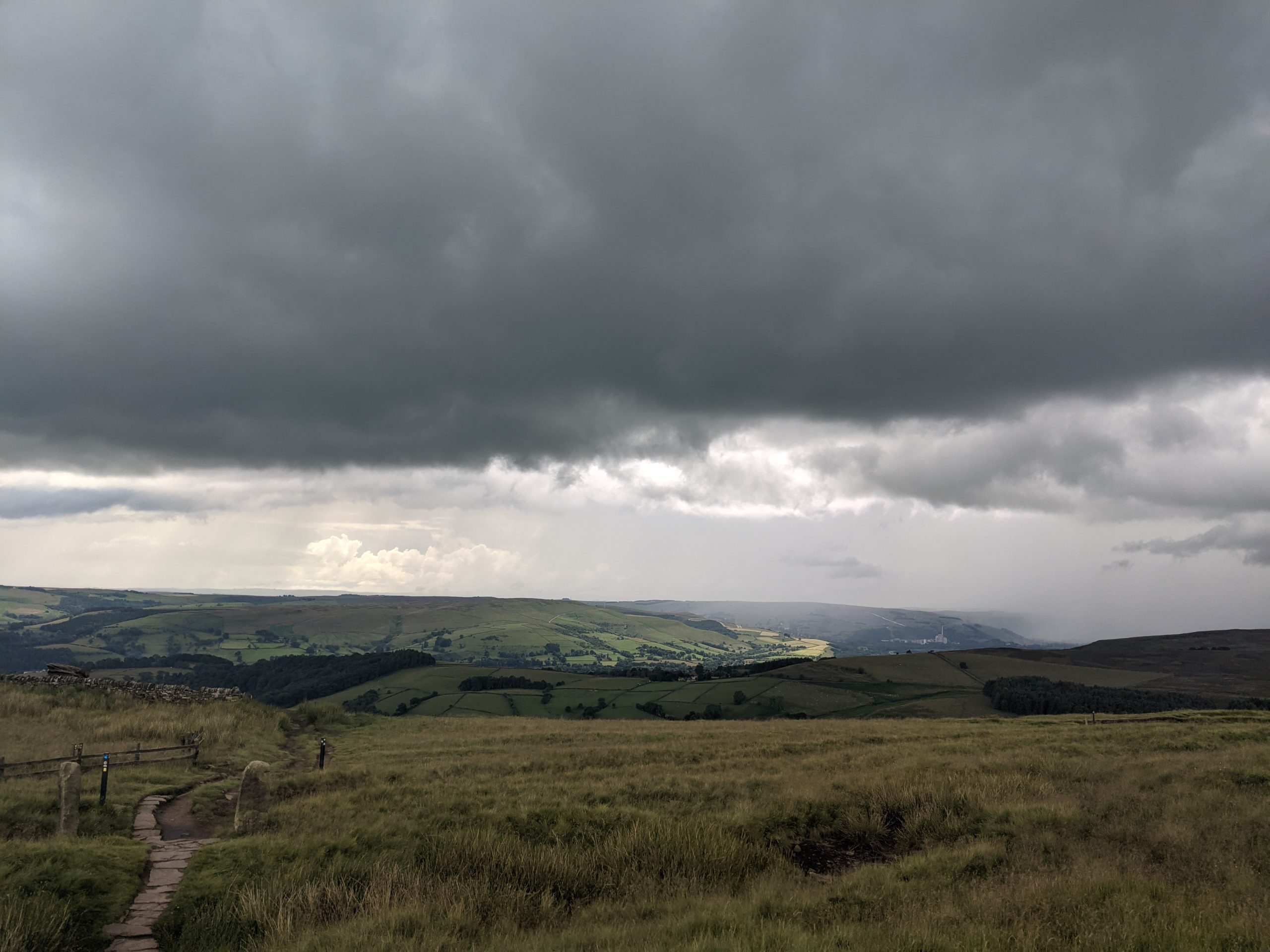
    As we joined the main path from the road the weather started to turn moody and the views back towards Mam Tor and down to Hathersage were incredible.
    The thunder rolled and rumbled and Tom was loving life, but I was a bit nervous. The heavens did eventually open and we waterproofed up for the final section at the top before descending down for our cross country route towards the pub.

    Watching Castleton being consumed by the storm
    Glad to be watching the worst of it from a distance!

    We got chatting to three young lads as we were going down who asked where we were walking to, and I think I shocked them with our story as they ascended up onto the edge in thier pristine white JD gear. Our cross country route was a bit slower than expected and we just made it to the pub in time for our 16:00 meet up with Mary & Paul.

    We had a dreamy evening at their beautiful cottage down the road in Eyam, showered, washed our clothes and had a stunning lasagne with am incredible salad, coleslaw and garlic bread, then a beautiful summer pud and Mackie’s ice cream.
    It was a fabulous evening and we even got to make up some sandwiches with home made bread, best packed lunch on trail yet.
  • Up hill, down dale

    Up hill, down dale

    Day 42: Horton-in-Ribblesdale to Malham 

    ?  23.60km

    ?812m

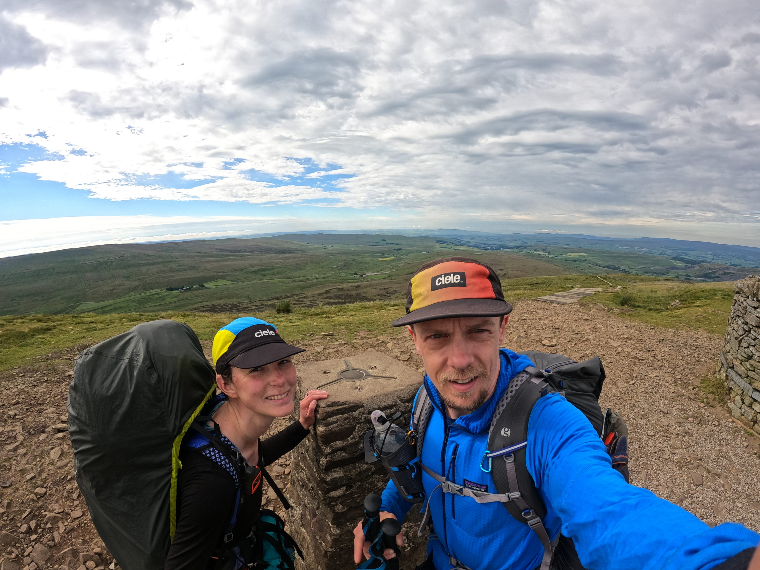
    Felt pretty hungry when I woke this morning, so gradually ate breakfast a bit at a time as we packed up.  Only felt able to eat a bit at a time, not huge appetite like normal, despite the hunger.  We got going at 0730 and left Malham for the long ascent to Pen-y-Ghent.  It was already warming up but we had a nice breeze to keep us cool on our way up.  The views back across the dales to where we had walked yesterday were pretty damn good! We passed quite a few people on Yorkshire 3 Peaks days out coming the opposite direction.  After the obligatory selfie at the trig point on top of Pen-y-Ghent, we started the descent which was much steeper than the route we had ascended, and soon left the the 3 Peaks route to continue on the Pennine Way where we hardly saw another soul until much later in the day.

    Pen-y-Ghent

    We crossed the valley and climbed up over Fountains Fell, great views again on either side as the cloud had continued to lift and it was getting warm and sweaty!

    We started to cross paths with other humans again at Malham Tarn, a National Trust area.  The foot traffic reached a crescendo at Malham Cove, with the jeans and trainers gang joining in, and we were just on a mission to get to camp now, both feeling pretty whacked.  Malham Cove was kinda cool, some interesting rock structures and impressive to see, but we didn’t feel like hanging around.

    We pitched and showered, then realised our camp spot had no mobile signal for the football later.  I discovered a spot with better signal on the other side of the field so we picked up the tent and moved house. ? We both felt like something cold to drink and eat as it had been a warm one, and found it just round the corner at Beck Hall in the form of lemonades and ice cream.  It was way over priced but we didn’t care!

    Back at the campsite we managed to watch England beat Germany although we were a good 30 seconds behind some D of E lads who were also watching, so we knew when goals went in before we saw them ?.  Had dinner, did the usual routines and zonked! ?

    Day 43: Malham to Cowling

    ?  30.19km

    ?754m

    The sun was shining right on the tent when alarms went off at 0600.  We were packed up and on the move by 0710, things already warming up and a nice day ahead.  I felt much better, my appetite and energy seemed to be back after a short hiatus the past couple of days. 

    We followed Malham Beck, then the River Aire for a few km and then across farmland, up hill, down dale, to Gargrave.  We passed a nice eclectic little cafe/sweet shop and stopped. It was 1000, nearly elevenses! ?‍♂️.  We had crumpet/teacake and coffe, got some sweets from the myriad of jars behind the counter, and I took an ice cream to go.

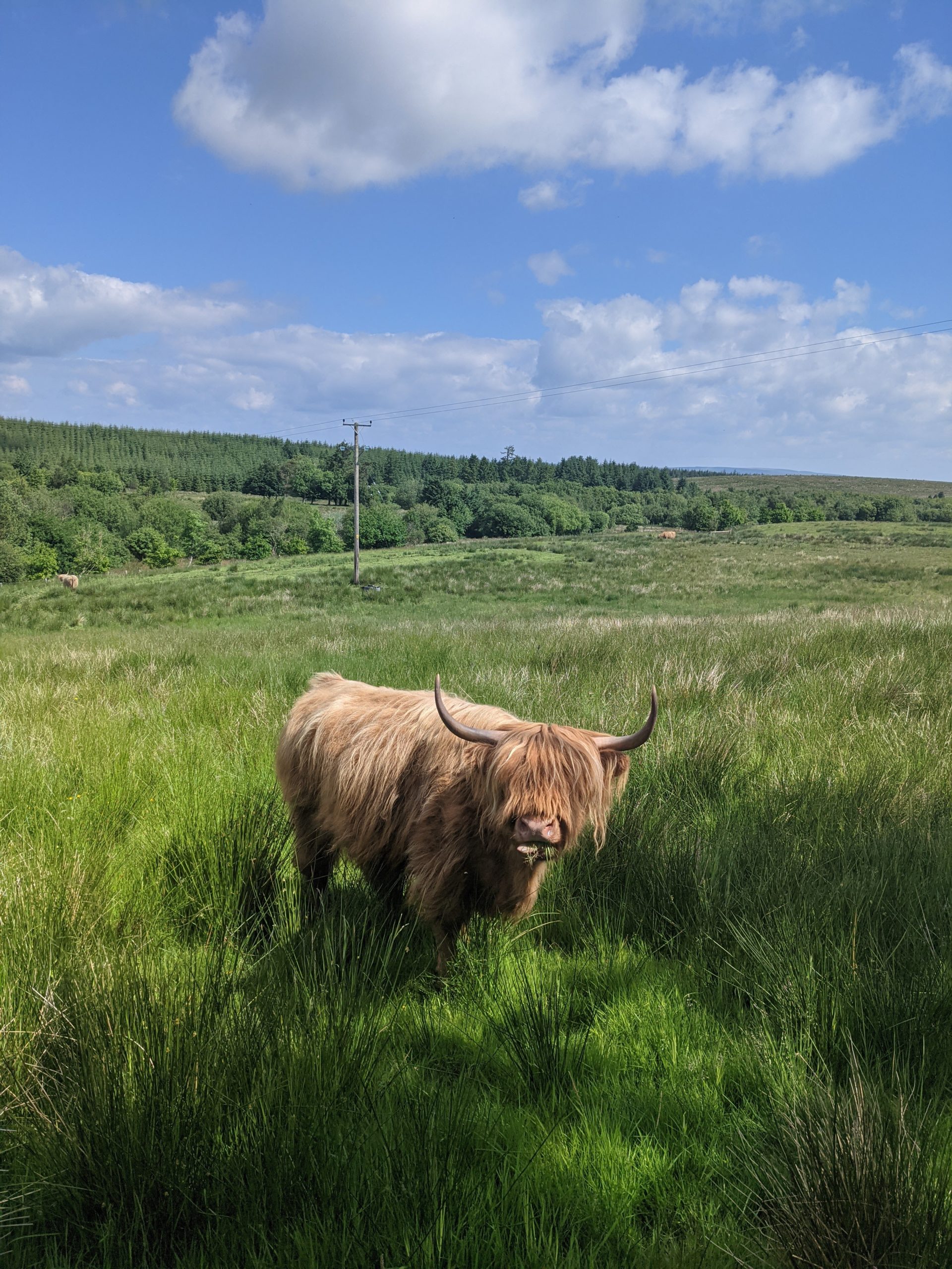
    Back on trail, the glorious weather continued (sure it’s hot but i’m not complaining!) as did the views.  We were entering Cravendale country and there sure were a lot of cows!  It was rolling Yorkshire countryside and we barely noticed the ascent and descent racking up.  There was also a nice section along a canal, much nicer than our prior canal path experiences on the trip.

    Funky bridge

    We crossed Elsack Moor, met two couples on the way, both excited by our journey and wishing us well.  The temptation of the pub in Lothersdale was almost too much but we continued up and down a couple of steep hills including Cowling Hill, and met another fellow hiker who was on the Pennine Way northbound. We chatted for a few minutes and discovered he had also planned to do the PCT this year, but had postponed to next year. Shortly after that we reached Squirrel Wood campsite in Cowling.

    Drone perspective
    Dales

    It’s a nice quiet campsite, walkers only.  The guy who owns it is a bit of a chatter so I’ve not investigated the ‘Bar’, I think it’s a honey pot trap and I might never get away.   It was getting late so we went halves on a £1, 5 min shower and then sorted dinner. I had a bit of a stretch whilst my gourmet noodles and cous cous ‘cooked’.

    Day 44: Cowling to Hebden Bridge (Old Chamber Farm Campsite)

    ?  28.83km

    ?798m

    We got going by 7, aiming to get to Hebden Bridge around lunch time, get some shopping, then continue 1 km or so to our campsite in the hope of having time to do some clothes washing and drying.  It was a nice morning again and promised to be another warm one.  We climbed out of the dale, on to the moor, and had great views back down with atmospheric haziness in the valley.  The top of Ickornshaw Moor was bleak, flat and brown, such a contrast to the green fields and meadows of the dales.

    Next up Withins Height, sharing some of the way with the Brontë Way, and passing a derelict farmhouse rumoured to be the inspiration for Wuthering Heights (apparently! ?‍♂️).

    We skirted Walshaw Dean Reservoirs and then followed Alcombden Water, later Hebden Water, all the way in to the busy town of Hebden Bridge. We’d had good paths much of the day and made good progress until we joined the path at Hebden Water which was narrow, rocky and undulating to begin with.  It settled down and improved, and was a nice walk along the river in a deep gorge with some shade from the woodland lining the river.

    In the end we made Hebden Bridge by around 1415, picked up some food at Co-Op, and sat by the canal to eat a late lunch.  I grabbed an ice cream to go and we started a steep ascent up the hillside south of Hebden Bridge to our campsite for the evening.  The camping field is on quite a slope and they have created some flat ledges for pitches.  It was already very busy and we got the last flat pitch. Unfortunately the washing machine was out of action, it transpired that someone had stolen the plug off the back of it within the last day or so!  It’s by far the best view we’ve had from a campsite, looking back over Hebden Bridge and the hills beyond.  

    Campsite views
  • If we can walk 1000km, then we can walk 1000 more

    If we can walk 1000km, then we can walk 1000 more

    Day 39: Kirkby Stephen to Keld

    ? 17km

    ?489m

    It took a while to get to sleep last night with it being a Friday night and we were at a campsite where big family groups were enjoying beers and BBQ’s.

    As a result we ended up sleeping in until about 07:00 and had a slow start to the day taking our time packing up. We checked the weather and to our disappointment, the off road route we had mapped out the day before was going to be in the cloud all day and therefore to reduce the chances of our stuff getting wet again and increase the chance of actually getting a view we went back to plan A and took the road route.

    We nearly failed at the first hurdle by missing the left turn and so had to walk back on ourselves 200m or so. Then not too soon after that I managed to loose my hat out the front of my fanny pack so Tom jogged back down the hill to find it. We then continued to gradually ascend the road, passing loads of cyclists whizzing down passed us. We got decent views looking back where we had come from and then ascended further into the cloud, putting on full waterproofs for the rest of the hike.

    We arrived in Keld by 14:30 where we were back under the cloud and it was so nice to put the tent up in the dry and for it to be dry.

    Looking back towards Kirkby Stephen

    Keld was a beautiful little village, with walkers being the centre of its activity. The farm and the farm house had toilets, showers, car park and a café run from the main house. It was busy with day visitors as well as a few fellow campers.
    We bought a tea and a beer and sat at the picnic benches in the garden of the farm house to enjoy. Tom got a second beer to take away, I cracked open an avocado that I had carried for a day and sprinkled my crushed black pepper crisps on it, what a surprisingly good combo, we then cooked noodles and couscous for dinner.

    Day 40: Keld to Hardraw

    ? 18km

    ?618m

    Today is the beginning of a few shorter days for us on the Pennine Way, which started with a lush traverse around Kiddon from Keld to Thwaite.
    Just as we were passing through the village so were a convoy of expensive looking cars on a bit of a Sunday road trip. It was a cute place with a few holiday cottages, a hotel and a cake shop, none of which were open. We left the road through the village to take the main gravel track which narrowed to a flag stone path to take us up and over Great Shunner Fell. We met a lovely older couple from London who quizzed us about the trip, asking about the finance side of things and we left agreeing that many people don’t make the most of the choices that they have available to them.

    The descent down was a bit in the clag but the sun tried it’s best to shine and we took the opportunity when it did show itself to eat our lunch rolls, scotch baps, with salami, lettuce and edam, a combination we have been putting together for most lunches since we left the West Highland Way, as we go past some sort of supermarket every 2 to 3 days.

    Yorkshire Dales
    Not quite in the cloud

    We arrived at The Old Hall Cottage Campsite, Hardraw by 13:30 and were pitched up in their field for £7 each. It felt like an easy day, but we wanted to give feet and bodies a bit of a rest and there are only so many ways you can split the Pennine Way.
    We settled in the pub with a pint, the WiFi and the F1, then caught up on blogs and started ordering a few bits to be delivered for our next zero day.

    We reached 1,000KM!
    Beer Moustache

    To give you an idea, our socks are a bit worse for wear being worn every day, so we ordered another pair each, my t-shirt has worn thin on the back from my back pack so I ordered a new one and “operation blister” means I have been getting through KT tape at an expensive rate, so ordered more to keep the supply up. Also my sleeping mat has needed two repairs already and there is definitely a third hole in there somewhere so I took the hit and invested in a new one for the final month or so and hopefully many more adventures to come. Tom broke a trekking pole near the beginning and has been making do with a repair job, but now ordered a replacement pair, again hopefully for many more adventures to come.

    Day 41: Hardraw to Horton In Ribblesdale

    ? 26km

    ?521m

    We were woken in the night by a furry visitor to the empty rubbish packets that were outside the tent, so we scared it away and went for a wee. We then woke at 06:30 and snoozed until just before 07:00, packing up the tent again in the dry with only a few midges and were on the road by 08:00. 3km down the road was the small town of Hawes where we raided the well stocked Spa (supermarket) for 4 days worth of supplies as we would not be passing much until Hebdon Bridge. With our bags heavier we headed for a café as Tom had not had breakfast and we decided as we had a shorter day and the weather looked clear we didn’t need to rush. I had eggs benedict and coffee and Tom had a full English. We then set off to the outdoor shop for gas but they had sold out, so we carried on and started a nice ascent up from the beautiful church in Hawes. We passed through the fields belonging to Gaudy Farm House which looked like it was being beautifully renovated.

    At the top we let a couple of cyclists on e-bikes pass and also met William, who then joined us for the rest of the day. He had quit his job, gone to visit his parents in Newcastle and decided he was going to walk back home to Huddersfield via the Pennine Way. He had definitely got his hill walking mojo back after a tricky first couple of days and we were all grateful for each others company for what was a scorcher of a day. We walked at a manageable pace, grateful for the rare gust of wind and shared stories as we made our way towards Horton.

    We saw loads of cars ahead in a field and wondered what was going on. As we reached the top of the hill it became clear they belonged to a big group hoping to fly off the top in thier microlights. The views were beautiful, classic Yorkshire Dales like you see in the tea adverts, and as we decended we bumped into a guy who had retired and was doing the Pennine Way 10 years after his first trip, he insisted that it had got steeper.

    He recommended some pubs for Tom, and an ideal swim pool just around the corner, we gave him a Tunnocks in return for his tips as he said he had not had any chocolate since been on the trail.
    Tom couldn’t resist taking a dip in the recommended spot, the water was a bit on the orange side with a slimy bottom but he insisted it was worth the cool dip.

    Tango Pool

    We carried on down into the town and the first building we came to was the Crown Pub so I had a Coke and the boys had an Orange and Lemonade. We said our goodbyes to William and headed to our campsite, but not without stopping for an ice cream at a small shop on the way. The man running the campsite was very particular about how he ran the place but it’s a nice local farm so was quiet and pretty chilled.

    Tom had a bit of an icky tummy and as a result didn’t finish his dinner and nibbled on bread, I think we were both a bit dehydrated. It was warm going to bed and then the rain came, but the thundery drops soon sent me to sleep.

  • The real highest point!

    The real highest point!

    Day 36: Greenhead to Alston

    ? 30.54km

    ?848m

    We were looking forward to a relatively easy day, expecting about 26km and 600m ascent.  Not sure where the extra came from, and the conditions underfoot were not easy although at least mostly dry.  There were also a lot of gates and stiles as we passed through a lot of sheep grazing farmland.  All this contributed to a longer day than expected and we both felt it psychologically and physically. 

    Fields of wild flowers

    We couldn’t really complain as we passed a few more participants of The Spine Race who were mostly very chatty and happy to stop for a minute or two to ask what we were up to.  One lady had had 20 mins sleep on the first and second nights, and had been seeing dinosaurs eating houses amongst other hallucinations! ?‍?

    In what was a fairly boring day, one of the highlights witnessing a couple of rams getting in a bit of mating season practice on each other.

    No, not a picture of the ?!

    We had booked a hotel in Alston a couple of weeks back so we were really looking forward to getting there early afternoon, which didn’t happen.  Upon reaching Alston we played bull in a China shop, squeezing through narrow aisles of the Co-Op, grabbed a gas canister from the outdoor store and then made our way to our hotel, the Lowbyer Manor Country House.  It was a lovely hotel, really old school and quirky, in a brilliant way.  I showered and then put my feet up whilst destroying a tub of Ben & Jerry’s and a Punk IPA.

    We ate at the Cumberland Inn, both had Cumberland Sausage, and then I had a STP – the sponge was good, nothing special, but the sauce was great plus custard AND ice cream, all added together to make a damn good STP! The Pennine Pale Ale was good too!

    Day 37: Alston to Dufton

    ? 33.17km

    ?1057m 

    I’d completely forgotten before we arrived yesterday that our hotel included breakfast!  We  had planned an early start with a long day ahead, so we were first to breakfast at 0800.  We helped ourselves to cereals, yoghurt, juice, then I had a full cooked breakfast and Katie had scrambled eggs and smoked salmon.  We left rather full and we’re grateful that the first ascent of the day didn’t start right away!

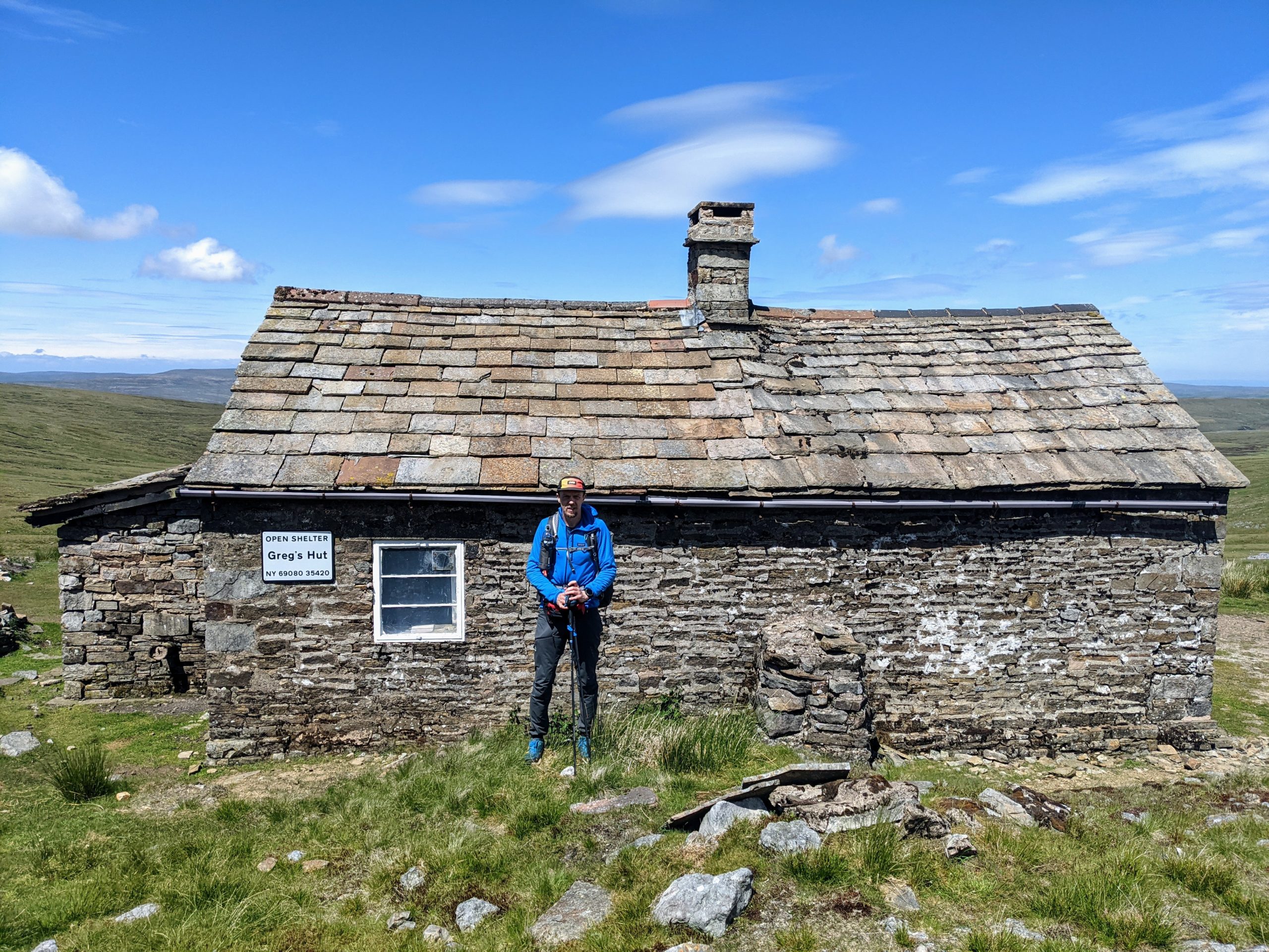
    To start off we were walking along a river to Garrygill village, very pretty little place. The ascent really started from there, gradually climbing along a decent track up to an old mining area where the track continued but was rockier.  We reached Greg’s Hut, an MBA bothy, and sat outside to eat our lunch.  Before moving on we checked out the bothy, wrote in the log book, and chatted to a father a son doing the PW in 10 days.  They commented that another son/brother had started with them but quit after 3 days.  I got the feeling he wouldn’t be hearing the end of that! ?

    The cloud had covered the tops first thing and had been lifting through morning.  By the time we reached the top of Cross Fell (the highest point of the End to End Trail – we lied previously in a post from Scotland, that was the highest pass on the trail, not the highest point!) it was a glorious day and we were treated to views of the Lake District and the Yorkshire Dales.  We spent some time drinking in the views and getting the obligatory trig point selfie before we crossed the Moreland on Cross Fell and had a series of up hill, down dale, taking in Little Dun Fell, Great Dun Fell and Knock Old Man.

    The descent to Dufton was quite steep in places, reaching farmland and tracks in to Dufton.  It had started raining as we were closing in on the village and we put up tent in the rain and cooked dinner.

    The rain didn’t ruin what was a great day, our second biggest so far in terms of ascent, the highest point on the trail, and some epic scenery.

    Cross Fell Trig Point

    Day 38: Dufton to Kirkby Stephen

    ? 28.02 km 

    ?469m 

    It rained pretty much all night and was still raining in the morning.  The wind had also really picked up in the night.  Thankfully the campsite was quite sheltered but the wind had blown all sorts of tree debris everywhere by the morning.  Checking the weather, it was due to rain all day and the mountain weather forecast suggested the cloud would cover the tops until the afternoon at least.

    Our route today was described by the guidebook as one of the best days of the trail and definitely the best of the Pennine Way.  It would take us past High Cup Nick, which looks pretty cool, and to a height of around 600m.  After taking the cloud cover, wind, rain, and the fact we had no paper maps for this section, we decided to take an alternative route and instead stop in Kirby Stephen tonight, then rejoin our End To End route at Keld tomorrow evening.  It also would mean two slightly shorter days than we had planned, which would hopefully help on the blister front.

    Plan B – The Pennine Journey

    We were conveniently able to follow another marked trail, The Pennine Journey, which was mostly easy to follow and took a lower level route through farmland and along the River Eden.  It wasn’t a bad route and although it rained all day, it was only of the significantly wet variety for an hour or so.  The highlights were probably some vivid green meadows and fields, offset against the dark grey moody clouds.  That and a couple of squeaky bum moments passing through small fields full of rams who seemed rather interested in us, grunted a lot and followed us looking aggressive.  We’ve passed other groups of rams on the trip who didn’t appear as interested/grumpy.

    Moody

    Towards the end of the route, the Pennine Journey took a bit of a circuitous route and we opted for a few km of quiet B road as we were rather damp.  We stopped off at Co-op and stocked up on food, then continued through town to our campsite.  Unfortunately the washing machine was broken so we hand washed some socks and hung up damp clothes to dry.  After a shower we found a nice comfy sofa in The Engine Shed, the on site bar.

    We checked out a route for tomorrow and did a DIY link up of trails using the OS app to get an 18km off road route to Keld.  It was this or about 15km on a minor B road.  The weather is looking like it will clear up nicely so should be a no brainer!

    We had a pizza from the pop up pizza van at the campsite and ate that with our other supplies for dinner in the bar whilst we caught up on some journals and other things.  It turns out that Kirby Stephen is on the Coast to Coast trail route so you never know, might be back here sometime!

    The Engine Shed
  • Hiker Havens

    Hiker Havens

    Day 33: Jedburgh to Forest View

    ? 33km

    ?974m

    Today’s the day we enter England and leave beautiful Scotland behind us. We woke at 04:00 with the crows, as Spence the campsite manager had told us we would, but did manage to snooze until 05:30. It had rained at various points throughout the night, the tent was wet, and it felt cold so it was a bit of struggle to get out the sleeping bag.

    We started the day by re-joining the Roman Road which was a lot more like we had expected it to be the day before, a little wider and more gravel under foot.

    The Roman Road

    We descended into a valley by some farm buildings and an old outdoor centre, then ascended up a lush green hill side. When we got to the top we followed the path around the edge of a bowl like valley with grasses, summer meadow flowers and the famous Scottish thistle not quite in full flower. We crossed a short piece of moorland and then clambered over a tatty piece of fence work to enter England.

    In two places at once

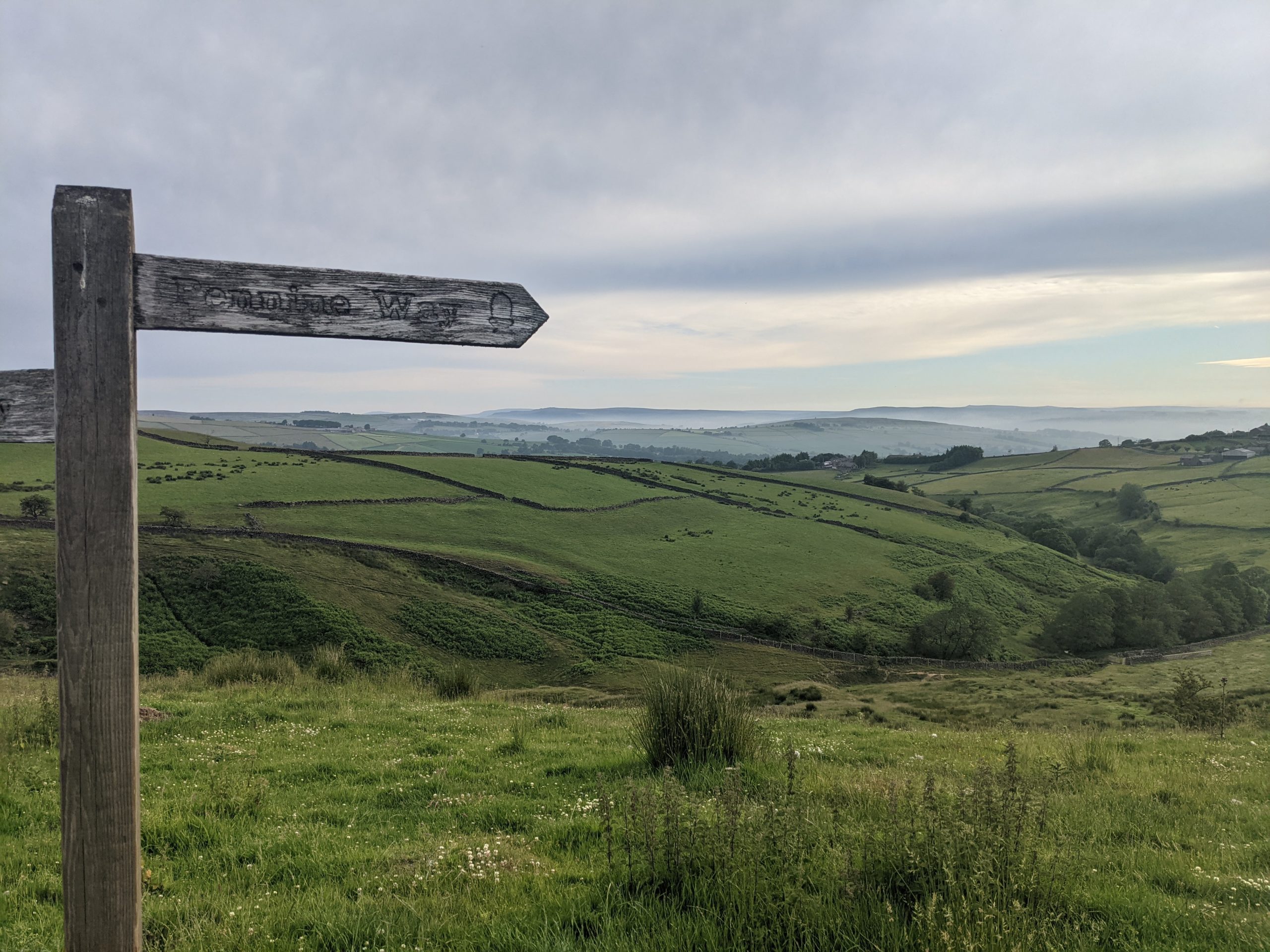
    We turn right onto the Pennine Way and almost immediately started passing people. The Pennine Way is a National Trail that stretches for 268 miles from Edale, in the northern Derbyshire Peak District, north through the Yorkshire Dales and Northumberland National Park and ends at Kirk Yetholm, just inside the Scottish border. Most people hike it in that direction (northbound) and therefore the people we were approaching were on their last day. We had some great conversations, noting down places to eat and camp. The last few km of the day was a sharp descent through the forest into Byrness towards The Forest View Walkers Inn.

    Joining the Pennine Way

    Located in a small cul-de-sac of houses and recently taken over by Oliver and Laura, Forest View is the ultimate hiker haven, a home from home, and a pure delight.

    We camped in the garden for free with access to a shower, toilet and drying room. We drank and chatted in the conservatory with the other guests, Oliver bringing out drinks just as if he was hosting a party. We all ate Laura’s home cooked menu in the dining room at our allocated tables and everyone was in bed by 10pm.

    Day 34: Forest View to Bellingham

    ? 25km

    ?495m

    It was raining when woke so we snoozed until it passed, then packed up our stuff, ate breakfast with a cup of tea in the conservatory, and then put the tent down in record time. We left, after having our photo taken for the Facebook page, a bit later than planned but with huge smiles on our faces. What a place run by such wonderful people!

    Big smiles at Forest View

    We re-joined the Pennine Way and walked up and through the forest tracks, meaning we made decent time. Things slowed down a bit as we met the moorland to head up Padon Hill and over Lough Shaw. There was the very occasional boggy bit but compared to the terrain we had to cross at the start of our trip it was incredible how much it had dried out. We camped that night at a farm in Bellingham, arriving in the sunshine with plenty of time to get the tent up and dried. There were some basic facilities but we didn’t bother showering and instead walked the 3 minutes to the centre of the beautiful little town.

    Out of the forest, into the moor

    First stop was the Post Office where we had had some maps sent to but unfortunately they had not arrived and apparently it was something that the sorting office would not have delivered even though we got maps sent exactly the same way to the Post Office in Fort William. We then headed to the pub, a pint for Tom and a tea for me to do some planning and then finally the Co-op to stock up on supplies. We ate a noodle and couscous combination for dinner and caught up on the weekend’s exciting F1 as we had managed to avoid the result.

    Day 35: Bellingham to Greenhead

    ? 38km

    ?1164m

    We both woke in the early hours freezing, so had to put extra layers on. When the alarm did go off at 05:30 there was a thin layer of ground frost. We did a decent job of getting up and out considering it was so cold and I ate a massive breakfast of both the pastries I had bought the day before.

    Frosty Feet

    The first half of the day was a little boring weaving through fields and farms The highlights being a beautiful garden in a gorgeous location complete with veg patch, orchard and ice water in a flask for hikers, and also The Pit Stop, a small area of a farm barn kept by PCT hikers that contained a toilet, shower, sofa and treats for anyone passing through to help themselves.

    Signing the book at The Pit Stop

    We then passed the first male and female runners of The Spine Race before we avoided a couple of rather scary looking bulls to hike up to Hadrian’s wall. Here we joined the crowds, and after stopping to eat sandwiches, made our way a few km along the trail that follows the wall, before temporarily leaving the trail to visit the Twice Brewed Tap Room and Pub in Once Brewed.

    Twice Brewed Smile

    After a pint of Twice Brewed Lares (a double dry-hopped Pale Ale) for Tom and a Coke for me we re-joined the wall and navigated its ups and downs. It was slow and much tougher going than we had anticipated, the last 5km were slow and painful, something that is becoming quite common on our longer days walking, and we finally made it to Greenhead and the honesty box camping next door to the guest house by 18:30. There was a basic toilet and shower in the same little hut which we took advantage of as the day had heated up and we were rather sweaty. We prepped and boiled water on the picnic bench but the midges got the better of us and we ate inside the tent with the football. We were joined about 21:00 by 3 other tents but never got to see the faces that they belonged to. We slept well after our biggest day of ascent so far.

    Honesty Camp Spot
  • Blisters in the Borders

    Blisters in the Borders

    Day 30: Just outside West Linton to an Orchard near Innerleithen

    ? 40.30km

    ?571m

    Midge Mayhem

    It was a beautiful morning but we were under house arrest by the midges.  Katie nipped out for a wee first thing and quite a few followed her back in.  We packed up, surrounded, and made haste!  Ironically, after being relieved to leave the tarmac behind on the canals, we opted for an easier start to the day to help Katie’s feet get going (her blisters are pretty bad right now!) and followed the road all the way down in to the pretty little village of West Linton.  I had a takeaway second breakfast of bacon and black pudding roll with brown sauce.  Katie had a cuppa.

    We continued on along the road for a bit, out of West Linton, before the route took us off in to the hills, again following the Cross Borders Drove Road national trail.  After a fun encounter with some interested cows, we passed through fields, forests and valleys on gently undulating, varied terrain.  It was nice walking.  We crossed a river and washed a pair of socks, hanging them on the back of our bags to dry as the good weather continued all day.

    We reached Peebles after about 28km of walking at around 1315, visited Tesco first for some food and medical essentials for a couple of days, then went looking for lunch.  We had read about a bakery but they only had sweet things so I took a ginger cream biscuit and a chocolate brownie cronut for later and the search continued.  We found a cafe but it was just closing (at 1400, ?‍♂️), so once again the search resumed and on the third attempt we got seated and ordered.  Chilli chicken flatbread and ginger beer for me, a brie and cranberry toastie and orange San Pel for Katie.  Portions were good, and we had happy tummies.

    We had a choice from Peebles to get to Innerleithen/Traquair.  We could take the trails to Traqauir, continuing to follow the Cross Borders Drove Road, or we could take a tarmac (?) path that stayed low in the valley, following the river Tweed.  In the end we opted for the tarmac.  It was shorter and quicker so it meant less time on feet and more time in camp for Katie to tend to her poor feet.  We found a nice grassy footpath initially along the river and then joined the tarmac.  It wasn’t all bad, the views were nice and it meant I could again walk without the knee brace.

    We found an orchard in a field just off the path, and set up camp, just with the inner of the tent initially which was nice.  It was a glorious sunny evening and we had dinner whilst resting weary feet.

    Orchard evening sun

    Day 31: Orchard near Innerleithen to Melrose

    ? 40.30km

    ?571m 

    We rejoined the tarmac by the Orchard and walked in to Innerleithen, topping up on liquids at the Co-Op there.  Katie was having a bad time with the blisters this morning.  What was originally a blister on each heel, was now double whammy on one of the heels, one on the inside of a big toe and one on a little toe on the opposite foot.  If I’m honest, they looked horrendous, and I wasn’t sure how she was still going, oh wait, yes, she is one very stubborn mule!  About a week now battling the blisters and the last couple of days seem to have been hell.

    Little Miss Piggy

    We were planning on wild camping this evening which meant not exactly knowing how far we would be going today but it was always going to be at least 35km.  Katie initially declined a hotel option, but after about 30 mins of walking, just as we were turning off the tarmac, on to the trails, Katie decided a hotel room would help her get through the day and also meant we would know how far we had to go.  We could also assess and treat the blisters a bit better, have a decent meal, a beer or two, and the England vs. Scotland football game was on so all good!  We booked one of the last rooms in Melrose (I presume as it was a Friday night) and got going on the trail.

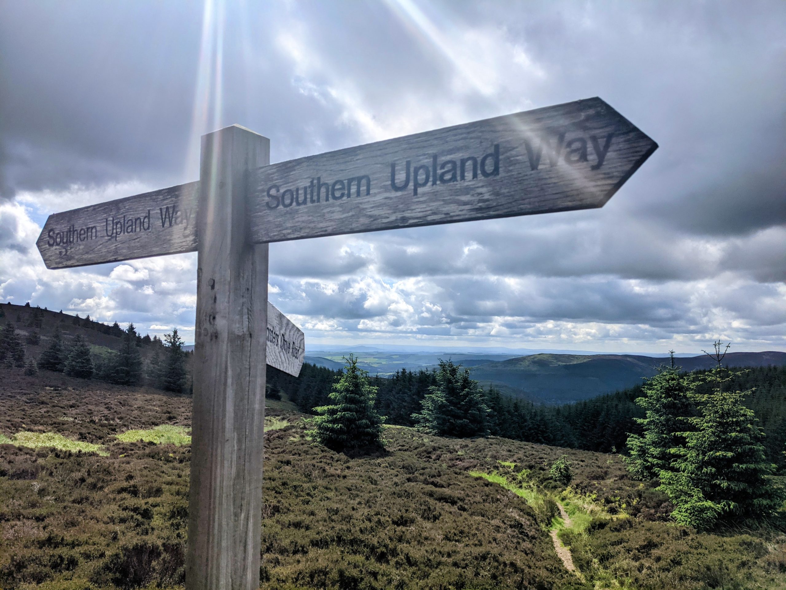
    Today, we would be following the Southern Upland Way (which is also for this section the Cross Borders Drove Road that we followed yesterday) which is actually a coast to coast route, around 450km.  We were heading east for the day, following the Scottish national trail thistle in a hexagon waymarker.  We gradually ascended Minch Moor, where I took a quick detour to the top  (567m) to check out the view, whilst Katie continued.  We could see in the distance, the Eildon Hills which were just outside Melrose, our target for the day.

    From then on, we undulated through the day and enjoyed some great views and lovely varied trails.  The landscape has completely changed since leaving the Highlands and today was the best so far since then.  Everywhere you looked there were lumpy bumpy hills, not a flat piece of land anywhere.  The weather was great, big fluffy clouds, patches of sun and (mostly) warm temperatures.  Whilst descending from the Three Brethren, 3 large cairns on top Hareshaw Hill, we chatted briefly with a local couple who said that on any normal year (i.e. without covid), we would have found hundreds of horses and people at the top, drinking whisky, dancing and singing (the people that is).  This was apparently the day of the Selkirk Common Riding, such a shame we were not treated to that spectacle!

    B-e-a-utiful!
    The Three Brethren

    We continued though fields of sheep, reaching Gala Hill and traversing round it through a lovely forest.  We descended to join a nice path along the river, then had to walk through some less scenic housing and industrial areas by Tweedbank, before some more nice riverside trails to finish the day.

    In Melrose we checked in to the King’s Arms, showered, and did some reading up on blister treatments.  I nipped to Boots before it closed for an assortment of medical supplies, and also some duct tape from the Spar shop.  We had dinner in the pub, the food was decent but the beer selection wasn’t great.  It was getting busy with it being Friday night and the football on.  We opted to retire to our room, and drain Katie’s blisters (cos that’s how we roll on a Friday night).  I dashed to the Co-Op for beers and ciders, and a 1 litre tub of Mackie’s Chocolate Orange and Honeycomb ice cream, which we enjoyed whilst watching the football (which was pretty dull on the whole).

    Set for the night

    Today marked 1 month on trail, stats as follows;

    Per Day

    • Max Time: 11:10:00
    • Max Distance: 42.02
    • Max Ascent: 997
    • Avg Time: 06:54:15
    • Avg Distance: 24.57
    • Avg Ascent: 483.68

    Totals

    • Total Distance (km): 761.67
    • Total Ascent (m): 14994

    Km per day

    • Zero: 1
    • >0, <10: 0
    • >=10, <20: 9
    • >=20, <30: 11
    • >=30, <40: 8
    • >=40, <50: 2 
    • >=50: 0

    Sleeping Arrangements 

    • Wild Camp; 14
    • Campsite: 9
    • Cabin/Pod: 1
    • Bothy: 2
    • Hostel: 1
    • Hotel/Pub: 3
    • B&B: 0

    Misc.

    • Beers: 26
    • Sticky Toffee Puddings: 5
    • Sunday Roast Dinners: 3

    Day 32: Melrose to Jedburgh

    ? 31.30km

    ?686m

    We took a bit longer getting ready this morning, taking advantage of a shower and getting Katie’s blisters ready for the day’s walking.  Eventually departing the pub at 0830, we didn’t get far before spotting a cafe that looked like it had a decent coffee so we had a brief pause and got one each to go, plus a brownie, cos, why not!

    The day started with quite a steep climb up and over between two of the Eilden Hills we had spent much of yesterday heading towards.  Today we were following the St. Cuthbert’s Way for the most part so again, the waymarking was good and easy to follow.  There were a few showers in the morning but the views were still great and we were in some lovely woodland which kept the worst of the water off us.

    We again enjoyed a great mixture of trails and after the initial hills, the route gently undulated through forests and fields, along rivers, past curious cows.  The weather cleared mid morning, remaining mostly cloudy but stayed dry for the best part of the day and the sun made the odd appearance.  We joined an old Roman road, Dere Street for the first time towards the end of the day, which was most visible from the drone shots I took.  These days the trail meanders in between field and through woodland.

    We reached our campsite on the edge of Jedburgh just after 1700.  We needed to stick up on some food and don’t go through town tomorrow morning so I had a quick jog down the road to the Co-Op.  On my return I grabbed a shower, we ate, watched the grand Prix qualifying, then caught up on some journals and photos.

  • Tow paths, viaducts & old railways.

    Tow paths, viaducts & old railways.

    Day 27: Drymen Campsite to Bar Hill

    ? 36km

    ?466m

    It rained very heavily throughout the night, I woke needing a wee and waited for the rain to lighten up before dashing to the farm barn where the toilets were.

    We set the alarm for 06:00 and when it woke us thankfully the rain had stopped. There was the occasional ray of sunshine through the very dark clouds. We packed up bags, eating breakfast inside the tent, and then took the opportunity to get the tent down in the dry. It was not due to rain again until about 09:00 so we risked it and left camp with waterproofs to hand but not on.

    There was a small section of road to start with then field hopping via a nice dry path, we had the Campsie Fells to our left all the way and it was beautifully green with meadow flowers lining the path but we were definitely leaving the Highlands of Scotland.

    We met a big group of lads who had started the West Highland Way early, hoping to get to Balmaha for the Scotland game. They had matching outfits, were doing the 96 mile walk for charity and were in good spirits.

    About 5 minutes after we left the gang the heavens opened for a short shower, so we scrambled on the waterproof gear, left it on as long as we could to try and get it dry and then it was off again for the rest of the day.

    We continued on, leaving the West Highland Way, just as it gets boring, to join the John Muir Trail. About half a km in a runner checked in with us to make sure we were not lost, turns out he was an ultra runner and we got chatting and explained what we were up to. He was super chuffed for us and reassured us that we were sensible to have started off with lower distances. Soon we were skirting the outskirts of Strathblane and I was craving a coffee, luckily we walked straight passed the Kirkhouse Inn where the lovely lady inside made me a gorgeous takeaway latte which I dipped my Twix into and away we went.

    The John Muir Way

    We joined a tarmac path which ran along the river and within 500m we met Chris a fellow End to Ender he was heading north and told us a bit about his trip so far including that we were the 7th and 8th people he had met doing the same thing. We exchanged photos and social details and went our separate ways.

    Chris

    We were very excited to have finally met someone else doing the same trip as us and this boosted our mood along the tarmac that would be our trail for the next 2 and a bit days. A few runners and cyclists passed us by but it was a relatively quiet path, we stopped at one of the many benches to eat our sandwiches for lunch and then carried on. We managed to dodge the rain for the rest of the day and kept plodding along the tarmac path through Lennox Town and Milton of Campsie.

    Milton of Campsie

    We picked up some water and sweet treats in Lidl in Kirkintilloch before joining the canal path to Kilsyth. We made our way up to the Bar Hill and the Roman Fort, hanging around for a bit, but it started to looked a bit showery in the distance so pitched the tent. We were not exactly subtle but it was a good spot and there were no signs saying we could not camp there. A couple of hours later a group of 4 ladies arrived to do the same so we committed to the spot, unpacked our bags and cooked noodles for dinner.  

    Day 28: Bar Hill to Loch Farm Campsite (Linlithgow)

    ? 38km

    ?194m

    We woke early at 05:30 and I found it hard to wake up, I had not slept well, I think because our wild camp spot had not been very wild, so was a little on the sleepy side.

    I eventually got going, we packed up and were on the road by 07:00. We passed a runner with his walking sticks coming up the hill, but apart from that saw no one else, we made our way down to the road to re-join the canal. Tom at least made the most of the flat ground and walked without his knee brace, trying to even up the dodgy tan lines on his left leg. ?

    Our view for nearly 3 days

    Just as we joined we saw an elderly gentlemen with a sizeable pack so could have been our second End to Ender but he avoided eye contact and marched straight passed. We then spent the rest of the day on the tow path, leaving it to change canals from the Forth and Clyde to them Union.

    This section of the canal wasn’t actually too bad aside from the tarmac.  There was less rubbish, the scenery was much nicer, there were herons and ducks with ducklings.  It was quite busy to start with, people on early morning walks or commutes, and when it quietened down a bit, we both listened to a couple of Desert Island Discs podcasts, one with Ian Wright, the other with Brian Cox (actor, not astronomer).  This was the first time we have listened to music, or anything for that matter, on trail.  There is normally plenty to keep you entertained/concentrate on and neither of us have felt the need so far.  Today on the canal path, there wasn’t much of interest or to concentrate on.  It certainly helped the day go by and was nice to listen to some tunes!

    This was a fun junction because the Union Canal is higher so there is a wheel at Falkirk by a visitor’s centre that takes the boats up, we watched the magic happen and had a cup of tea and a wee at the visitors centre.

    We ate lunch sat on the seats in Polmont train station because we were desperate to rest our feet and couldn’t find a bench anywhere.

    We travelled through 2 tunnels one right at the start of the canal with rainbow lights the other The Falkirk Tunnel, located just behind Falkirk High Station, was created nearly 200 years ago and was originally used for transporting coal, today it carries the Union Canal beneath Prospect Hill in Falkirk and connects Falkirk to the heart of Edinburgh. The Falkirk Tunnel is 630 meters long and really fun to walk through. It was dripping water through and two little girls laughed at us for putting on our waterproofs and hoods up to go through but the 2 old ladies we met in there were jealous.

    Falkirk Tunnel

    We finally got to Linlithgow, Tom picked up some treats from the shop and then headed to the campsite which was next to the motorway and as we feared was rather run down and far from ideal.
    Toilets and showers were basic, a bit broken and dirty. But we did what we needed to do and showered but also got to do laundry which was one of the main reasons for staying there.

    About 18:00 we heard some music and after a few songs of listening more carefully realised it was the sound of a full on cheesy wedding disco straight out of Phoenix Nights. We never worked our exactly where it was coming from and if there was anyone in a crowd somewhere but it was all over by 21:00. We also ordered pizza to be delivered to the campsite, we have been eating about 18:30 most nights so when they said it could not be delivered until 19:30 and then actually arrived at 19:50 it’s safe to say we were qualified to eat the 18″ each that we had ordered.

    Worth the wait Nero’s Pizza

    It was a muggy night and we both woke in the middle of the night a bit on the sweaty side.
    The downer of the day for me, no doubt irritated by the long day on the tarmac, was that my blisters had doubled in size and the plasters useless. Now too big and painful we opted to burst, antiseptic and cover with new plasters.

    Day 29: Loch Farm Campsite to Baddinsgill Reservoir (West Linton)

    ? 42km

    ?683m

    Today was always going to be a big day distance wise so we woke at 05:30 in the rain and got cracking.
    It continued to drizzle all morning but it was not too bad as we were back on the tow path so it was easy cruising.

    Tired of the tow yet?

    We kept going until bridge 27 where we were advised to take the town route and were at first disappointed that the Lidl had moved location, but then had fun in a posh Co-op instead, getting a pastry each for second breakfast, Costa coffee from the machine, more breakfasts for the next few days and what we went in for, water. We then continued through the town and along Station Road to rejoin the canal at bridge 23. We got to a viaduct where a group were SUPing and passed back under it to join a country park walk along a river and a bisse. It was great to be off the tow path and the trail was great fun through trees and by the water.

    Drip Protection

    We stopped for lunch and a either stupidly or luckily checked my blisters. The plasters had swollen up with liquid and I was getting another blister on the other side of one foot so a bit further on when it started to rain again we hid in a tunnel under a road to sort out stuff including putting on an extra blister plaster. I was a bit upset and panicky now about the seriousness of the blisters but ultimately there was not much I could do but plaster up, drug up, and keep walking.

    We continued up a road and then up and over Corston Hill (348m). This was particularly painful on the heels as we were climbing on not that much of a path but the reward was seeing Edinburgh in the distance and spotting all the key landmarks, The Forth Bridge, Edinburgh Castle and Arthur’s Seat.

    Corston Hill Trig


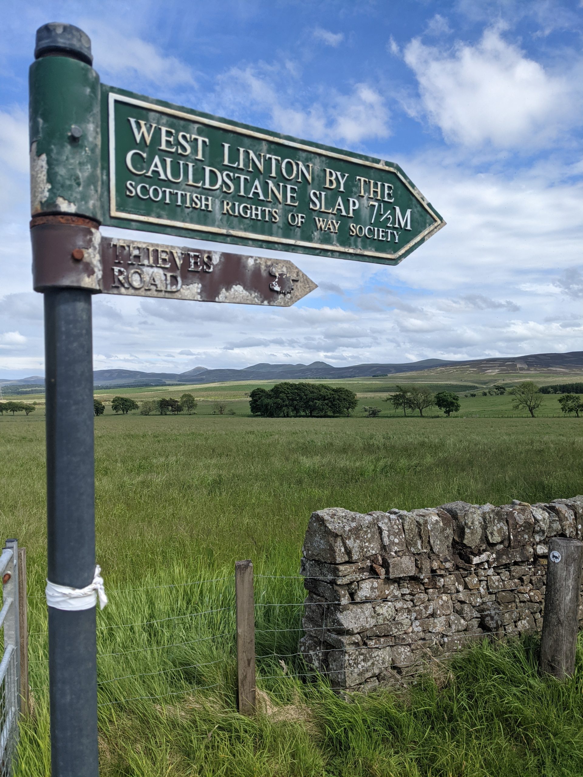
    We then descended to a car park to join the start of the Cross Borders Drove Road which took us back up and over Cauldstane Slap.

    By this point I was tired and in some pain from the blisters, but we completed our first marathon day pitching up to wild camp just at the top of thieves road in a field. It did not take long for the midges to sniff us out and this would be the start of our second serious midge encounter.

  • “You’re going the wrong way”

    “You’re going the wrong way”

    Day 24: Strathfillan Wigwams Campsite to Beinglas Farm Campsite

    ? 15.94km

    ?397m

    It was raining when my first alarm went off at 0600.  It was raining when my second alarm went off at 0630.  It was raining every 10 minutes that I snoozed the alarm for an hour.  Eventually, at 0730, it wasn’t raining and we decided it was probably time to get moving.  We packed up, used the facilities, and put the tent away whilst it still wasn’t raining.  The forecast was showers all day and sure enough, within a minute of leaving the campsite, I had to put on my waterproof trousers. Soon after, we passed a sign that informed us we were in one of the wettest parts of Britain.

    Wet Facts

    Shortly after leaving camp, we were climbing through some nice forest.  It was probably the nicest hour or so of forest walking we have had on the whole trip and we started passing a few northbound hikers as we exited the forest and descended to Crianlarich.  From there it was pretty straightforward through the valley Of Glen Falloch, following the river Falloch to our campsite at Beinglas Farm.  We followed the road most of the way and the path did a reasonable job of being far enough from it not to see it, but it could be heard.

    We only covered 16km today, so arrived at Beinglas just in time for lunch, a ham and cheese toastie, with a pint of beer.  Taking advantage of a dry spell, we got the tent up then took showers.  We grabbed a seat in the bar around 1700 and got drinks, then dinner around 1800.  We both went for lasagne, which came with salad, coleslaw and garlic bread.  Solid pub grub and big portions.  The choc fudge cake and ice cream fitted snugly on to the pudding shelf.  Back at the tent we watched the first episode of Jeremy Clarkson’s Farm show on Amazon.  We had seen earlier that, unsurprisingly, an ever predictable Guardian write up had given it 1/5, in fact it was actually pretty entertaining.

    Just about to get heads down at 2100 and I can smell burgers being cooked on a BBQ, making me hungry again! ?

    Day 25: Beinglas Farm Campsite to Millarochy Campsite

    ? 32.79km

    ?855m

    We had a big day ahead and needed to hit the shop at the campsite before we left so we were waiting at the door ready to go when it opened at 0730.  We both grabbed a roll for lunch, some snacks, and Katie got some more Compeed blister plasters.

    Full waterproofs were required, contrary to expectations and off we went, headed for a day of walking along the eastern edge of Loch Lomond.  Sounds easy right, walking along the edge of a Loch? Nice and level, not too much elevation? Wrong!  The trail was undulating in the same why the South West Coast Path undulates – big time!

    We warmed up pretty quickly and with the rain stopped, but threatening, we had to de-layer and risk it. Passing some goats with massive horns required holding your nose as they smelt so bad, like gone off goats cheese. Soon, Loch Lomond was revealed for the first time and we started our journey along its edge. We had heard walkers in the pub last night saying how tough this section had been and before long it got a bit technical, lots of roots and rocks.  Personally I loved it, nice single track going up or down most of the time, never flat.  At times we were right by the loch, walking past stony beaches, others we were in really nice woods with huge pines and mossy floors.

    There was quite a bit of passing others and at one point a mountain biker (carrying the bike at the time – much if this section is quite literally unrideable) decided to squeeze past Katie, rather than wait just a few more moments for her to reach a wider part of the track.  His foot was right on the edge of the track which gave way and he went head first, with his bike, sliding down the side of the trail towards the water.  He managed to stop after a couple of metres, his mate got down to him and helped pull his bike off which I then lifted on to the trail and the biker scrambled his way back up.  We checked he hadn’t dropped anything and his mate joked only his pride was left down there. ? If only he’d been a bit more patient.

    We stopped for a nice lunch break by the loch and continued, soon reaching the first holiday park/campsite of the day at Rowardennen.  The temptation of a cold fizzy can of pop was too much and I joined the queue in the bar, however the queue was too much, and I couldn’t be arsed so we continued with our thirst unquenched.  From there we had about 7km more to reach our goal for the day and now that we were in an area near a road and holiday parks, the trail was easier underfoot, however it still went up and down like a roller coaster!

    Forest trails

    We arrived at Millarochy Campsite around 1730, where we had booked a tent pitch, and the lovely people here informed us that we could pitch in the backpackers area for less and they would refund the difference on our booking!  Lovely stuff.  They also had ice creams so Katie had a Cornetto and I had a Magnum.  We deserved it.

    Tent pitched, we showered and then made use of the backpackers kitchen area to cook and eat, as the midges were out, and after us!

    Food Diary

    Thought it would be fun to keep a track of the food and calories eaten today, not as much as I thought!

    Breakfast
    • 2 waffles – 240 cal
    • Peanut butter/choc spread combo – 100 cal
    • 4 dried figs – 54 cal
    Lunch
    • Cheese and pickle roll – 300 cal
    • 1/2 bag crisps – 375 cal
    Dinner
    • Packet of Ainsley cous cous – 354 cal
    • Packet of noodles – 271 cal
    • Mange tout – 50 cal
    • 1/2 pack jerky – 80 cal
    • Birds Instant Custard – 150 cal
    • 1/4 Yorkshire Tea Loaf – 231 cal
    Snacks
    • Magnum White Chocolate & Cookies – 235 cal
    • 2 handfuls of peanuts – 250 cal
    • Stroopwafel – 180 cal
    • Nakd Bar – 137 cal
    • Kind Dark Chocolate Nuts & Sea Salt Bar – 214 cal
    • 1/2 pack peanut M&Ms – 300 cal
    Total: 3521 cal

    Day 26: Milarrochy Campsite to Drymen Campsite

    ? 18.13km

    ?555m

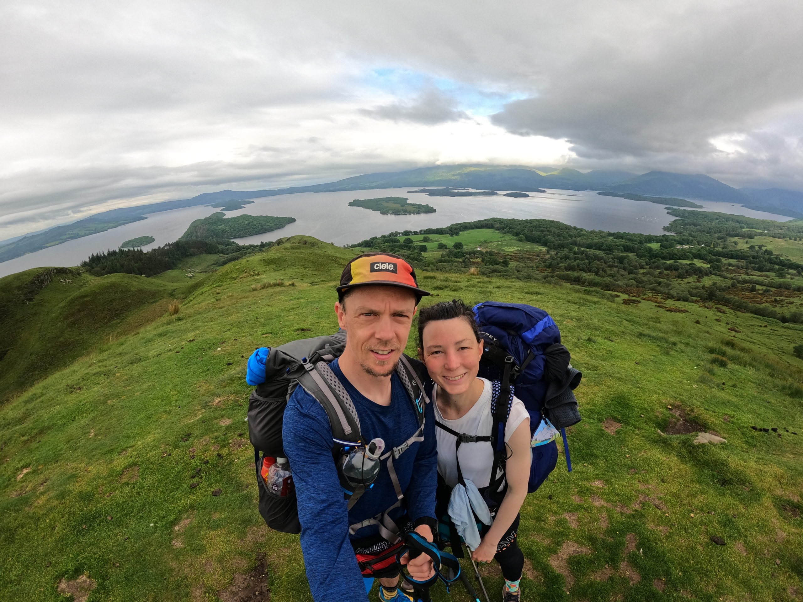
    We hit the trail just after 0700 knowing we had a bit of a lump to climb over and around 15km to a Sunday Roast at the Clachan Inn in Drymen.  We continued where we left off yesterday following the edge of the loch, until heading east and starting the climb up Conic Hill.  We were now among not only other WHW hikers, but also the day hikers too.  There was a lot of huffing and puffing.  Not from us though.  We made our way slowly up and stopped to take a few pictures looking back over Loch Lomond.  The cloud had lifted just about in time and it was a view to savour for a few minutes!

    The WHW doesn’t actually take us to the top of Conic Hill and we figured we had seen as good a view already as we would get a few more metres up so we stuck with the main trail and started descending.  We walked through forest and farmland for a couple of hours and the sun started to peek out as promised.  We had our first ‘your going the wrong way’ comment today after 6 days against the flow on the WHW, Katie quickly piped up “Not if you’re walking to Lands End!” which stopped the fella in his tracks for a moment!?  We soon popped out on to the A811 and headed into Drymen for lunch.  We were early so we did a quick shop for the next couple of days food at a Spar.

    The Clachan Inn didn’t disappoint and did a decent roast.  Katie went for ham, I had the beef.  This is becoming a bit of a tour of Britain’s Sunday Roast, so we started scoring them.  Today’s scored a solid 7 out of 10.  Decent meat, great potatoes and Yorkshire pudding.  Veg was nice but lacked anything green, and no cauliflower cheese.  The sticky toffee pudding, our fourth of the trip, scored an excellent 9, equalling that of Garrison West in Fort William.  They didn’t even blink when I asked for ice cream AND custard.  What’s this ‘or’ malarky all about?

    By the time we finished lunch the sun was shining and it was about 23⁰C!  We still had 2-3km to do to get to the campsite for the night so off we trotted, back along the road out of Drymen, picking up the WHW again, through some fields and then back on to a road before arriving at the campsite, right on the trail.  We pitched up and took advantage of extra time to relax in the sun before showering, doing our normal routines stuff and dinner.

  • “Oh you’re one of those”

    “Oh you’re one of those”

    Day 21: Fort William to Kinlochleven

    ? 22km

    ?167m

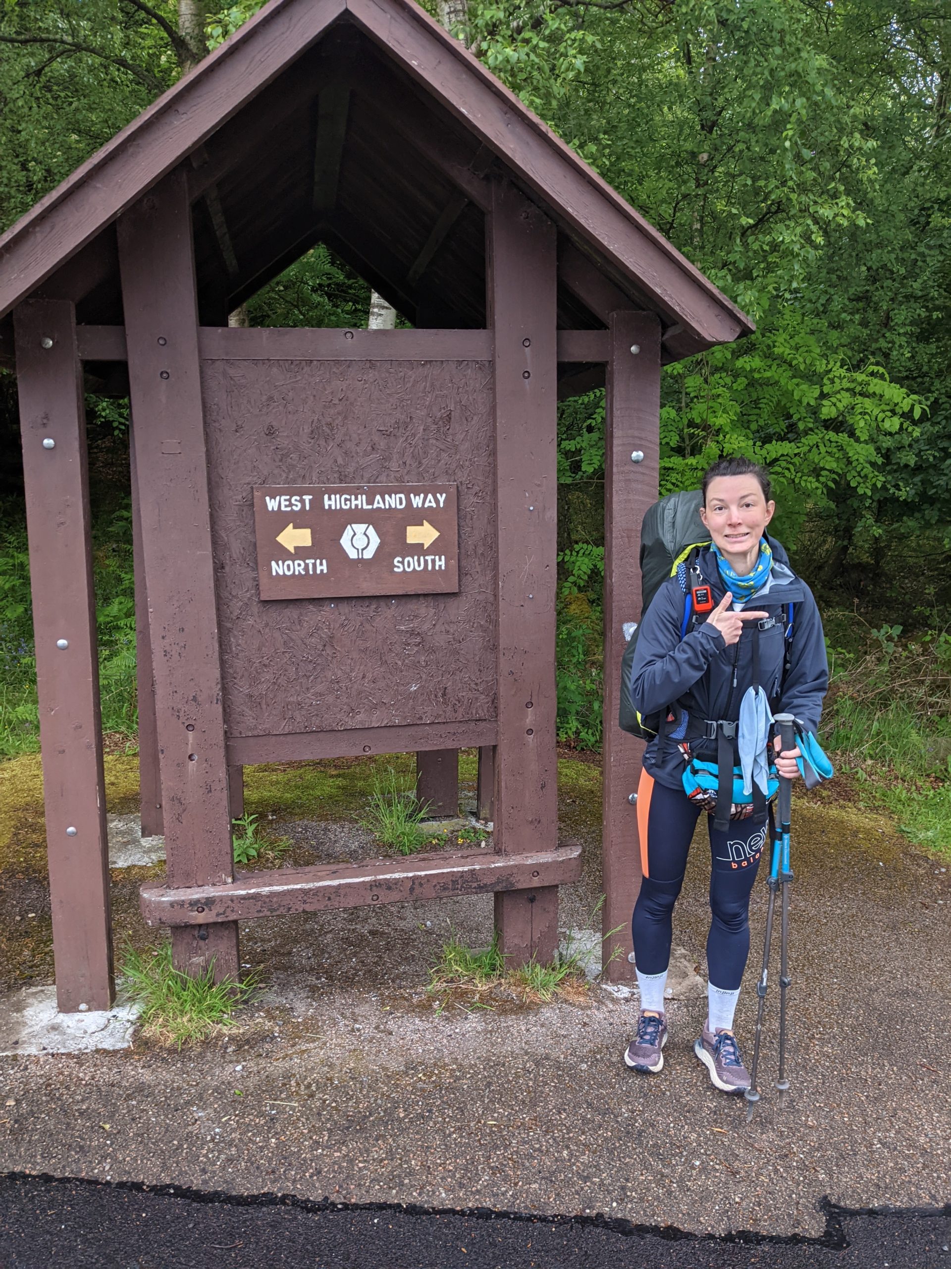
    Today we started the West Highland Way going southbound. Established in 1980, it starts in Milgavie, north west of Glasgow, and finishes in Fort William and is 96 miles long. It is a well established route and very popular, but we would be walking against the crowds.

    The West Highland Way

    We woke early and snuck in a last shower before heading out the campsite. Despite knowing we will be going through towns fairly frequently from now on we both still got stupidly carried away in Morrisons the day before and my backpack was worryingly heavy.

    We joined the route out the site and followed it’s gradual ascent up through the forests and along the forestry roads. The cloud was very low and soon we were in it, with the light rain upon us, jackets were on but we were a bit late with the waterproof trousers. About 09:00 we came across our first walkers coming towards us who asked us how much longer they had to go until the end. After this there was then a steady stream of people some happy and excited it was the last day, some smiling through gritted teeth and a couple who were obviously not having a great time. The rain got a bit heavier before easing off for the rest of the day. The views through the valley were lovely and we made good pace despite significant ascent as there was zero navigation to be done. 

    Blurry Wet

    We had both picked up new shoes from Fort William so we’re nervous but in the end pleased how they were doing for us after 23KM.

    We stopped just before town to eat our lunch, some left over pizza from the day before, and then decended into the town passing some late starters and mountain bikers on our way down.

    We arrived about 14:30 to the wooden hut we had booked. Basically a shed with bunk beds in, that you put your own sleeping bag on but it was the power sockets that you really pay for. We showered because we could, and it was quiet, then headed to The Bothy Bar to update the blog and read about what was to come ahead on the route.

    We had the best burger yet for dinner and another sticky toffee pudding. Time to start a sticky toffee leader board, another column in Tom’s spreadsheet added. ?

    Day 22: Kinlochleven to Inveroran

    ? 32km

    ?902m

    Leaving our pod it was dry, but the mist was looming. We left Kinlochleven via a big service road parallel with some hydro power pipes. About 10 vehicles, a mixture of trucks and land rovers, passed us on the way up to start their day but we never saw where they ended up as we then came off the road onto a much nicer trail. By this point it had started to rain quite heavily and was blowing into our right side. We were basically in the cloud, but walking along a decent path towards devil’s staircase.
    We put an extra layer on just before popping over the top where a group of 4 ladies were celebrating reaching the top from the other side.

    The rain had eased off a bit and we descended devil’s staircase carefully as we met a few people coming up. They were from all over and all abilities including a lady carrying a bike.
    We then reached the main road and the path traversed nicely along it so we didn’t have to contend with any traffic, it was narrow here however and we had to wait for several people to pass by. As with the day before there was such a variety of enjoyment on the faces that came towards us. We followed the road for quite a way and stopped at the super plush Kingshouse, for a tea and hot chocolate.

    Before Descending Devil’s Staircase

    Then we set off out into the drizzle and it didn’t stop, I was fully waterproofed up Tom had opted for shorts and waterproof top because it was not actually that cold temperature wise.
    We walked almost up to Glen Coe ski resort and then followed a very boring cobbly road that ran through Rannock Moor, we were head on into the wind so the rain felt worse than it probably was but it was safe to say we were pretty soggy, and after several km’s I finally figured out that the funny taste was the smidge being washed off my face by the rain. We passed several soggy faces on the way through, including a lovely lady in her late sixties who joked about how boring it would be to hike in the sunshine and when we told her what we were up to she said ‘oh you are one of those’, she was absolutely delightful.
    We approached the Inveroran Hotel, and set the tent up in the dedicated ‘wild camping’ spot before continuing with our bags to the bar. We were drenched and glad for a chance to dry out which kept the barman busy mopping up our puddles. We sat with a cuppa for me and a pint for Tom before pre ordering beef and Guinness pie for supper, which was amazing!!

    Day 23: Inveroran to Strathfillan

    ? 21km

    ?438m

    We were rudely woken in the night by some car horn honking and more rain but generally had a good night’s sleep in our ‘wild camping’ spot.
    Next door a young group of 4 had set an early 05:45 alarm and were up negotiating thier morning logistics soon after. We snoozed our 06:00 alarm since it was raining, and started to get ready just before 07:00. Wrapping up in waterproofs expecting the worst, we packed up our tent and were first out of camp and pleased to find it was actually windy and dry.

    Cloud Slowly Lifting

    We made our way back passed the hotel that we had dinner at and climbed a steady up and over to avoid the road, reaching Bridge of Orchy where there was nothing much but a big hotel and the railway station. We went under the railway and then continued on a wide gravel track along the tracks, passing those who had started the day early as well. The path was very similar most of the way and we just avoided ascending into the cloud and therefore even though the wind was in our faces we stayed dry.
    After about 14km of very similar path with unfortunately little view, because of the low cloud, we arrived at Tydrumn. We couldn’t resist a cup of tea and hot chocolate at the Green Wellie Stop, an American style service station with toilets and gift shop. We have visited one before on a previous trip to Loch Ness and thought they were hilariously great.

    We then looked at our next few days and the food we had available, booked Sunday Roast in Dryman and decided to have lunch down the road and save our waffle and jam lunches for our big day along Loch Lomond on Saturday. So we made the 500m journey down the road to The Real Food Cafe for a burger, after which we headed out again arrived at our camp spot within the hour and got the tent up minutes before the first rain of the day came down.

    When I took my shoes off I fustratingly found a blister on each heel, lower down than where I was getting pain before and wondered if the new shoes had a different pinch point. Looks like the Compeed will be on for the next few days and hope it won’t make the harder ground to come more painful than it already will be. Tonight is our first DIY evening meal and we have a combination of Pot Noodle with Broccoli, then Tea Loaf and custard for pudding.

    Beautiful Evening Sun

  • The nitty gritty

    The nitty gritty

    A slightly different post with a few more details of the reality of doing a thru hike.

    Bugs:

    Ticks were our first nightmare when it came to bugs, these blood sucking creatures are so small you could probably get 50 on your thumb nail. We have had a couple of bad evenings when it felt like they were everywhere and we were constantly checking that they had not latched on especially before going to sleep. We spray a bit of insect repellant to try and put them off but at the end of the day there is not much you can do about them.

    Midges were always the talk of the trail when we met people and we had got really lucky until about day 20 when we camped by a river. It was quite humid and as soon as the wind died down they were all over the tent, thousands of them. It just made your skin feel a bit crawly and was not ideal in the morning when we needed to pack the tent away. From then on we have encountered a few and they have gone for our wrists and ankles. We brought some Smidge in Fort William as we were intrigued if it was any good and the plus side is that it smells OK and therefore disguises the smell of us.

    Equipment:

    We have done pretty well in terms of the core equipment that we need. Our tent is doing a fabulous job which is the most important thing and always feels like our cosy, safe place to end the day. Tom snapped a pole quite early on in the bog but it seems to have held together well with good old Gorilla tape so decided not to replace it in Fort William. We left a tent peg at a camp site as we were chatting to a fellow camper, so learnt our lesson and brought a new pack so we could have a spare and posted the rest home. My sleeping mat was starting to deflate quite a bit during the night meaning I would wake most days on the floor. It was impossible to easily find where the hole(s) were until one night when there was quite a lot of condensation about, I finally heard the bubbles and marked them up with pen. I now have 2 patches and hope that these stay strong for the rest of trip as they are not a cheap piece of kit to replace.

    Feet:

    Our feet were sore to start with which was expected and after a few days we both used Mole Skin Blister Prevention pads on the hot spots, this ultimately was due to the time we were spending on our feet but my shoes didn’t properly dry for the whole time so I don’t think that would have helped.

    We both picked up new shoes in Fort William and were cruising for the first couple of days, but I seem to have picked up a couple of blisters, so the Compeed plasters are out! We have been taking special care of our feet as we know that if they are good, we have a fab chance of getting to the end.

    Hunger:

    About 10 days into the trail we started to get the Hikers Hunger feeling and have definitely been snacking more in-between breakfast, lunch & dinner, especially in the mornings as we get going for the day. For the more remote sections we carried out favourite Firepot meals for the evenings which were stress free and super yummy but they are not cheap. Post Fort William we are going for the DIY approach picking up noodles, couscous & veggies to go with them. Snacks wise go to at the moment are Tunnocks Caramel, Banana Soreen Lunch Bites, both as a result of trail magic donations, Twix for dessert after noodles and dried mango for sweet snacking on trail.

    Laundry:

    We both have just a hiking day outfit and nightwear along with a waterproof jacket and trousers to keep things as light as possible. At the start of the trail it was quite cold and wet meaning we didn’t sweat much so luckily didn’t smell, however as the sun started to shine things do start to smell. We have done 2 loads of laundry since starting the trail, one in Kinlochewe at the campsite and again at the Campsite in Fort William, the process involves putting everything in the machine and wearing waterproofs whilst it drys much to the amusement of the cosy caravan owners at the sites. We have also washed socks and t-shirts in the sinks when we have booked accommodation.

    Showers:

    We have had approximately 7 showers in the last 3 weeks at the campsites and accomodation that we have stayed at which have been an absolute luxury every time. You may have noticed that Tom lopped most of my hair off (sorry Angela) before we started which means it’s been very easy. You may or may not have noticed Tom has not shaved since we started, he has not produced the manly beard he wished for but will be interesting to see what it looks like by the end of the trip. When we are in the tent the baby wipes are out to keep us hygienic. Feet and removing sun cream at the end of the day take priority. It’s not until you enter a pub toilet or hotel bathroom that you realise you have not seen your own face in many days, one of the most liberating things about being on the trail is that you don’t waste any headspace on what you look like and as a result it does not cross your mind to worry about what others think of you.

    Tech:

    Evenings are spent writing up notes of the day for the blog and backing up photos as well as reading the e-guide book and looking at the maps for the next day. We have had many evenings of no signal which has been lovely but it has also been nice to sit in the tent after dinner and catch up on F1 highlights even if it’s a few days late. When we are low on charge we each have a battery pack and we do our best to take advantage of any opportunity, pub, café etc to charge the essentials such as the Garmin Outreach and phones.

    Water:

    We have been primarily getting our water straight off the mountain, using the same one bottle to collect it and then using our Sawyer filter to fill our other bottles. We are using 1 litre ActiPH bottles from the supermarket as the thread matches that of the filter and you can easily squish them, to force the water through. They are durable, and we are yet to replace one.

    The People:

    It’s fair to say we didn’t meet many people in the first 3 weeks but those that we did were just wonderful. So kind, enthusiastic and as passionate as us about being in the outdoors and relative wilderness. We have received such kindness from complete strangers, shared and listened to some wonderful stories and have always said good bye and safe trails with a smile on our faces.

    As we hit the West Highland Way there are a different kind of people, and there will be many more to come but the people of our Highlands adventure have certainly been a highlight.