Author: Tom

  • Mountains, midges, and a milestone

    Mountains, midges, and a milestone

    Day 16: Glen Affric to Cluanie Inn

    ? 11.34

    ?242m

    We left Glen Affric knowing that we only had 10 or so km to cover, with not too much ascent, to get to our overnight stop at the Cluanie Inn.  I was looking forward to a beer! ?  The route, for some unknown reason, took a marginal short cut through a fenced off area where some re-foresting was being attempted, rather than taking the river trail, which the route met with later anyway.  Perhaps the woodland area wasn’t there when the route was created.  After making slow progress through tufty ground, around and through trees, and stepping into a covered hole, around knee depth, I had a bit of a sense of humour failure!  We should have just followed the river path.

    Views across to the Cluanie Estate

    Once we had joined the marked path, we made better progress but it was still tough going underfoot, and as we walked over the pass, a visible path was intermittent.  Things improved on the other side and we were soon on a vehicle track heading down to the main road (A87).  Only 2 more km along the road and we were there!  It was a busy road with fast moving traffic and not too enjoyable to walk along.  We were thankful for a good verge and even more thankful to reach the Inn.

    We were early so our room wasn’t available yet and so we sat in the bar for a couple of hours.  I had the beer I had been looking forward to, and we ate an early lunch from the bakehouse over the road which is part of the Inn.  Unfortunately both Katie’s salmon and cream cheese baguette and my cheese and ham toastie were underwhelming at best.  The ginger cake upped the game a little but the lemon drizzle needed both more lemon, and more drizzle.

    The service was a bit strange so far at the Inn, whilst done up to try and be authentically Scottish, lacked soul.  I guess I was expecting a traditional Scottish Inn as we have experienced elsewhere so far.  Things improved when they made our room available around 1300 and within a few minutes the contents of our bags were strewn everywhere, clothing had been washed and was drying on radiators which had been whacked up to max level.  Katie showered and then I had a bath since there were some bath salts ?‍♂️.  Strangely I had to fill it with the shower since there were no taps.  And to be clear, the shower was over the bath. ☺️

    We returned to the bar and I had another beer whilst we planned the next part of our route from Fort William, along the West Highland Way.  It’s a busy route so we opted to book some campsites which wasn’t easy as some were full, but we got there in the end.

    Things started to get a bit busier around dinner time and it was entertaining people watching.  At one point the staff tried to sit two parts of separate families on one table thinking they were together.  This caused much confusion.  The food was decent, Katie had a beef burger and I had a chicken burger.  We had some fries and stir fried Asian vegetables on the side (the burgers came with crisps! ?‍♂️).  Then chocolate ice cream for Katie and Scottish Bread Pudding with extra vanilla ice cream for me.  It was good, I slept well on a well fed tummy. ?

    Day 17: Cluanie Inn to Glenn Garry (Loch Poulary)

    ? 16.89

    ?524m

    I took full advantage of the mornings breakfast offerings at the Cluanie Inn and had some cereals, fruit salad, full cooked breakfast with toast and the good bits from an almond croissant which I’m sure was a leftover from yesterday since the rest of it was tough as old boots.  The coffee was surprisingly decent filter coffee, and strong, so I had a few refills.  Ultimately this resulted in a pee stop every 5 minutes throughout the rest of the day.  We had a good giggle when I realised I had sprinkled Demerara sugar over my breakfast too, I hadn’t read the packet or paid attention, thought it was pepper. ??

    After checking out we hung out for a bit in the lounge before getting going about 11.  We only had around 15km to go today and mostly on marked paths, so no rush.  There was also uncertainty over the camping spot with no obvious nice location as we’ve had previously so didn’t want to arrive too early in the day.  We had allowed for the possibility of having to cover 25-30km today, mostly along the busy A87, should the river Loyne have been in spate and un-crossable.  To our relief, about a week now of dry weather meant we could avoid this hellish prospect and take the shorter, cross country, route.

    We made good progress on a tarmac road initially, through the Cluanie Estate, before branching off to head south over to the river Loyne valley and we crossed the river with ease.  We didn’t need to stop for lunch as such today after a big breakfast, just grazed on snacks.  Climbing again to walk over to the next valley, we passed through a fenced re-forested area, then on over and descended, filling up on water from a stream along the way.  Across the valley, the hillside was deforested and heavily scared by tracks used by the machinery.  Thankfully we were heading east for a couple of km to take a path south that looked like it headed into some of the remaining forest. ?

    Reflecting on the Cluanie Inn as we strolled along today made me think of Fawlty Towers and made me want to watch an episode.  I wonder it it’s as funny as I remember it being when I watched it as a kid…

    It was about 1630 when we found a camp spot just by the river and got setup.  There was a good breeze when we arrived, but as soon as this dropped shortly afterwards, the midges were on us.  Not too many, but enough to make us dive for cover.  Things soon got fruity in the tent as the midges prevented me from heading down to the river to wash my feet and I had to have a wet wipe wash in the tent.  We played ‘squish a midge’ with any midges than managed to wiggle their way in whilst the doors were briefly open, and set about our usual routines.

    Midges

    Only two evenings of Firepot dehydrated meals left now, Orzo Bolognese for me tonight.  They are good and I’ll miss the ease of them.  From Fort William in a couple of days time we pass shops frequently so will get whatever we need as we go.  I was also thinking today of a hiking blog I read last year in which a hiker’s top tip was to always eat the thing in your pack that you fancy the most.  So with that in mind I polished off the rest of a Ritter Sport marzipan chocolate bar that I had been saving.

    Day 18: Glenn Garry (Loch Poulary) to Gairlochy

    ? 24.61km

    ?746m

    We woke up to a damp tent, and there were still midges everywhere.  We packed up and made ready to jump out and pack up the tent as quickly as possible.  We did pretty well but it was horrendous, they get right in your face and I had given up on the head net which seems to be about as much use as a chocolate teapot.  We got moving sharpish as they can’t keep up if you’re walking.  Peace at last!

    Leaving camp

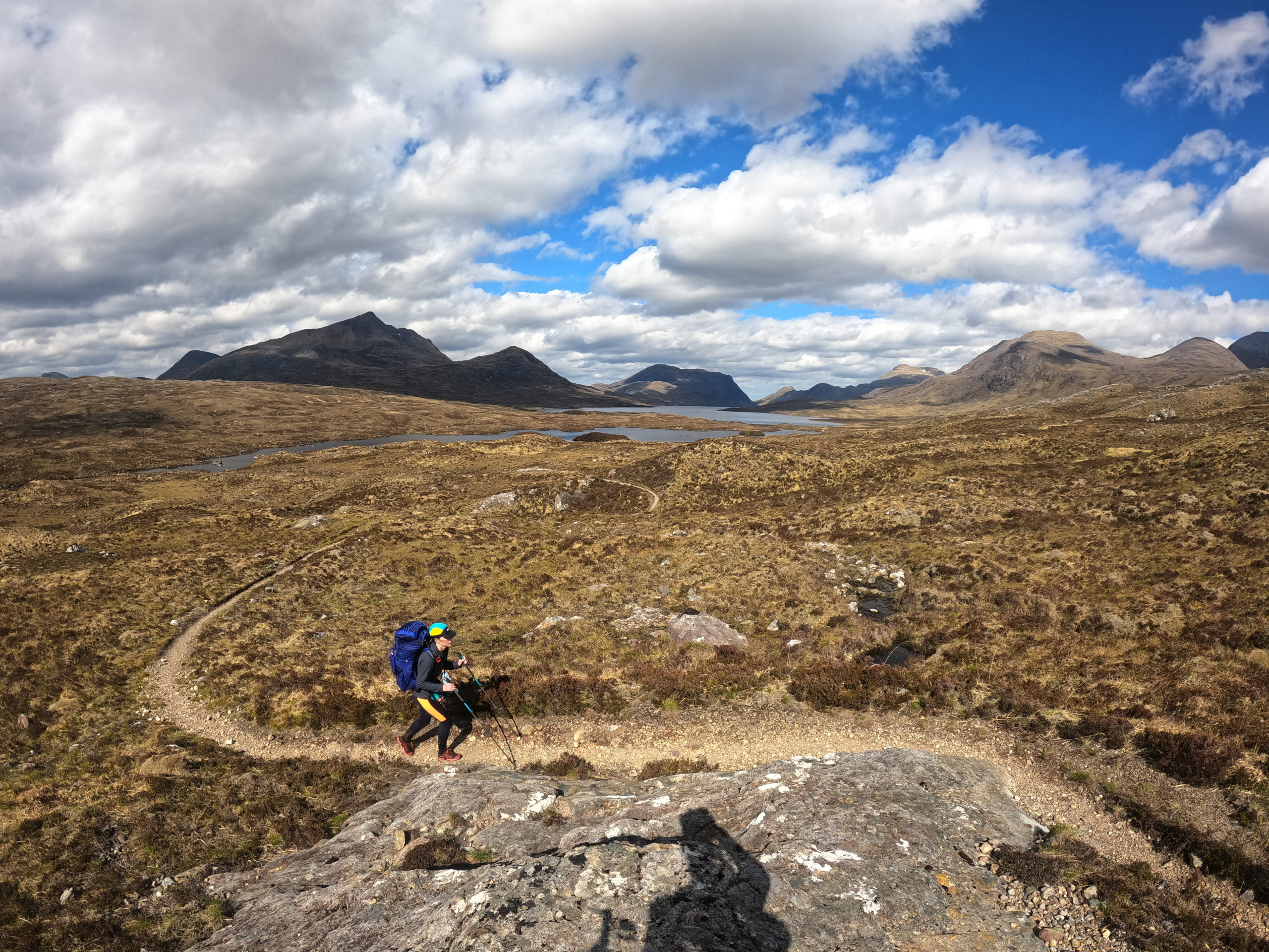
    We were climbing from the start, gradually up through (de)forest, then up onto the open country.  There was a decent track to follow and the higher we got the better the views got behind us.  Weather was perfect, big fluffy clouds and sunshine casting cool shadows over the landscape.  When the trail ran out we bee-lined for the pass, the Bealach Carn na h’Urchaire, which, at 648m, was the highest point of the trail.  The views were stunning and in front of us the first view of Ben Nevis.

    The descent was.steep at times, following a stream to begin with where we topped up on water, then joined a path continuing by the stream and later a gravel track down to the road along the northern shore of Loch Arkaig.  After a couple of km on the road heading east, we turned south again and joined the Great Glen Way as far as Gairlochy where the Caledonian Canal begins.  There is a spot here where camping is permitted by know of the lochs.  I guess it’s ‘semi-wild camping’, there are no facilities but it’s quiet and we are the only ones so far.  Plus the midges don’t seem so bad so far, winner!  Just as we zipped up for the night the rain started.  The first significant rain in about 10 days, we’ve been so lucky with the weather recently!

    Day 19: Gairlochy to Fort William (Nevis Campsite) 

    ? 19.95km

    ?61m

    A lazy start this morning, we set off around 0830 for the last stretch along the Caledonian Canal to Fort William.  The canal was nice enough, lovely views and a flat gravel path.  Not much more to say than that as it changed very little for about 12km to Lochyside. We played dodge a snail to pass the time. ? We reached the edges of suburbia, skirting it at first alongside the river, until we entered Fort William, conveniently right by Morrisons where we picked up some food for dinner.

    Continuing through town we arrived at our Sunday lunch stop.  We were an hour early after making good time along the canal path and so sat with a drink for a bit, celebrating reaching Fort William, our first big milestone.  We both had beef brisket with veggies and a Yorkshire pudding, then the sticky toffee for pudding.  It was really good, as were the beers.

    We made our way out of Fort William to Nevis campsite, found a spot and did some clothes washing whilst also scrubbing ourselves.  When you only have one set of clothes, you don’t have much choice but to sit there in your waterproofs whilst things wash and dry.  Luckily it wasn’t too warm a day.  Chores done we enjoyed a dinner of broccoli, garlic, lemon and parmesan pasta.  I followed up with custard and ginger cake.  Gotta get those calories in!

    A well earned Sunday roast & drinks ??

    Fort William concludes the first section of our journey, and possibly the toughest.  Certainly the most remote.  We should only need to carry a couple of days worth of food at a time now, since there will be shops, pubs etc. throughout most of the rest of the trip.  Tomorrow we are having a ‘zero day’ in terms progress on the route.  We need to go in to town to collect and post some things at the post office and do a bit of shopping  to top up on snacks and other essentials like sun cream, insect repellant etc. 

    How things add up so far;

    • We’ve walked a total of 430km (265 miles) and ascended 8250m.
    • We averaged 22.64km per day.
    • Our longest day was 37km and took 9 hours 48 minutes.
    • We’ve wild camped 10 times, stayed in 2 bothies,  2 campsites, 1 hostel and 3 hotel/pubs.
  • Antlers, lochs and (possible) falling rocks

    Antlers, lochs and (possible) falling rocks

    Day 10: Strath Mulzie to Inverlael

    ? 13.85

    ?310m

    We woke in a cloud filled valley and packed up a very wet tent and donned full waterproofs before setting off.  The cloud lifted with us as we climbed out of the valley and we were soon stopping to peel a layer off, then stopping again to peel another layer off…  After descending to cross the river in Glen Douchary, we were just about to leave the main track when I spotted a deer antler!  Not the full shebang, head and two antlers deal, but a decent single antler.  Pretty darn lucky to find it right by the track like that and a great souvenir, so I strapped it to my pack and will post it home from Fort William.

    The second climb was on difficult terrain without much of a path for most of the way.  Occasional vehicle tracks helped pick a good route over the flat boggy pass and we eventually picked up the gravel track on the other side which took us steeply down towards Inverlael Forest.

    Trail silliness

    Along the way we met Adriene and Peter who were out on a day hike, the first hikers we’ve met whilst it walking so far, after almost 350km!  We also met an geologist who was going up to check on some peat restoration work that was going on.

    Blue sky day

    We then had to walk a few km along the busy A835 which is part of the popular NC500 route, to our accomodation for the night at the Forest Way Bunkhouse.  We were a bit early arriving so took advantage of cafe just nearby.  An can of orange San Pellegrino hit the spot on such a hot day and both the ginger and courgette cakes were delish!

    At the Bunkhouse we meet a group of four hikers who were in the area climbing a few Munro’s.  They very kindly provided us with a glass of red to go with our bolognese Firepot camping meals, which we ate al fresco since the weather was so warm and no sign of midges yet.  We also received our first ‘trail magic’ from the group in the shape of a couple of Tunnocks bars, and some skittles. ?

    Trail Magic!

    An alternative route for tomorrow was suggested by Iain who owns the Bunkhouse, which would save us walking back on ourselves up the busy A road, so we will take that to tomorrow’s camp spot at Loch an Nid.  The only downer was realising that we had planned to get to Fort William on a Sunday so the Post Office will be closed. Will need to decide how we can revise our schedule to fix this as we have a package or two to collect there.

    Day 11: Inverlael to Loch an Nid

    ? 18.88

    ?452m

    We set off this morning in just shorts and tops.  Following the route suggested by Iain the previous evening, we were soon walking along a lovely river side path which soon began climbing the gorge that the river flowed through and there were many waterfalls and pools.  We crossed a rickety old bridge above one of the falls and climbed a bank to emerge on a B road which we had to walk a couple of km along before taking a path that leads to Loch a’ Braoin.

    Enjoying the waterfalls on the gorge walk

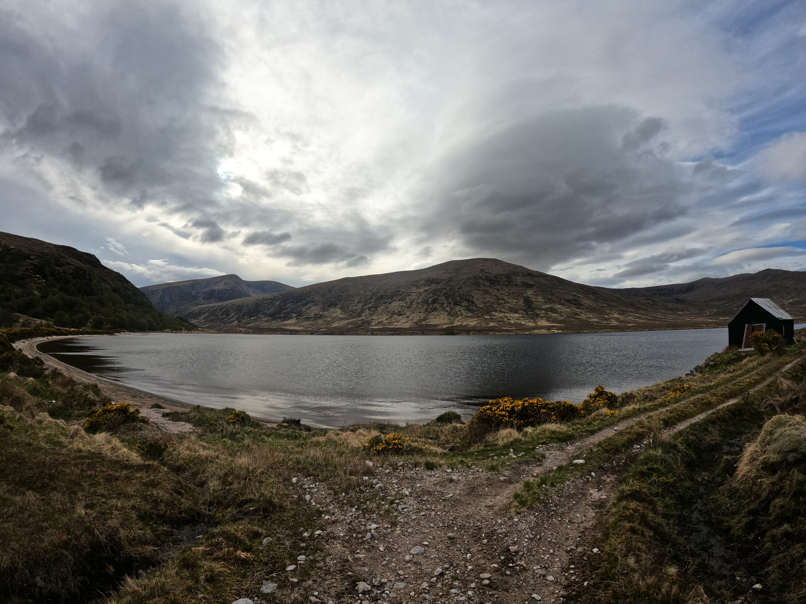
    We had misheard or been misinformed about a new path the opposite side of the Loch to the one shown on the OS maps.  At some point in recent years, the water level of the Loch had been risen a couple of meters in connection with a hydro power project, and the track alongside the Loch had been moved too as some was flooded.  We realised after not seeing a track on the other side of the Loch that the new track followed the same (northern) shore which we followed and eventually came to Lochivroan bothy where we stopped for lunch, sat on a bench outside in the sun.

    Continuing, the path deteriorated but was easy to follow round to Loch an Nid and we arrived around 1430. After setting up camp in the shadow of 3 Munro’s, I went to collect some water from a stream fed by the waterfall we can see.  It’s crystal clear, not like the peat filtered stuff from earlier on in our journey, and tasted so gooood!

    The last End to End trail hiker to pass through

    With extra time after a shorter days walking, I did my usual thing and had time to get the drone out, then do some photo management and backups.  An early night ready for smashing it over to Kinlochewe tomorrow morning.

    Day 12: Loch an Nid to Kinlochewe

    ? 18.61

    ?403m

    After a slightly disturbed night with us both waking around 0200 to the sound of what I think was a rock tumbling down one of the nearby steep sides of the valley (and had thought about this when pitching the tent but figured we were in a reasonably safe place, not that it helped in the middle of the night!), we woke to clear blue skies, the sun already glowing on the surrounding mountain tops.

    Beaut of a morning

    We got an early start and set off to find the path that would lead us up to the Bealach na Croise, a pass with a small loch at the top.  There was a good path most of the way but for about 3km at the top it was a matter of finding your own way, again around a few boggy areas, but much easier than some of the previous missions.  We were rewarded with views of Loch an Fada once we were over the pass and I couldn’t resist a quick dip once we got down to the loch.  It was fricking cold and I didn’t really do it justice!

    From Loch an Fada we followed a nice undulating single track trail down to the valley of Kinlochewe Heights, picking up the estate road through the valley, then tarmac into Kinlochewe.  Easily three busiest day in terms of other hikers on trail, and even a couple of bikers, with it being a bank holiday.  We made it just in time for the village store which closed at 1300 on a Sunday, I grabbed an ice cream, we each guzzled a fizzy pop, and topped up on a few snacks.

    We checked in at the motorhome campsite only to find that their tent pitches are a bit of turf on top of the gravel laid down everywhere so you can’t actually stick any pegs in the ground properly. This really ground my gears. Luckily it’s not windy.  We spent the afternoon relaxing, did some clothes washing for the first time on the trip and had a wicked Sunday Roast at The Gorse Bush to finish off the day.

    We have had a few easy days recently and I’m feeling a bit frustrated that we aren’t doing longer days, partly because I’m not very good at not doing nothing, so arriving at camp early afternoon like we have recently seems weird to me.  We needed to rearrange our schedule to be in Fort William when the post office is open so this either meant having a big day tomorrow, or having an extra day in Fort William and having a rest day.  In the end we chose the latter.  Although it means our next two days are again a bit on the short side, we are also in the heart of the Scottish Highlands now and there is more climbing to be done in terms terrain, not to mention it’s a nice place to hang out. ?  We are both still nursing foot issues that we haven’t seen before on such trips which is frustrating, but we need to manage them and not rush it!

    Teamwork makes the dream work
  • A tale of Lodges, a Bothy, and an Inn.

    A tale of Lodges, a Bothy, and an Inn.

    Day 4: Dalnawillan Lodge to Knockfin

    ? 22.5km

    ?447m

    Weather wasn’t too bad today, on and off sun/showers all morning then the afternoon was mostly sun/cloud with the odd light sprinkle.

    The track passed a couple of derelict lodges before leading us past the Glutt Lodge by Glutt Water (a tributary from source that feeds the Thurso) where we filled up. Water from the tap was straight out the burn, bits and all, we filtered and it tasted pretty damn good!  A good track continued past a cosy walkers hut maintained by the keeper at the Glutt Lodge and we sheltered there for an early lunch, avoiding a short shower.

    A couple of km after the hut we left the track and headed over the desolate bog that is Knockfin Heights, following Glutt Water to its source before locating the trig point atop the bog which involved picking our way through a boggy maze.  Unfortunately, during this tricky ascent, I slipped and broke one of my trusty trekking poles ?.  Some in the field DIY has done a reasonable job recovering it for now, until we reach Fort William an 10 days or so.

    We then picked up Knockfin Burn at its source and followed it down into the beautiful flat area looking across to Lochside and the Loch an Ruathair where a sheep fold provided the perfect camping spot (aside from the zillions of ticks -. No camp spot ticks all the boxes ?) near the ruins of Knockfin.

    Took the opportunity to wash my feet in river, stretched, ate, reviewed our route for the next two days and and we indulged in watching the Monaco F1 Qualifying Highlights courtesy of 4g ?. 

    Day 5: Knockfin to Loch Choire

    ? 37.10km

    ?432m

    After a cold night, knowing we had more than 30km to walk today, we were on our way by 0700.  We had a day of dry weather to look forward to and we were somewhat disheartened to only cover about 4km in the first 2 hours, picking our way through some boggy terrain alongside Bannock Burn, climbing a deer fence, and eventually meeting the road to Kinbrace.

    We had decided to take the wet weather option rather than trying to cross the river on the main route, and that meant walking the road down to Kinbrace, past the train station, where we stopped for second breakfast snacks, then a few km more before turning off onto a gravel estate road which was in good condition and meant we started knocking off the km’s a little more quickly.

    The estate road continued for around 20km through stunning Highland scenery and we saw so many deer is not even that novel anymore!  Loch Choire eventually came in to view and we passed the hunting lodge, then taking the South East route alongside the side of the Loch, through first and past small sandy beaches.  We eventually reached the proposed camping spot around 1700 to find it didn’t look great, not to worry though as we discovered there was a Bothy we could stay in.

    A quick foot wash in the loch (considered a quick dip but my god it was cold!), arranged ourselves in the bothy and dinner before an early night, dreaming of just 10km tomorrow to get to The Crask Inn. ??? 

    Day 6: Loch Choire to The Crask Inn

    ? 22.5km

    ?447m

    The rain arrived just as we had gone to bed last night and was still coming down in the morning when we woke so we were very grateful to the Bothy for keeping us warm and dry.  We were disappointed not to have seen the resident Pine Martin in the night as advertised!

    We took advantage of our accomodation to have a hot porridge brekkie before tackling the inevitable wet walk up to the promise of beer and a warm fire to dry off by at the Crask Inn.  We followed a good track around the head of Loch Choire, crossing two rickety bridges on the way, and started the climb up over the pass.  Despite the rain, the cloud had lifted a little and an occasional glimpse behind us was rewarded with views of the loch.

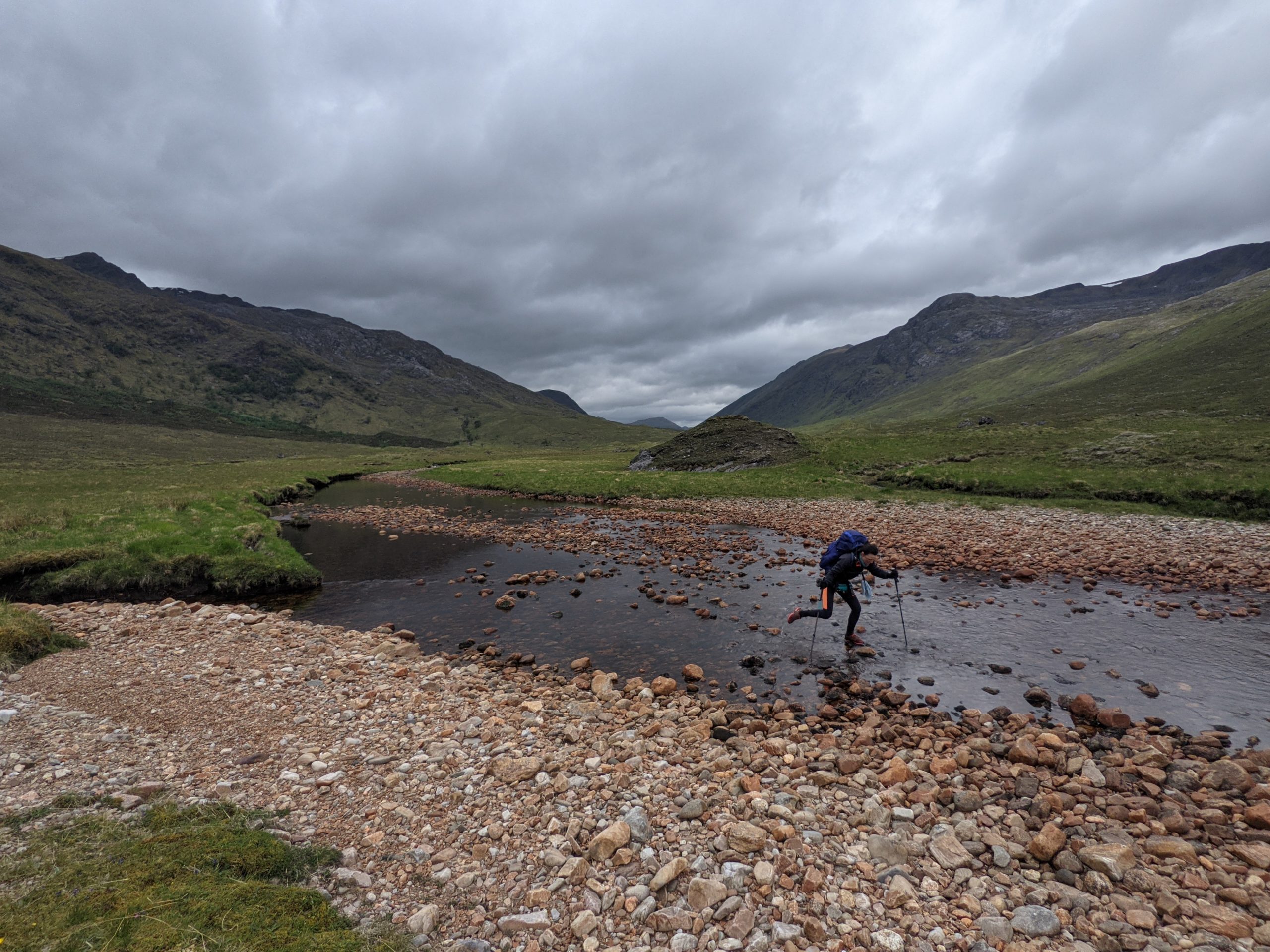
    After heading over the pass the path became less obvious in places and it was much boggier.  It was a rather bleak section and we were heads down with the Crask Inn in sight for what seemed like an age!  With all the rain, the rivers and streams were high and we had a fun leap across to avoid getting soaked, think junior school standing long jump style.  Eventually we arrived and had made good time to get there by 1100.  Our room was ready so we promptly emptied our bags, dried things off and enjoyed a hot shower.

    We had sent a package to the Crask with our food for the next 9-12 days as far as Fort William so we organised it all between us and then relocated to the bar for tea (Katie) and beer (me) whilst we set about planning our days to Fort William, chatted to Douglas, the owner, and other guests, and were entertained by Brandy.

    Having got used to the guide we are using for the route, and our pace over the first 6 days, we had a bit more information to base our next few days plans on.  With the recent rains the rivers are also quite high, so we may need to look at some wet weather alternatives in the next few sections.

    We revised our route and timescales a little and will now take 13 days to Fort William, instead of our original 9 days guesstimate.  There are a few reasons for this;

    1. We need to take a few wet weather alternative routes due to the high streams.
    2. The wet weather route doesn’t include the Crask Inn so tomorrow we will walk to Lairg via some forest tracks, to a campsite near Lairg where we can pick up the wet weather route on to Okykel Bridge.
    3. Taking our pace into account and how we can logically break up the route.
    4. Whilst our legs seem to be adapting ok now after the first few days of aches and strains, our feet are taking a little longer so we are taking a few shorter days. It’s a marathon, not a sprint!

    We also booked a few accomodation options for locations because with some of the revised stops along the route, wild camping spots aren’t too easy to find.

    That all took about 5 hours so by the time we were done it was about dinner time and we were excited for some fresh vegetables!  

  • Down but not out… What’s next?

    Down but not out… What’s next?

    Clutching at straws: stages of hope, denial and acceptance

    After the huge disappointment of deciding to get off the PCT and postpone our hike, there followed a difficult few days of hope and denial.

    1. Maybe this will all blow over in a couple of weeks. ?

    We can stay with my Dad and wait it out, then pick up where we left off, only a couple of weeks out of sync…

    2. Ok, maybe a couple of weeks isn’t gonna be enough, 1 month? ??

    How long until we out stay our welcome???? ?

    3A. In the meantime, risk mitigation hiking on the PCT? ?

    Could we still hike the PCT in a way that mitigates the reasons we aren’t hiking right now? We thought we could perhaps keep hiking and use a car with the following plan;

    1. We drive to location A
    2. One of us starts hiking to location B
    3. The other drives to location B
    4. The other then starts hiking to location A
    5. We cross in the middle, have a few mins break together and (importantly!) hand over the car keys
    6. On arrival at location B, one of us drives back to location A to collect the other
    7. Camp on trail near the car and repeat the next day

    Alongside this plan, we would do a few things to mitigate concerns about hiking during the C-19 pandemic;

    – Always have 2 weeks worth of food and water in the car as emergency backup (i.e. more than we needed) – the thinking here that if we got ill on trail we had enough food and water to self-isolate for two weeks in the tent/car without having to risk passing the virus on to others.
    – If one of us was ill enough to need hospital the other could drive to a hospital. Each day hiking would only be 10-15 miles due to time constraints with the added time needed to drive between locations. This meant that one of us was never more than 5-8 miles from the car.
    – We would avoid hiking in weather or locations where there was a greater risk of accident (most of the PCT is reasonably non-technical and easy to navigate in good weather).

    This idea seemed attractive. We could do two week stints before returning to my Dad’s to review the situation and resupply if possible for another stint. When things settle down we wouldn’t have lost so much time in terms of making progress on the trail. The only thing I was still uneasy about was the scenario where an accident occurs and we need assistance (see this article which highlights the problem here). If we mitigated this as noted above then it felt we were not putting ourselves at any greater risk than driving, walking, cycling in residential areas although rescue may be trickier.

    Katie did some research and in fact, whilst this seemed like a good idea, it would be difficult logistically and quite a lot of extra effort and cost. We decided it wouldn’t actually be a fun way of hiking the trail.

    4. In the meantime, Plan B: Hike local, keep fit, you never know when we might get back on trail…

    Hike relatively local to my Dad’s until we could get back on the trail. The day after we got off the PCT I insisted we walked down to and along the beach with our packs on. Must have looked like right goons. ? I didn’t care.

    5. Fighting acceptance ?

    Day by day the situation changed, as it had been for the past 2-3 weeks. Gradually, measures became stricter, some National Parks are completely or partially closed, campsites are closed etc. It doesn’t look like even option 2 has any hope of coming to fruition.

    6. The straw that broke the camels back ?

    When Boris announced the UK’s isolation lock down on Monday 23rd March the Foreign Office also issued a statement to say that all UK citizens abroad should return to the UK. I contacted our travel insurance to find out what this meant for us and was told what I had feared – if we stayed, and made no attempt to return home, we would not be covered for medical expenses in the US. We couldn’t risk this, it would wipe out all our savings, and more!

    We booked a flight home for Thursday, re-packed all the things we had unpacked from the trail after packing everything to get ready for the trail and made the most of our last couple of days with my Dad.

    Back on home soil ?

    We arrived home in the UK Friday lunchtime and are fortunate that we have plenty of family options where we can stay. For now, we are staying with Katie’s parents and hope that we didn’t pick up the virus on our trip home. Like many others, we are video calling friends and family more than we ever have before and making the most of it!

    We gave up our flat and our jobs in London so we are job hunting once again (if anyone has anything going, let us know!). Depending on how/where that turns out, we might find ourselves looking for a flat again.

    The plan, when we left London for a year out, was to not return to living in London. We expected to have plenty of time to discuss where to look for jobs whilst walking from Mexico to Canada; we could look for jobs in London and commute from outside, or we could look somewhere else entirely. Well we accelerated some thinking on that and both agreed we like the Bristol area as a location but want to live somewhere nice and green. But given the situation we are looking for jobs all over the UK and worrying about the location later! ?

    Once again, whilst we are devastated that we have had to postpone our year out adventures, not just the PCT but our travel plans for South America too, we are lucky to have family we can stay with whilst we find our feet again. Many others have been affected in bigger ways that really impact lives, this is just a minor readjustment in ours.

    The PCT isn’t going anywhere and we will be back at some point in the future… ?

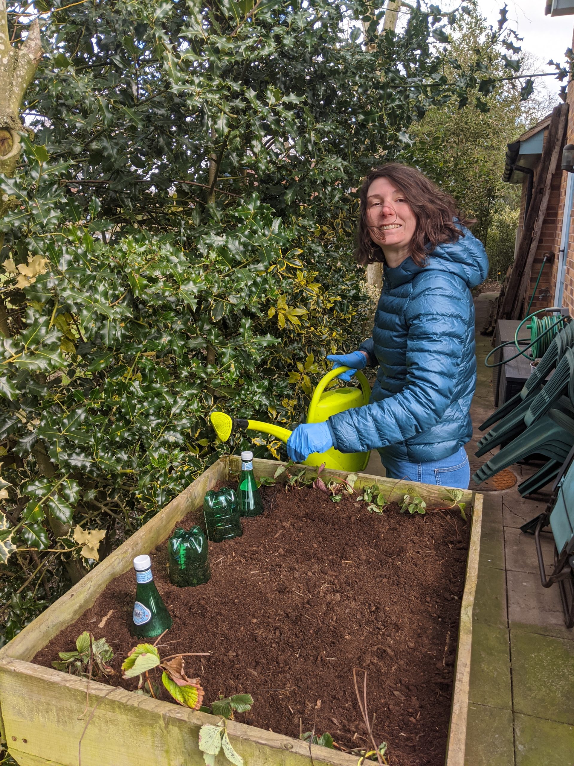
    In the meantime, amongst CV polishing and job applications, some tlc for the tent and some fruit and veg planting! ?

  • PCT Day 4: A Difficult Decision

    PCT Day 4: A Difficult Decision

    20/3/20
    PCT Day 4
    7.2 miles (+0.5 miles off trail)
    Tiny House @ Mount Laguna (0.5 miles off mile 41.5) to Penny Pines Trailhead (mile 48.7)

    Didn’t sleep brilliantly and even in our Tiny House it was a chilly night!  Spent a while in the early hours doing a bit of dozing but mainly thinking about the PCTA update and Big Bear statement I read last night before bed.

    Thoughts floating around…The PCTA update asked hikers not to hike and postpone or cancel plans.  The PCTA do a lot of great work for the trail and I wanted to respect their request, the same goes for the Big Bear statement.  It feels disrespectful to turn up in towns which are asking people to stay away to curb the spread of the virus.  At the same time, I was within a few feet of more people when I went to In-n-Out the day before we set foot on the trail than I have been during the 3 days on the trail.  Am I really that big a risk to others as a thru hiker?  I’m still not convinced on that, but what if I unwittingly did pick up the virus and Katie or myself became ill in the next few days?  We had 4 days to Warner Springs and only 4 days of food.  If we became ill, we couldn’t sit in the tent for two weeks, we didn’t have enough food.  We were relatively near roads to get picked up but we would need to get to the road and who would pick us up?  My Dad lives less than 2 hours away and is our very own trail angel, taking us to the start and was due to post some re-supply boxes to a few locations.  We could call him, but he’s in his late 60s and has asthma and we then put him in danger.  Anybody who comes to collect us, we put in danger.  And we put ourselves in danger to.  Despite being young and healthy, I have asthma and although it’s very mild, who knows what effect the virus may have on me.  If we were ill and needed emergency assistance, we would then be taking up emergency resources that are needed elsewhere at the moment.  So it felt to me at least that the morally responsible thing to do was to get off trail while we are at least knowingly virus free, get back to Dads and take stock. ?

    When Katie woke we discussed things and agreed to phone Dad and ask him to come and get us.  Katie did suggest that we at least walked some way today which was a great idea, so we asked Dad to meet up with us about 8 miles down trail.

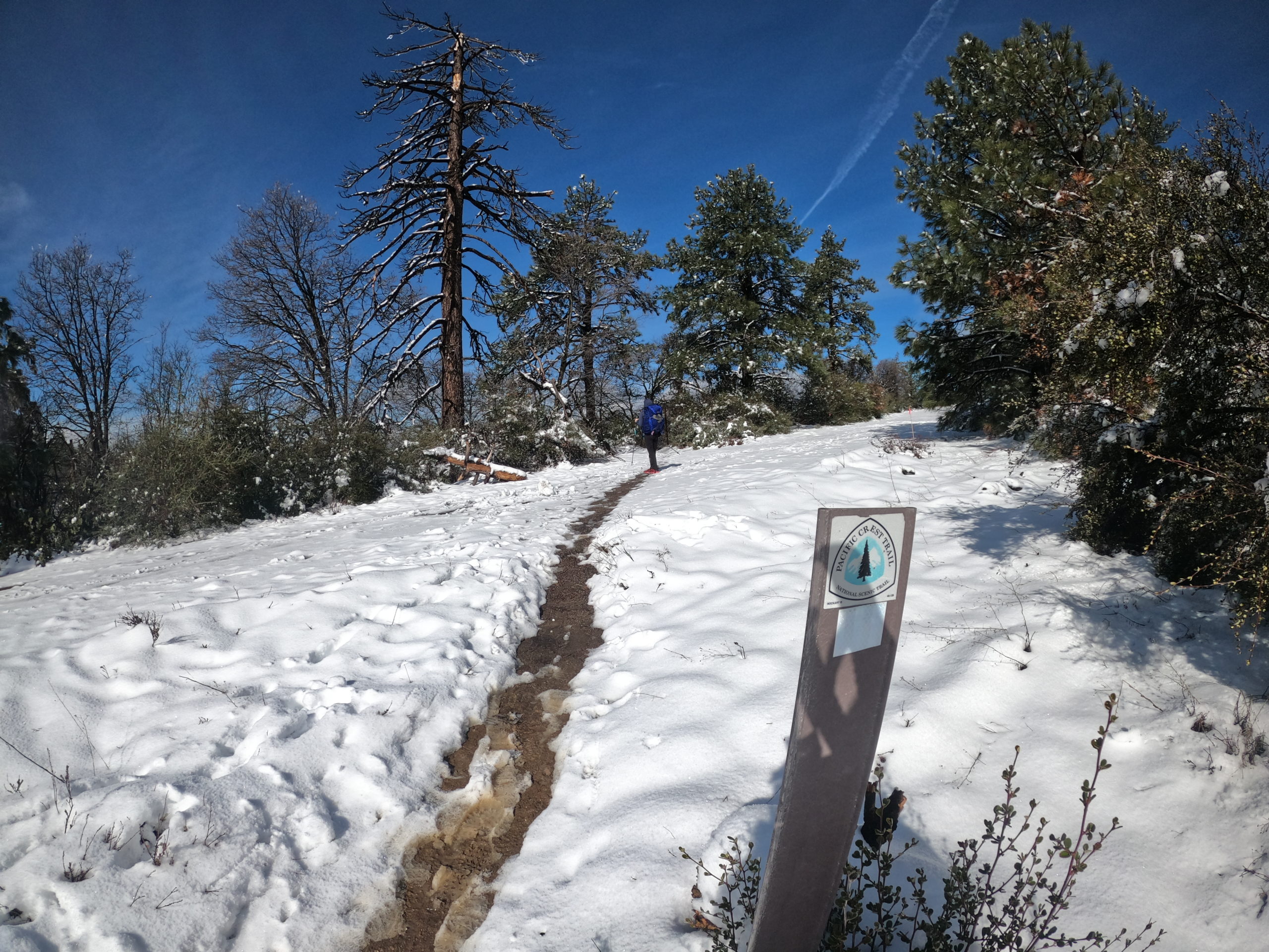
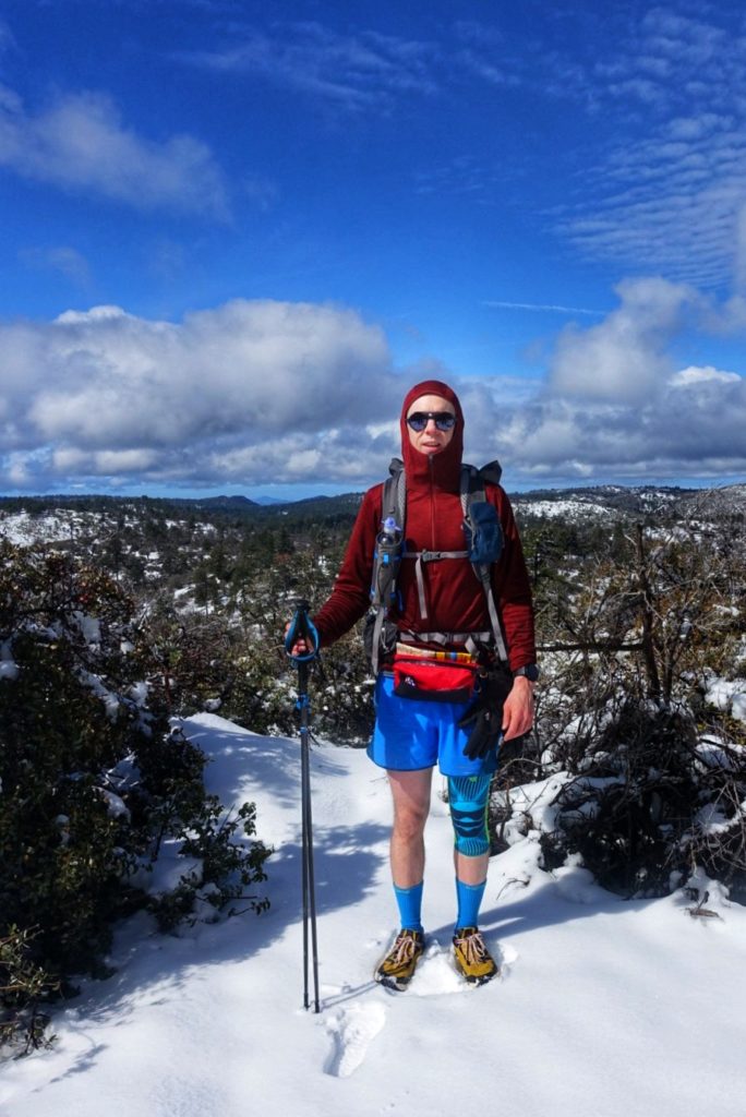
    It was a cold but sunny morning and the snow was dazzling so I at least got a chance to try out my sunglasses at last!  Whilst we were both deeply disheartened to have to leave the trail, it felt good to be walking again and not in the rain!  It was a beautiful morning to hike and we made the most of our last hike on the PCT for the time being.  The low temperatures made the snow nice to walk in and the landscape was sparkling.  In these conditions you suddenly became aware of all the animals around you, that are otherwise invisible, due to the many cat and rabbit shaped paw prints in the snow.

    More Hiker Vogue

    We only crossed paths with one other hiker from San Diego who had similar views about respecting the PCTA statement and was considering his options.

    The views out across the Anza Borrego Desert NP were amazing and we could see Salton Sea in the distance as we wound our way along the mountain side.  The first really impressive views that would could actually see and right at the abrupt interruption to our hike!  As we descended, snow turned to slush and by the time we arrived at our meeting point with Dad, there was little snow on the ground.

    When we arrived back in HB, we grabbed ice cream and sat in the sun at Dad’s reflecting and contemplating.  Tomorrow we will update the blog and share a few pictures.  Over the next few days we will think about our options and decide where we go from here.

    We are incredibly unlucky that this virus has hit at this time just as we quit jobs, move out our flat, and plan a year away to hike the PCT and then travel around South America.  At the same time we are incredibly lucky.  We are both healthy and are able to stay with my Dad which will help limit how much we spend day to day whilst we assess our options.  The virus has affected our travel plans this year but not our life and many others will be affected in worse ways; some dying, many losing jobs, businesses will go bankrupt.  The PCT is not going anywhere, our adventure on it is postponed, not cancelled.

  • PCT Day’s 1-3: Off to an all elements start!

    PCT Day’s 1-3: Off to an all elements start!

    17/3/20
    PCT Day 1
    15.4 miles
    Campo (mile 0) to Hauser Creek Tentsite (mile 15.4)

    Finally, the day we had been dreaming about, then planning, had finally arrived.  Today we started the PCT!  Dad drove us from Huntington Beach to Campo on freeways that, due to the corona virus situation, were very quiet for a Tuesday morning rush hour.  I was a mixture of nerves and excitement and Dad have to pull over for two wee stops on the way even though I had only had a coffee to drink this morning (along with lemon meringue pie and ice cream – the only sensible way to set yourself up for a thru hike!) ?

    We parked up near the infamous southern terminus posts and after some final preparations checked in with the PCTA at the terminus, had the obligatory pictures taken and set off at 1015.

    Dad joined us for the first 2 miles before turning back and we were off on our adventure.  The weather was cool and cloudy for most of the morning, in contrast to the weather we had all imagined on this day, even Dad had remarked as we arrived at the terminus that when he had imagined dropping us off there, in the desert, he had pictured a hot sunny Californian day.

    The weather improved a bit throughout the day and we enjoyed the walk, thinking about how far we would go today, would we make it to Canada, what would tomorrow bring, do I have enough food, do I have enough water……  I think it finally hit me about mid afternoon that we were really doing this.  We have saved, quit jobs, given up a flat in London and it’s all been a bit non-stop recently with planning and preparation but now, with time to think, the realisation set in and I felt all warm and fuzzy!

    We had been planned to go about 16 miles today and were aiming for Hauser Creek tentsite which we arrived at about 1800 that evening with about an hour remaining until sunset.  Not the most ideal camp spot in a valley by a stream but there were plenty of pitches despite it being a popular first day camp spot and we found a pitch, setup camp and had dinner.  Content, sore and aching (yes, already!), it was lights out for me by 2030 with the frog chorus from the creek for company as I drifted off.

    18/3/20
    PCT Day 2
    13.2 miles
    Hauser Creek (mile 15.4) to Wild Camp (mile 28.6)

    Our second day on the PCT was full of sogginess from the beginning.  Alarms went off at 0600 and before long were were breaking camp, prepared for a damp day.  On the move by 0715, we had about 4.5 miles to Lake Morena where we were hoping for a hot drink, some food, and I needed to pick up a few snacks for the next few days.  At Oak Malt Liquor Store & Cafe, we were able to order a couple of toasted sandwiches and some supplies but had to takeaway so we headed to the campground up the road to find shelter, share a sandwich (saved the other for later!) and use the facilities.

    The rain continued most of the day with a few dry patches from time to time. On the plus side my rain ‘kilt’ was doing an excellent job and making me easy to spont from miles off. ?  When the trail passed under Buckman Springs Road, we used the protection of the bridge to have a brief stop with a few other hikers (social distancing observed!) and grab a snack.  Moving on, the trail crossed Cottonwood Creek and we experienced our first ‘river crossing’ with no way of keeping feet dry getting across and just round the corner the trail itself resembled a stream.  Not too much further, another river crossing where the planks of wood put across the stream were floating.  That’s a few more ‘river crossings’ than I was expecting in the desert! ?

    Hiker Vogue

    We didn’t have a campsite or distance planned, but after arriving at camp the previous night at 1800, we had decided that we ideally wanted to be arriving at a camp by 1700 to allow enough time for setup and dinner before dark.

    We considered stopping at Boulder Oaks campground but facilities weren’t great and there was a fee to camp there so we continued 1.6 miles to a spot and grabbed the chance to setup during a break in the wet weather by 1600.  The rain continued on and off as we hunkered down in the tent and finished the sandwich we bought earlier in the tent.

    I can just about hear highway 8 down in the valley below and we had good phone signal so checked weather forecast.  Below zero tonight and due snow tomorrow.  An interesting day to look forward to tomorrow with the trail steadily climbing about 1100ft to Mount Laguna.  Looking ahead at the forecast tomorrow night in Mount Laguna, it reported overnight temperatures of -10 so we decided to use the good signal to book a place to stay in Mount Laguna where we can dry out some wet gear (it’s only day 2, we are easing into it! ?).

    19/3/20
    PCT Day 3
    12.9 miles
    Wild Camp (mile 28.6) to Mount Laguna (off mile 41.5)

    A slow start this morning, alarm snoozing, packing up, eating breakfast and then waiting for a break in the rain to jump out, do our business in the wild and pack up a soggy tent.

    The weather forecast had improved since yesterday and we were hopeful of drier, slightly warmer conditions. We set off with the prospect of a dry night in lodging at Mount Laguna in about 12 miles.  We were climbing for a few hours through a mixture of wet and dry spells with chilly temperatures and not to much wind.  As we climbed, rain turned to snow and for at least half the day we hiked in snowy conditions, 4-6 inches in places. ⛄

    Despite the climb and conditions, we made good time to Mount Laguna and found the Pine Tavern open for takeaways.  We grabbed a coffee to warm up and found our home for the night just round the corner.  I nipped back to the Tavern to get a couple of takeaway burritos for our dinner.  We showed and spent the evening drying all our gear in the tiny house.  The heater has been on full, windows open and wet stuff hanging everywhere!

    Arriving into Mount Laguna
    Tiny (drying) House

    We made plans for the next two days with a couple of camping options 15 and 18 miles further along the trail for tomorrow and bearing water sources in mind as some long waterless stretches coming up.  The weather is due to warm, brighten and wind should be low so the second camping option, which promised great views had us pumped to get a solid day in tomorrow.  We made sure we had enough food to get us to Warner Springs (about 4 days solid hiking away) where we had posted a package to collect at the Post Office.

    I spoke with Dad to get an update on the corona situation.  At the moment we feel we are minimum risk to ourselves and others and with a package to pick up at Warner Springs, we can get to Idyllwild with minimum need to interact with others and minimum chance of picking up the virus ourselves.

    The day before we started, the PCT Association released a statement asking hikers to take care and use common sense but the advice wasn’t to not hike, the trail was open which is why we felt starting was the right thing to do and continuing while we are not interacting with others is a reasonable thing to do.

    Just before I went to bed I saw an update from the PCTA and a statement from Big Bear asking people not to make trips to Big Bear (a stop about 2 weeks away on the hike and not the first place to make such a statement)… ?

    3 days on the PCT has so far given us quite the mixture of conditions and experiences!

    ✅ Rain ☔
    ✅ Sleet
    ✅ Hail
    ✅ Snow ⛄
    ✅ Sun ?
    ✅ ‘River’ crossings
    ✅ Nature poo ?
    ❌ Snakes ?
    ❌ Bears ?
    ❌ Trail Magic
    ❌ Hitch Hikes

  • Tom’s PCT Gear!

    Tom’s PCT Gear!

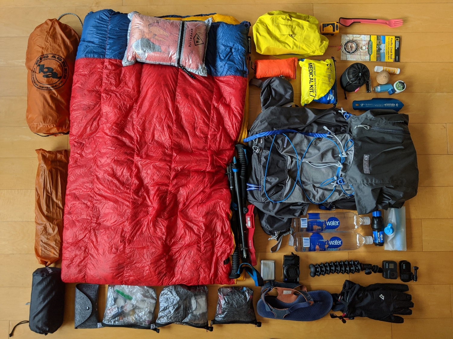
    The Big Stuff

    ⛺ Tent

    There was a spreadsheet involved in the purchase of this tent. Ultimately wanted a free standing tent rather than a trekking pole tent and with two of us, a door either side is important. We have the Big Agnes Copper Spur UL2 (an older version than this latest, think ours is the 2018 version) and have been very happy with it on a few trips. Sure it’s not the lightest but it’s light enough, withstands storms and keeps bears out (maybe).

    ? Sleeping Quilt

    Yup, a quilt, not a ‘bag’. I find I get hot and sticky in a bag so tried a quilt instead and it’s great! I have the Enlightened Equipment Revelation Quilt 20°F with 850 down fill, 6’6″ (long) Length and 58″ (wide) width. It is quite literally a revelation and even Katie was a converted. She has the same but rated to 10°F.

    ? Sleeping Mattress

    The Thermarest NeoAir XLite is great, warm enough for me in most conditions and comfy enough. Of course there is the risk with a mattress that it gets a puncture but having tried the Thermarest Z Lite mattress, the xlite is so much better (the Z mattress eventually resulted in silver bits everywhere!)

    ? Bag

    After some research, I had decided on the Gossamer Gear Mariposa 60L for backing trips in general and it’s first outing was the Hebridean Way in May 2019 where it performed admirably and so it will be joining me for the PCT. Great accessible outer pockets and able to attach camera case and a Bottle Rocket to the shoulder straps.

    ? Fanny Pack

    ThruPack Summit Bum to keep handy items available.

    Footwear

    ? Shoes

    Initially I thought I would stock up on one style of shoe to keep me going through the hike (on average, hikers get through 5 pairs). In the end I’ve resisted doing that completely because some sections might call for different shoe styles, as you hike your feet tend to go up a size and different sections/times of year may call for different sock thickness.

    I’m planning on starting in a new pair of New Balance Fresh Foam Hierro v5 in a generous size 11 (I’m a size 9 in normal shoes, wear size 10 normally for running shoes). These have good cushioning and breathability for the desert. They also have room for foot size increase and larger socks without being too big in the first place. I’ve had good experiences with New Balance trail shoes in the past so am confident they will be great! I also have a pair of La Sportiva Mutants in a size up from what I normally wear. I’ve worn these shoes for the past few years for hiking and trail running and the grip on phenomenal so I think they may be a good choice for the High Sierras section where we will see snow and cross lots of rivers.

    I’ll decide on others shoes as they are needed based on experiences so far. The most popular shoe choice on the trail (based on survey link) are the X. I did try these out in the Outer Hebrides in May 2019 and did not find them a good option for me.

    I’ll decide on others shoes as they are needed based on experiences so far. The most popular shoe choice on the trail (based on survey link) are the X. I did try these out in the Outer Hebrides in May 2019 and did not find them a good option for me.

    ?Socks

    General approach, which I got from Andrew Skurka (link post) is to have a couple of hiking pairs on the go and cycle them each day, washing them if possible and drying when you stop or hang from your pack as you hike. I’ve found this is a good system, it always feels nice to put a ‘fresh’ pair of socks on half way through the day and if you can wash them, it helps the stinky situation (my feet tend to get pretty nasty smelling! ?)

    I’ve done long distance running for a few years and always used injinji socks which I’ve found to be excellent at preventing blisters. I think I would benefit from a bit more cushioning than injinji socks provide so I’m going to start the trail with two different options;

    1. Injini hiking liner sock paired with Darn Tough or Stance Socks
    2. Injinji hiking sock (most cushioned available)

    ?‍♂️ ‘On The Move’

    Base

    ? Layers

    ? Accessories

    ? Stop/Camp Clothing

    • Down Jacket: Mountain Equipment Skyline in eye catching bright orange!
    • Merino boxers – warm temp sleeping
    • Merino leggings – cold temp sleeping
    • Camp Footwear: Vivobarefoot sandals for around camp, give my shoes a chance to dry out and my feet a chance to breath

    ☔ Waterproof Gear

    • Jacket: REI Drypoint GTX Jacket. Gets great reviews and I’m happy to carry some weight and pay a bit more for a jacket that will do a good job of keeping me dry.
    • Bottoms: ULA Rain Kilt – yeh a ‘skirt’! I find I overheat in waterproof trousers so gonna give a rain skirt a go. Doubles as modesty protection whilst I’m washing all my other clothes in town from time to time!

    ?Navigation

    I’ve no doubt there will be many on the PCT this year with only their phone for route checking and navigation. I believe you need a backup and that good old paper maps are superior in many ways to electronic maps, including giving a much larger view area at one time. So we will have both options;

    ?Electronics

    I want to capture memories and document the trip through photos and diaries so I have quite a bit of electronic gear. I can always dump some of it if i’m not using it all.

    • Go Pro Hero 8 Black – action shots and nice wide view, easy to get pics of Katie and I together
    • Sony RX100 IV – takes great photos, has zoom and can add filters
    • Google Pixel 2 – does take good pics but using mostly for trip diary, nav backup etc.
    • Zendure SuperMini 10000mAh power bank
    • Sandisk Extreme Rugged 1TB backup drive
    • BioLite HeadLamp 330
    • Accessories: Wall charger, cables, 3 batteries per camera, camera battery chargers, spare SD cards, Joby Gorilla tripod with GoPro adaptor.

    ?Camp Kitchen

    ? First Aid Kit!

    Lightweight Adventure Medical Kit, because it’s good to be prepared

    All The Gear…

    Lighterpack Breakdown

    Yup, I totally geeked out and weighed a load of stuff. ? It’s not uncommon.

    https://lighterpack.com/e/w9r5bd
  • PCT Prep: Winter Skills Training

    PCT Prep: Winter Skills Training

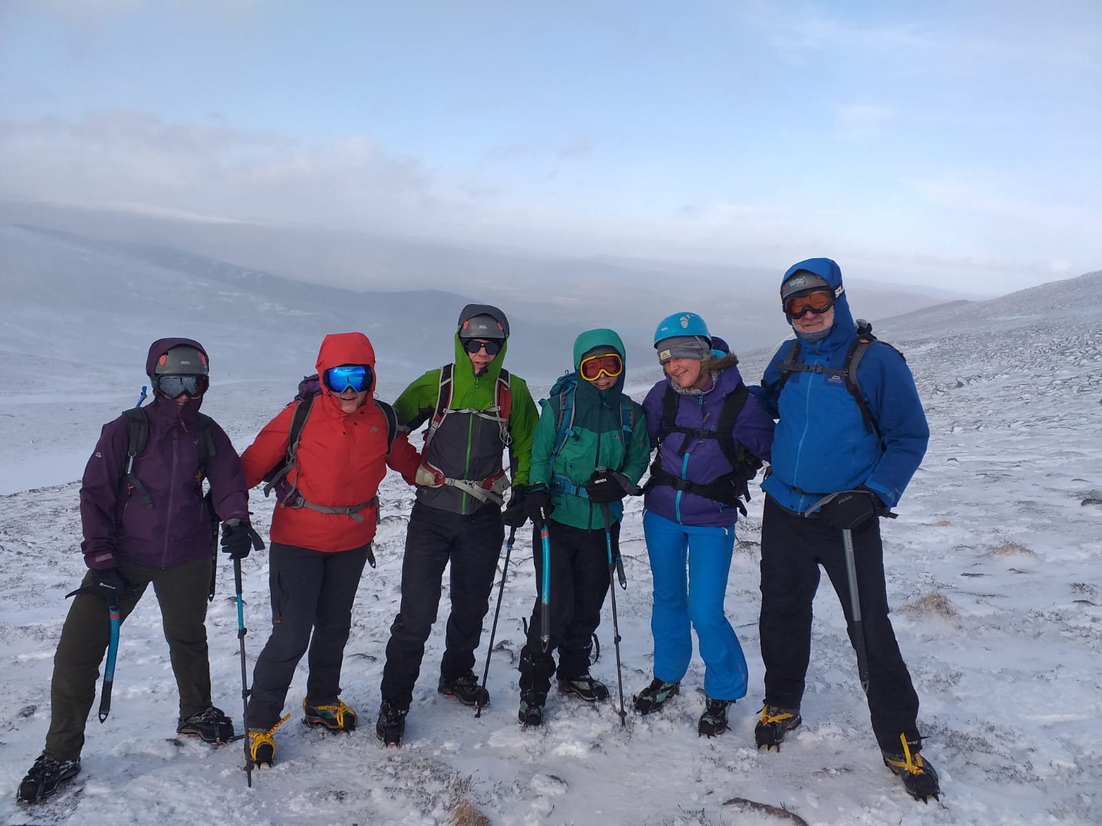
    It’s pretty much a certainty that we will encounter winter conditions and snow pack in the High Sierra’s (if not other areas) particularly as we are starting the trail mid March and therefore entering the mountains about a month earlier than is generally considered the best time to be doing so. By failing to prepare you are preparing to fail (Benjamin Franklin!) so we headed to the Cairngorms in Scotland for a Winter Skills Training with Cairngorm Adventure Guides.

    The weather forecast on Day 1 was clear in the morning, showers/snow later in the day and damn windy! We met our guide, Scott, and the rest of our 6 person group, and Scott talked to us about some of the essential skills for outdoor winter adventures. There was a lot to cover! Over the whole weekend we learnt about identifying and reducing avalanche risk, reading avalanche forecasts, how snow pack is analysed to produce the forecasts (and how you can use that yourself to assess risk), numerous ice axe skills, crampons skills, navigation skills and planning a day out taking all this, and the weather forecast, into account.

    Having covered some of this indoors we headed up to the Aviemore Ski area with a planned route in mind and practiced some simple navigation skills to get going. We soon found that we were at freezing level at around 600m, just as forecast, and so our first time putting crampons on in anger to safely walk up the frozen path.

    The higher we got, the windier it got and we soon learnt that it took gusts of about 75mph to knock us over! Throughout the day we stopped frequently to learn skills and put them into practice, everything from how to hold an ice axe, techniques for traversing or climbing slopes in crampons, and keeping a continual eye on the weather – was it doing what we expected, has anything changed that would change our plans? Importantly, we not only learnt how to avoid slipping but also how to ‘self-arrest’ – using your ice axe to stop yourself sliding down a slope should you need to. Emphasis on techniques to prevent this happening in the first place!

    DCIM100GOPROGOPR0002.JPG

    Despite only walking a few km, it had been a tiring day and we spent the evening relaxing back at the hostel, caught the end of the England Six Nations game (beating Scotland). Fish and chip dinner, I went for the tourist classic – battered black pudding followed by battered mars bar. ? After some homework – checking the weather and avalanche forecasts for Sunday, we got a good nights sleep ready for another day of training.

    The weather forecast wasn’t good on Sunday, rain, cold and even more wind! We met at a cafe near the ski centre and went over some map knowledge and some exercises before heading up to the ski centre. We stayed lower and explored the ski slopes (which were not open for skiing!), using some fencing where snow had collected to practice more techniques without crampons and some more techniques with the ice axe for cutting steps into a slope. The weather had not been quite as bad as forecast to begin with, but the rain soon fell and the wind picked up, particularly whilst walking along a ridge. It was hard work to walk against, we were wet and cold so we practices some navigation whilst heading back down to the ski centre for a hot drink and debrief.

    Another evening reading and relaxing at the hostel, and couldn’t believe my ears when I overheard someone else in the lounge say they were hiking the PCT this year! What are the chances? Lovely to meet a fellow PCT 2020 hiker (Cam Hikes) and an enjoyable evening chatting everything PCT with her! ?

    We woke Monday morning to an inch or so of snow in Aviemore and it was still coming down as we enjoyed a cracking breakfast at the Mountain Cafe. We had time for a fun Wintery walk in the snow, with the sun poking through before heading back to Inverness for our flight home.

    We were both really happy that we had done the winter training and learnt so much. We definitely feel better prepared to make good decisions during planning and whilst out on the hills, trails and mountains.

    ?Top 5 takeaway’s from the weekend

    ? Katie

    1. Wind: 60mph is pretty hard work, 75mph literally blows me away. ?
    2. My walking pace for a flat 100m is 72 steps.
    3. 4 D’s for Planning & Navigating – .Direction, Description, Distance, Duration.
    4. Have everything you need throughout the day, to hand and tied on. Pack everything else in the correct order and in familiar packaging.
    5. Have an ‘Ouch Pouch’ ready to go at the top of your bag, full first aid the bottom.

    ?‍♂️ Tom

    1. Avalanche Risk Assessment – Angle, Aspect, Altitude, 100m run off, 30 degrees.
    2. Basics of ice axe arrest – how to try and stop sliding if shit hits the fan.
    3. More importantly, techniques for preventing situations that require an ice axe arrest in the first place!
    4. Don’t just use tech maps (phone, watch) when you aren’t sure where you are, verify where you think you are with them regularly, before you aren’t sure!
    5. I’ve put myself in some silly situations not knowing how to plan a winter outing bearing in mind weather and avalanche risk! Been lucky so far, make better choices in future!

    Bonus: I need new gloves. ?

    #PCT2020 #failingtoprepareispreparingtofail #ScottishWinter #Winter

  • What is the Pacific Crest Trail?

    What is the Pacific Crest Trail?

    The PCT is a national trail in the USA which stretches 2650 miles between the Mexico and Canada borders. On average it takes about 5 to 6 months to hike and mid April is considered peak time to set off from the southern terminus, heading north. If you are hiking south from the northern terminus (the less popular option), due to weather differences between southern California and Washington, a later start is more common.

    There are a whole host of other resources available online that will tell you all about the PCT, I won’t regurgitate it all here!

    A few fun facts

    Altitude Gain: 489,418 ft
    Altitude Loss: 488,411 ft
    Highest Point: 13,153 ft (Forrester Pass)
    States: 3; California, Oregon, Washington
    National Forests: 25
    National Parks: 7
    Steps: ~6,000,000 ?!
    Bear Sighting: 73% chance
    Rattlesnake Sighting: 92% chance

    Links to other info

    The PCT Association – all the information you could wish for!

    Halfway Anywhere 2019 PCT Survey – Interesting stats from 2019 thru-hikers of the PCT (and past years), not to mention other great info and resources.

    Map!

    Here is a fun illustrated map of the PCT by Nate Padavick who very kindly said I could use his work here. Check out his site for more loveliness!

    Fun Illustrated map of the PCT by Nate Padavick – check out his site!

    See you on the trail…

    #PCT #PCT2020 #thruhiking #adventure

  • May 2019 : The Hebridean Way

    May 2019 : The Hebridean Way

    Getting to the start of the Hebridean Way was the first obstacle. After a flight to Glasgow, 1 night in a hotel, a train to Oban, a ferry to Castleba, Barra Island, 1 night in a hostel in Castlebay and finally a taxi to the start of the Hebridean way, we set off!

    We had read about the amazing ‘Caribbean like’ beaches (Katie assures me they have been used as Caribbean ‘doubles’ for film and TV) and the starting point of the Hebridean way is sandwiched between two incredible beaches. The stories were true and amazing beaches we to be a regular sight on the first half of our hike up the western side of the islands of Barra, South Uist, North Uist and Harris.

    Day 1 – Vatersay to Eriskay, 9h, 25.2km, +701m, -728m

    We set off walking back along the road the taxi had driven us down and had a few inquisitive seals in the bay for company. Eventually a left turn took us off the tarmac, up and over a few hundred metres climb with views of more amazing beaches and Barra Airport which is the only airport in the world where scheduled flights use a tidal beach as the runway. The road then took us to the ferry terminal and we caught a ferry over to Eriskay where we walked a few kilometres to the Am Politician pub. Dinner sorted we find a good spot on the beach nearby. Not the wildest camp spot, it did the job and eased us in to wild camping life.

    Day 2 – Eriskay to Wild Camp, 8h30m, 31km, +126m, -147m

    We were on the move by 0830 and had only been going an hour and fifteen minutes we happened upon a cafe. Second breakfast was too irresistible, an egg and black pudding (local specialty) bap for me. ?

    Typical view of never ending beaches on the islands of South and North Uist

    We followed the coast all day, lapwings diving and making a racket everywhere! Weather had been good all day and we setup at a great campsite spot on the beach that night. First night trying the Firepit camping meals, Orzo Bolognese tonight, which was shot in! Watched the sunset before snuggling down for the night.

    Note made to self: avoid camping on sand, it quickly gets everywhere!

    Enjoying a Firepot meal with a view

    Day 3 – Wild Camp to Wild Camp, 9h, 33.5 km, + 156m, – 207m

    Long day today, quite a bit of road and beach pools some interior past 3 huge turbines. Weather was good again, sunny but some wind chill at times. Chatted to an old chap outside his house, he told us off his fishing takes and warned of coming rain!

    Stopped at a supermarket for a late lunch, some supplies for tomorrow and I ate 3 magnums. It was cheaper to buy a pack of 3 than one on its own! ?‍♂️ Sneaky loo stop at a hotel we passed.

    Another cracking beach! Spot the Magnum.

    Saw cows lost on the beach who tried the water, didn’t like it, walked down a bit and tried a different bit of the ocean only to find it still tasted crap. We setup camp about 1900 and enjoyed another great sunset beach view with our second Firepot meal, Beef stew and pearl barley, which once again hit the spot.

    Epic views (and where the cows got lost)

    Day 4 – Wild Camp to Lochmaddy, 9h, 35km, + 387m, -380 m

    A lot of road today as we navigated island to island across causeways. A few off road sections thrown in and we stopped at the Langass Lodge for a coffee and cake. The final 8 km was all road and we made it to the shop in time to stock up on some supplies before heading to the Lochmaddy Hotel bar for a steak pie and a couple of beers.

    Frustration had set in at the amount of road walking today, a little dehydration. Plus a couple of beers resulted in no desire or patience to walk far to find a camp spot, we settled for a patch of grass round the corner of the arts centre next to the Lochmaddy Hotel (they wouldn’t let us camp on their nice lawn). Less than idyllic but did the job. ?

    Day 5 – Lochmaddy to Berneray, 5h, 18km, + 270m, – 287m

    Made an early start, looking forward to finishing walking for the day around midday and having a relaxing afternoon in Berneray where we had a bunkhouse booked. After road initially retracing our steps a little to rejoin the trail at the junction to Lochmaddy, we then had some pleasant trails including bogs, ascents, descents and cracking views across to Berneray and over the sea to the next island of Harris. Honestly, even on a cloudy day, the sea looked tropical blue and the beaches are amazing.

    Made good progress to arrive in Berneray in time for lunch at a cafe, where we chatted with an older couple called John and Anne (that story continues later…) and picked up some supplies from small shop attached to the cafe. We then had a lovely relaxing afternoon in the bunk house we had booked, showered, washed clothes and did some planning for the next few days. We had been lucky with the weather so far but knew from the forecast that our luck was soon going to run out.

    John’s bunkhouse comes highly recommended and we had an enjoyable stay chatting to others staying there whilst cooking up a deserved meal!

    Day 6 – Berneray to near Seilebost, 7h50m, 19.5km, + 612m, – 605m

    Up early to shower, breakfast, coffee before getting the first ferry over to Leverburgh on the island of Harris. Whilst waiting we met Megan, a spritely 70 year old lady walking the Hebridean Way on her own over 14 days and raising money for an animal charity she had setup and helps run.

    The trail soon took us on to the moors and over a pass before heading down to Scarista. From there the route took us on to a huge expansive beach before returning us to the moor where we followed an old boundary wall that separated the moor from the farming croft land. Much of the time the path was actually along the top of the old wall and apart from that was fairly indistinct. We had been to-ing and fro-ing with Megan all morning and ended up spending the rest of the day walking and talking with her.

    The sandy expanse at Scarista

    We stopped for a bite to eat at the top of a climb with an incredible view down to Horgabost which we soon reached once we got going again and Megan left us here where she was staying at a B&B for the night. We had decided to keep going another 4km before finding a camp spot for the night. Well, the next 4km turned out to be the toughest 4km of the whole walk and took us 2 hours to cover! Lots of ascent and descent through heather and rocks with no discernible path. Luckily the views were awesome and it was dry. The next day we were glad we had tackled this stretch today as the weather turned wet and would have made that section even tougher.

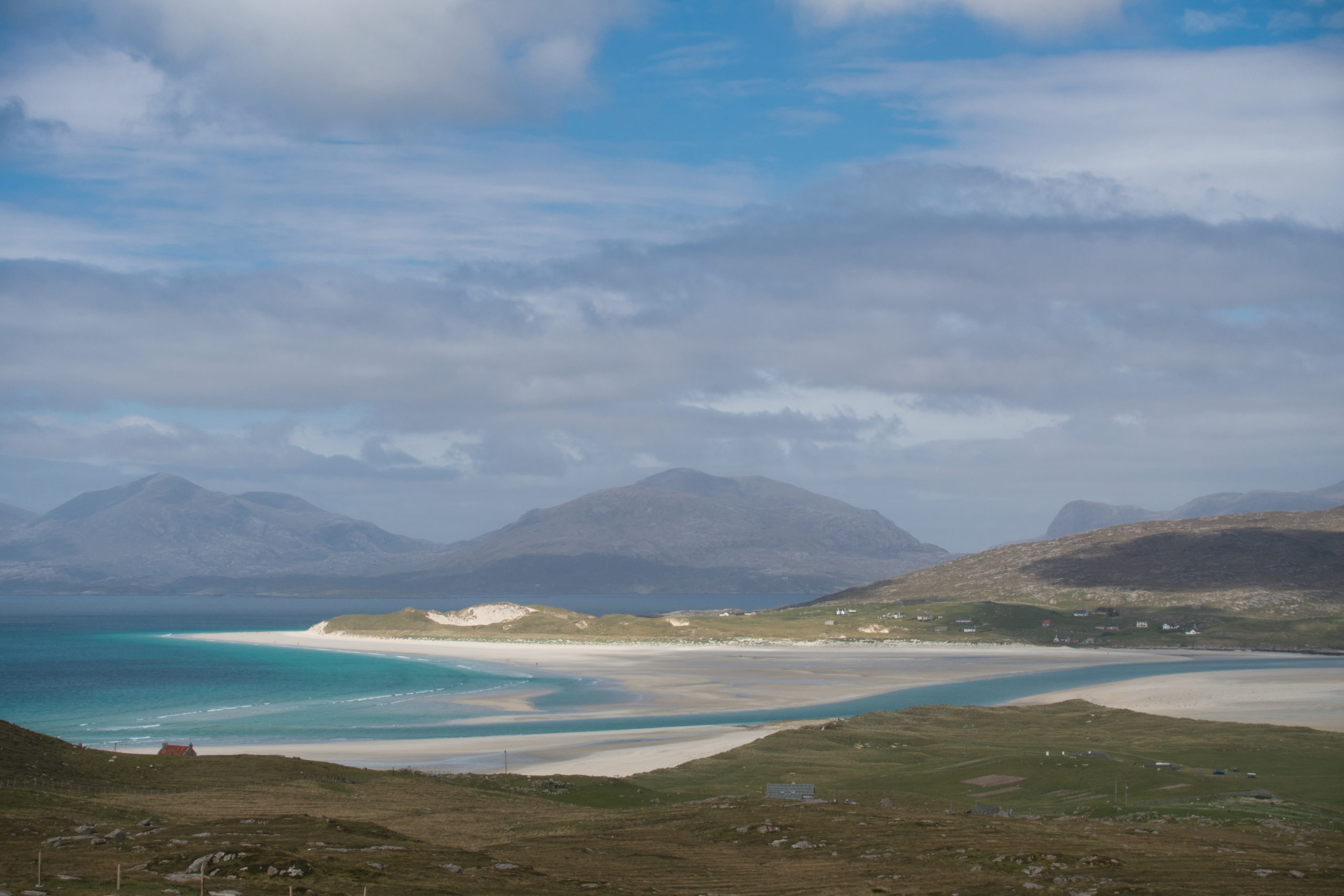
    Looking out over Luskentyre Sands with the mountains of Harris in the background.

    We found a secluded spot in the dunes with a view over Luskentyre Sands and tucked into a Chilli Con Carne Firepot meal, another winner. ?

    Day 7 – near Seilebost to Tarbert, 6h36m, 22.5km, + 555m, – 519m

    We were keen to get to the town of Tarbert today where we had the promise of a warm place to stay thanks to the couple we met in the cafe the other day at Berneray who had a spare bedroom where they were staying and were kind enough to say we were welcome to stay. When we had been planning the next few days back in Berneray and seen the looming wet weather forecast, it was an offer we couldn’t refuse! So we were up at first light and on our way along ‘The Coffin Route’, not kidding!

    The coffin route has a long-standing reputation of being a coffin road from the east of the island to the west. The old burial grounds were on the machair of the west, there being insufficient depth of soil on the rocky east side.

    The rain had started pretty much as soon as we got up and persisted throughout the day although it was rarely that hard. The path was well defined and much less boggy than others we had followed, which made for quick progress, and we had soon lost sight of the sandy east coast of Harris.

    We were in Tarbert by 1400 where we went to the Gin Distillery cafe to dry out, grab a bite to eat and sup a G&T. Our hosts for the evening John and Anne were arriving a little late so we grabbed some supplies from the shop and had a pint in the Hotel Hebrides Bar.

    We were very grateful for a dry, solid roof over our head that evening and managed to dry out some wet gear ?. John and Anne were great company and we had an enjoyable meal with them.

    Day 8 – Tarbert to Rhenigidale, 2h30m, 9km, + 250m, – 250m*

    *distance, time and +/- bit of a guess since paused and forgot to restart watch!

    We were taking an alternative route today to the Rhenigidale hostel for a number of reasons.

    1. The weather was due to be wet again today so we had planned a route that meant we ended up somewhere with a roof over our heads.
    2. Although the Hebridean Way officially ends at Stornaway, there is an option to continue for 2 more days to the Butt of Lewis. Having originally planned to do this, after reading the guide and discovering about a day and a half of that was all on road, we decided against it and that left time for this extra stop off at the hostel
    3. The Rhenigidale Hostel was quite unique and in a beautiful area (even in grim weather!).

    It was a bit of a gamble as it was a Bank Holiday so accomodation was hard to come by but the hostel had a no bookings policy, just turn up and hope there was room!

    The trail took the Old Postman’s Route from Tarbert and there was a good path. It was pouring down but we had a fun walk up and over then some steep switchbacks down into a bay before a gentle climb round the headland and descent to Rhenigidale. On the way we passed a party of 12 who had just left the hostel which gave us confidence that there would be space for us when we arrived! We later found out they had arrived at the hostel the previous evening quite late and there had not been enough space for them but they had all crammed in and slept wherever they could find space. We were glad they did not return later that day!

    Spent the afternoon trying to dry things off in front of the fire, chatting to people as they arrived. All in all, a good bunch; Sue from Devon (whom we had spotted at the cafe on Berneray where we met John and Anne, and was obviously identified by her bright pink cycling jacket. She was cycling the length of the Hebrides and taking various side trips to explore and wild camp), a couple from London, a German chap who was staying a couple of weeks (and did so every year!), some bikers and an annoying older lady who I decided looked like the Night King from Game of Thrones.

    Leaving the Rhenigidale Hostel the following morning

    Day 9 – Rhenigidale to Wild Camp, 8h20m, 28km, + 683m, – 702m

    We woke to clear weather and had a skip in our step as we climbed along the road leading away from Rhenigidale. The most enjoyable road walking so far with fantastic views out across Loch Seaforth.

    After walking the length of the Loch, we came across a mobile cafe on the road which over looked the Loch. We had miscounted the number of lunches we needed so this was a welcome sight and perfectly timed. Sue appeared just as we arrived too so we had lunch with her.

    Soon we were heading up to the top of a hill called Grimacleit where I had been hoping for some nice views but half way up it began raining so we put our heads down and marched on through a mozzy infested pine forest bog.

    Surveying the land ahead

    We knew from here that we had a couple of sections across moor now and we found they were slow going, often following a bearing and not much obvious path. The rain had stopped and we were lucky to miss a few other showers so soon dried out nicely!

    Raised turf paths were a relief where the existed
    Narrowly avoided some heavuy rain showers on the moors!

    We soon arrived where we had planned to stop for the night but it was quite early in the day and no decent camping spots in sight so we decided to continue on. We had walked a further 6km before we found a great spot in an old shielding with views across a loch.

    Best wild camp spot of the trip!

    I finally had a chance to get the drone out which I had been carrying all this way and we enjoyed the views whilst having dinner and hatching another itinerary re-plan! We had been planning another stop between where we were now camped and Stornaway, but figured we could get to Stornaway in one go tomorrow, grab dinner in Stornaway, then get a bus to new tolsta and camp on the beach there (halfway between Stornaway and the Butt of Lewis).

    Day 10 – Wild Camp to Stornwaway, 9h40m, 35km, + 541m, – 603 m

    It was a beautiful day and we got cracking early, determined to execute the new plan! The terrain was generally much easier to navigate and less boggy today which was nice and we made good progress. Having left the mountains of Harris in the distance, Lewis by contrast if really quite flat and soon we could see Stornaway on the horizon. It seemed to remain on the horizon for some time, the final 2 or 3 hours being along a road, albeit a reasonably quite one so it wasn’t too bad apart from the tired bodies and sore feet! ?

    Abandoned shack on the road leading to Stornaway

    We made it to Stornaway in good time and enjoyed a well earnt fish & chips dinner before grabbing a bus up to Tolsta and found a spot by the dunes to camp.

    Sunrise the following morning at Tolsta

    Day 11 & 12 – The Butt of Lewis and Stornaway

    The following morning we got the first bus back to Stornaway and grabbed some breakfast before pitching up and dumping some stuff at a campsite just out of town.

    We too a bus to the Butt of Lewis where we happened to bump into Sue yet again so we hung out there with her for a bit and took some photos.

    We spent the rest of the afternoon relaxing at the campsite and the next day spent some time exploring Stornaway and stocking up on the essentials; whisky, gin and black pudding.

    At the Butt of Lewis ?: Sue

    Some Stats!

    The Hebridean Way (including Rhenigidale Hostel alt. route – +distance and elevation)
    • 260km
    • + 4565m/ – 4565m
    • ~ 30,000 calories
    Days
    • 10 days walking
    • 2 days sightseeing
    • 4 days travelling
    Nights
    • 8 nights camping
      – 7 wild
      – 1 campsite
    • 2 Hostels
    • 1 Bunkhouse
    • 1 kind hearted hospitality (self catering cottage with John and Anne who we met in a cafe 2 days prior)
    • 1 AirBnb
    • 2 Hotels
    Travel
    • 2 Flights
    • 6 Buses
    • 1 Train
    • 4 Ferries
    • 3 Taxis

    Lots of wet feet, soggy socks, smelly socks, amazing views, sunshine, wind, rain, dolphins, seals, caterpillars, Hebridean sheep, Highland cattle, deer, birds (inc. maybe Golden Eagle), beers, black pudding, haggis and a bit of whisky. Oh and 1 sea otter. 4 tired feet.

    Would I recommend the Hebridean Way?

    Yes and No. There is a lot of road walking which sucks because it makes for sore feet and quite often it actually didn’t feel very safe which didn’t make for fun walking.

    At times the route is a little contrived, taking big detours to avoid a short road section for example and doing so over moors with no real path. And we had it relatively dry!

    The Hebrides are beautiful and we did really enjoy the trip. I would definitely return and would recommend a lot of the route but perhaps not all of it. There are plenty of areas we walked past but didn’t have time to detour to that we would come back to including the island of Berneray round walk.

    #hebrideanway #hiking #scotland #wildcamp #camping #outerhebrides