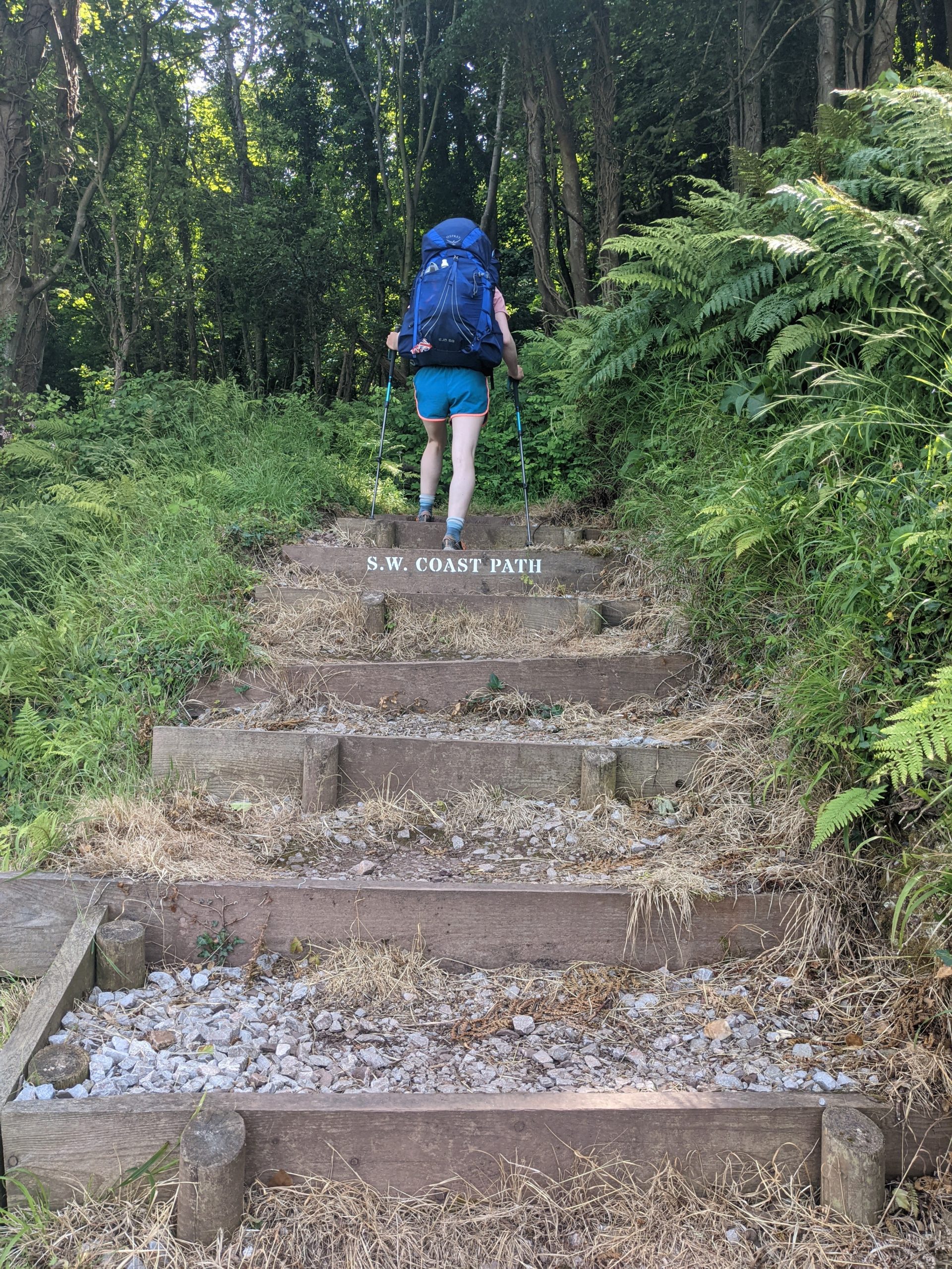
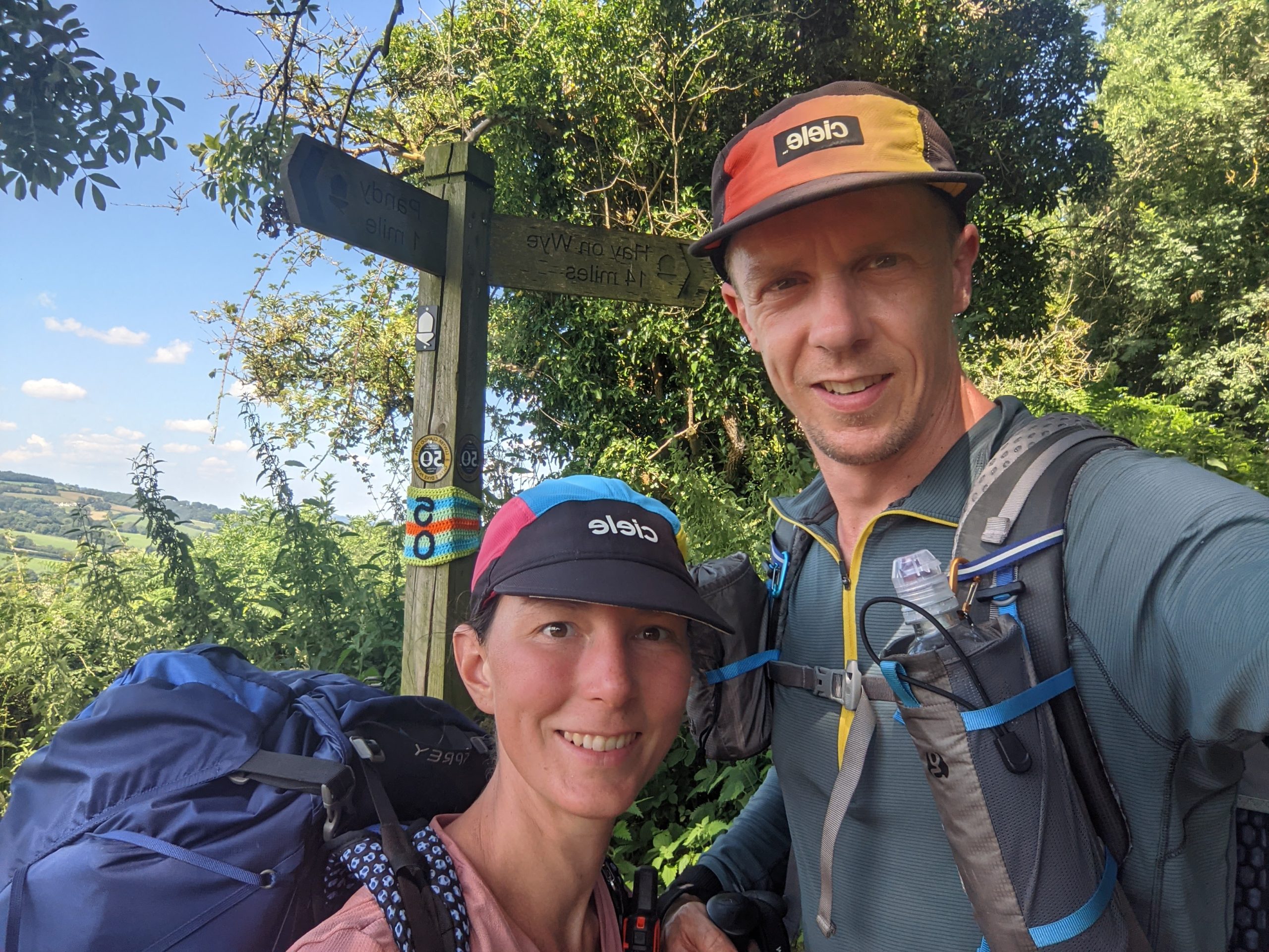
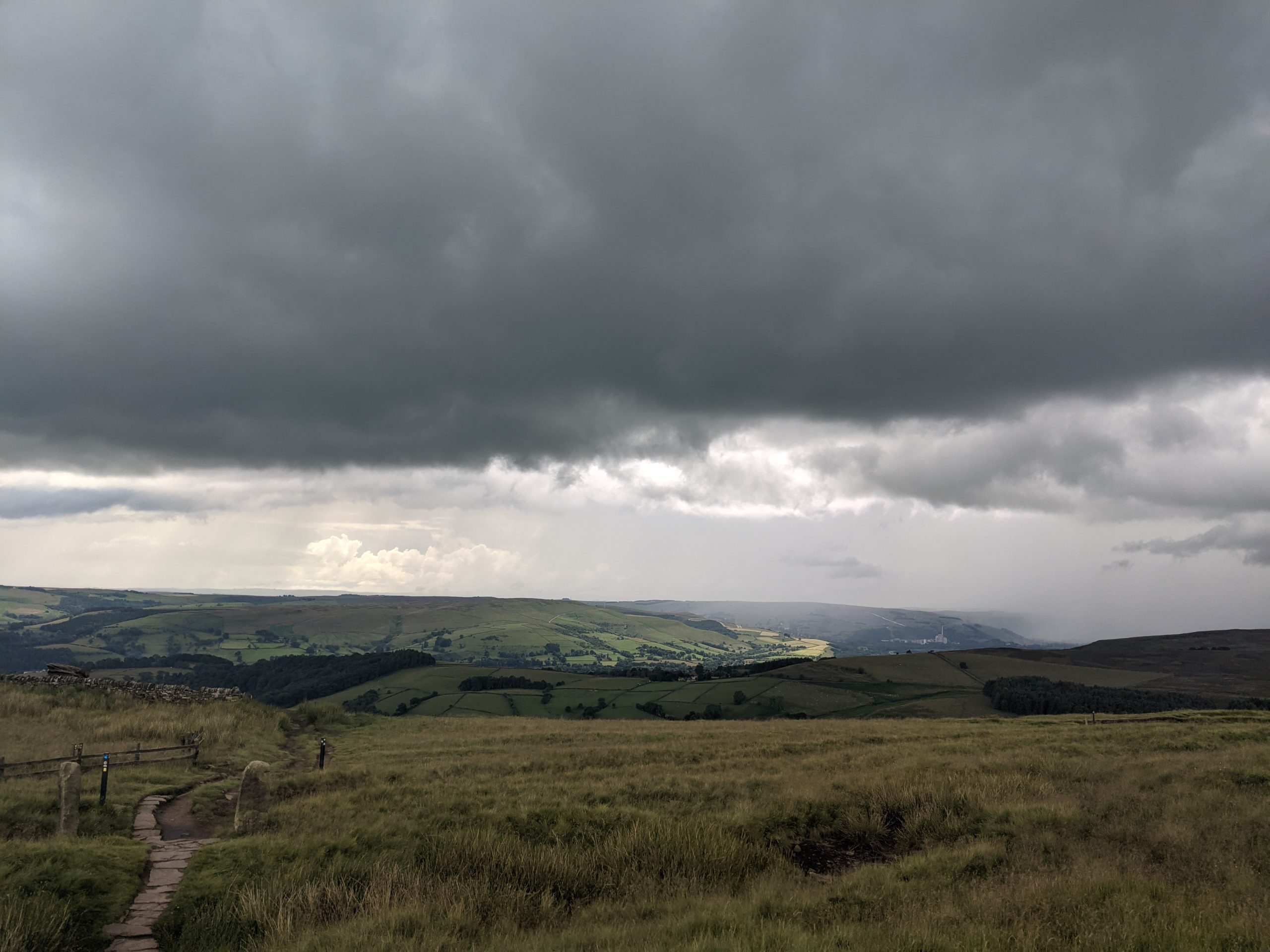
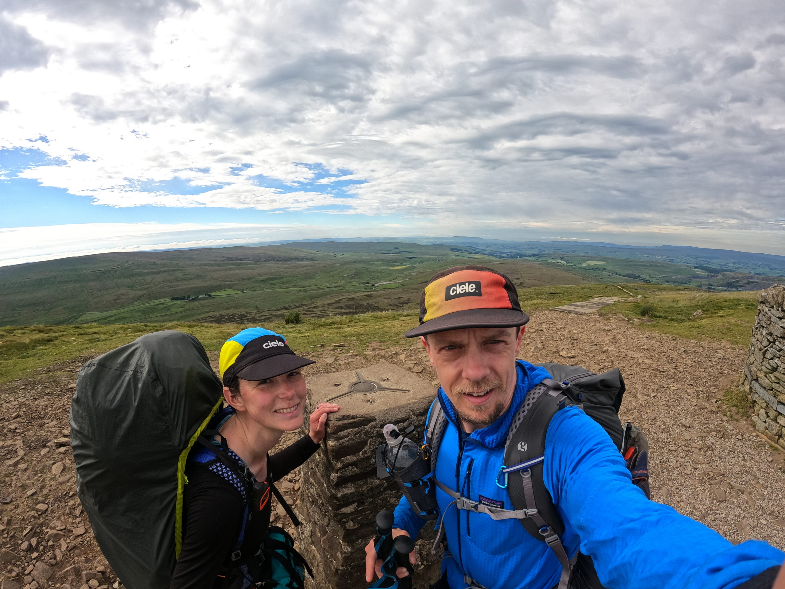
Author: Katie

  • The End

    The End

    Day 79: Perranporth to Sandy Acres

    ? 35km

    ?1131m

    After a fabulous sleep in the lovely quiet campsite and slightly later alarm, we had a slowish start, the drizzle arriving before we left so we packed up in the rain.

    Darker nights, torch out

    Becky and George kindly dropped us back at Perranporth Beach and we set off in the rain, up a steady climb above the beach. It was still pretty warm so we immediately started to sweat on the inside. The drizzle did then start to ease and the sun tried to shine. This was the game of the day, judging how long to leave waterproofs on for, as it had to be long enough that they dried a bit, not too long that we roasted, but in enough time to actually enjoy them being off before the rain started up again.

    We cruised around to St Agnes Head and dipped down to Chapel Porth just before the rain came again. We enjoyed a Croque Monsieur and coffee from the café there talking with a lady called Pixie who was doing the SWCP. We then headed up the path reminiscing on some family fun we had had 18 months before at that beach. We walked over to Porthtowen, a shorter distance than we remembered, and passed the Unicorn pub. We headed back up to skirt the disused air field, back down to Portreath and then a final big climb where we realised we had only covered half the distance for the day and it was already 15:00. Luckily this final section was quite flat and we joined the Carvannel Downs and the rainy day hikers.

    I was tired by this point and the view of the headland jutting out that I knew we had to yet cover was getting me down, but on the positive side, the sun was out for good so we de-layered for the final time and pushed on through the crowds that had finally left their cars in the car park.

    The final hurdle was the sand dunes of Gwithian Beach, following stone markers with dubious arrows. We met an elderly gentlemen also having the same issue as us, he had some very old kit on and a Blue Peter badge on his jungle hat.

    Stone markers in the dunes

    We finally made it to Sandy Acres, pitched up, showered and ate. The kindness of strangers who hear our story is one of the best things that we have experienced this trip as generally British people unlike other cultures around the world keep themselves to themselves. The evening was completed with a gentlemen meeting Tom at the water tap, listening to our story and then coming over with his son to give us Bananas and offer anything he could including Sudocream as he had spotted my tape and was very concerned about the state of my feet. It’s just 2 more sleeps until the end and we confirmed arrangements to be collected at Lands End by Tom’s brother.

    Day 80: Sandy Acres to Porthmeor

    ? 29km

    ?981m

    We were waved out of Sandy Acres by our new biggest fan and headed back out on the dunes. I found it quite frustrating both navigating and following the very wiggly path. We popped out by the estuary near Hayle and picked our way through a new housing/flat development on the quay, reaching Asda where we did our final stock up on food and used the toilet. From here we headed out of town on the road and then along the railway line that took us back out on the opposite side of the estuary towards Carbis Bay and St Ives.

    We made our way through quite a few houses and then got to see the fabulous beach and famous hotel at Carbis Bay. From here we followed the crowds on the tarmac path to St Ives, where it started to rain briefly, and we dashed to the toilets before meeting Jim and Enys coming towards us. Jim picked up some pasties whilst we found a bench. Gully and Jess joined us and we spent a bit of time together getting big hugs and smiles from everyone before heading out of town, picking up water as we went. 

    We then joined a notorious bit of coast path that is slow and rocky underfoot. The wind was high and the waves dramatic, which made for great scenery. A few hours in and the drugs had worn off, my right foot was already quite sore and things were getting tough.

    Gusty

    We met a local couple with a dog who asked lots of technical questions about kit etc so were obviously keen hikers themselves and we later met a Russian man ‘everyone calls me Jeff’ who was doing Newquay to Lands End and then maybe onto Penzance if he had time.

    Finally some drone-worthy conditions on the SWCP

    We had scouted out our last camp spot on trail months before when we lived in Cornwall at the beginning of the year, and luckily no one had found it before us. It was a beautiful evening, and we even got half a sunset. The cloud did come in at the last minute but we sat watching it go down anyway, seal spotting and appreciating how lucky were are.

    Last Night

    Day 81: Porthmeor to Lands End

    ? 24km

    ?964m

    The night was perfect; quiet, dry and the wind was relatively low. About 04:30 the weather turned and by 05:30 it was heaving it down and the wind was strong again. It felt like it would be a shower, so we packed up our stuff in the hope it would all be over by the time we were done. No such luck, we put a time on it and when the time was up and the rain had not eased, there was no option but to just go for it.

    We got drenched within seconds, the wind was so strong and as we pulled the outer off the frame the poles bent in a very worrying direction but by some miracle didn’t buckle.

    We climbed out the cove and continued along the tricky rocky path which was now flooded with water and we were being blown sideways from the right. The brambles we had been fighting through the last couple of weeks had damaged my waterproof and within half and hour my right side was soaked through 2 layers to the skin.

    Grateful to leave the rain behind

    The trail had certainly decided to challenge us right until the end and on reflection it was probably one of the worst bits of weather we had encountered all trip. I was sulking big time as this had not been how I had imagined we would finish the hike and I was starting to panic about getting cold.

    We reached the National Trust at Levant Mine and Beam Engine and the toilets were not even open never mind the café, so we carried on. Soon after that the rain started to ease and I started to look up and appreciate the tin mine, it’s beautiful buildings and the wonderful chimneys.

    We marched along some saturated but easier paths to Cape Cornwall meeting the morning crowds and enjoyed a toilet break and our last coffee on trail in wonderful Charles and Diana wedding mugs. By this point the sun was trying to shine and I took my waterproof trousers off, by the time Sennen Beach came into view, we were down to one layer and sun cream was on!

    Last coffee on trail

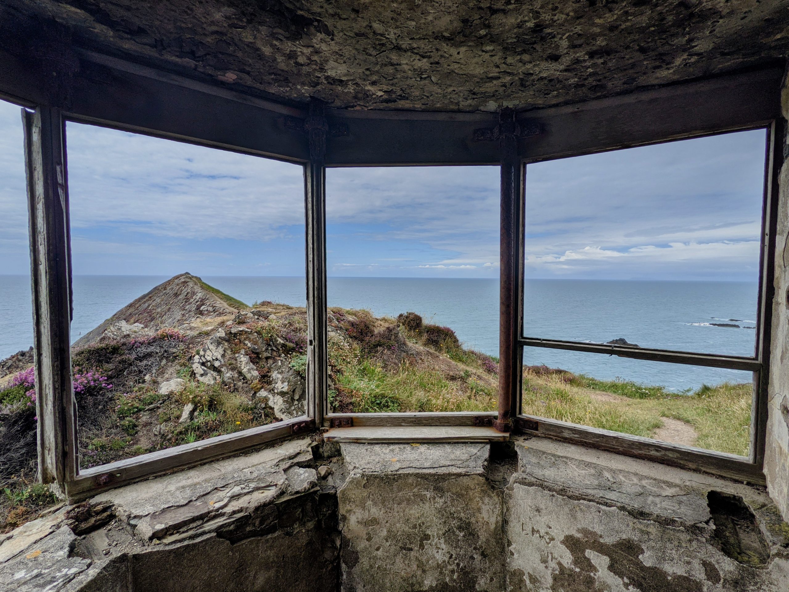
    We walked along the beach, a small section of the water had been given red and yellow flags by the life guards for swimming and body boarding. We walked passed the café’s of Sennen Cove and up to Mayon Cliff’s coast guard look out before following the path towards Lands End.

    So close

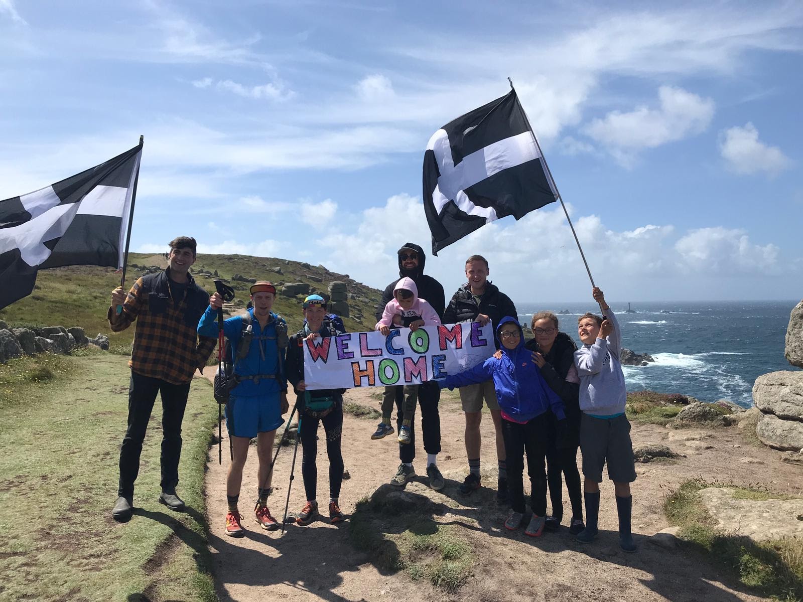
    Ahead we could see a small crowd of people, the Cornish flags flying and realised it was for us. Friends and family had come to greet us and thankfully the sun was shining and they were all smiling. It was just the best thing to have familiar faces to hug and share the end of our journey with. We enjoyed photos, a pint of Rattler and an ice cream to celebrate.

    Welcome Party ???
    Lands End! ☺️

    Neither of us think that the reality of our achievement has sunk in yet, when you embark on an adventure where your every day is changed for such a long period of time the last day feels like any other. I think reflection on the highs and lows will bring to the surface the emotion that maybe we were expecting.

    But that’s one of the many things that we have learnt on this journey, live everyday without expectation and you are free to experience life for what it is, rather than for what you think it should be.
  • Long days & sticking to the plan

    Long days & sticking to the plan

    Day 73: Yelland to Mouth Mill

    ? 35km

    ?1309m

    As predicted the storm came in during the night, the rain was heavy and the wind strong and gusting. We pre-empted it would happen and used our trekking pole trick but in the middle of the night the one on Tom’s side came down and the poles of the tent felt like they were under serious strain. 

    Somehow the tent survived and we woke with our 05:30 alarm surrounded by a grave yard of other tents and people taking shelter in their cars. One family had already started packing away and were driving out by the time we had packed up our things.

    It had stopped raining but was still very windy so we packed up quickly, when I lifted one side on the inner up to fold it over as usual, Tom panicked and dove on top of the tent as he thought it was going to blow away. It was a bit of an unnecessary reaction (editor: we agree to disagree on that) and made us giggle for the rest of the day. The plus side of the wind was that it had dried the tent and so was much better to pack away.

    We joined the Tarka trail, still cycle path to Bideford, and headed for Costa, but the cafe on the opposite corner looked nice, we paused for a look and a local persuaded us it was the one to go for so we had a well recommended coffee which was lovely.

    Moody Tarka Trail

    It’s worth noting at this point that Tom had been doing some reading ahead in the guide books for the End to End and SWCP.  There is a difference in that one is all about walking the length of the country and another is about walking a defined trail.  We joined the SWCP at Minehead with the intention of walking the costal path as far as Lands End.  The problem with that is that the SWCP uses a ferry to get from Rock to Padstow, but that would invalidate our claim to have walked the length of the country.  So the End to End route leaves the SWCP before Rock and walks inland to Wadebridge and then back out along the Camel Trail to Padstow.  So we could follow the coastal path to Rock and then walk inland to Wadebridge, however this would add distance to what we had planned for, requiring a revision to our current schedule to arrive at Lands End on Saturday 7th August, and there are no footpaths from Rock to Wadebridge so it would all be road walking.  So we decided to stick to plan A – walk the length of the country.  As this meant we were going to skip part of the Coastal Path, Tom could stop being so particular about walking every inch of it and we could follow the End to End guide route when it deviated from the SWCP.

    This is important to note now because from Bideford we avoided 8km of walking on the SWCP around the headland and towns of Appledore  and Westword Ho! by taking a cross country route to meet the SWCP just south of Westward Ho!.  The day turned out to be longer in distance and time than we thought so it was a good move!

    When we re-joined the coastal path it was extremely windy and gusty and the next 10km were hard work. Narrow paths, being blown off balance, lots of steep up and down sometimes with steps, along with a fair amount of bush whacking. However it didn’t really rain and the scenery was rather dramatic and beautiful.

    Getting the shot
    The shot

    When we got to the end of the stretch we met a couple of National Trust rangers clearing the fern at the start of the trail.

    We then joined a stretch through a forest which was much more clear and under cover so sheltered from the wind, we hit Buck’s Mills which had more people than expected and then the up through more forest and field to meet an old road winding to Clovelly. Clovelly was lovely from what we saw, a chocolate box village nestled in a cove, with a steep access road and no cars, so we made a note that we must go back to explore further.

    We had a drink tea & Coke, a wee and water top up at The New Inn and then headed off to find our wild camp spot at Mouth Mill, passing the Angel Wings shelter on our way.

    Angel Wings Shelter

    It was our first spot by the sea and a bit more like how we imagined wild camping on the coast path.

    Mouth Mill Camp Spot

    Day 74: Mouth Mill to Bude

    ? 40km

    ?1796m

    We had some human visitors at 02:00 in our quiet idylic camp spot, we have no idea where they came from or why they turned up in the middle of the night but they put up 2 tents on the other side of the mouth and stayed up chatting for the rest of the night. It was a funny moment when we first heard them as we were not quite sure what to think or do, but we were soon reassured and tried to get back to sleep, I don’t think I got much.

    Today was the “big day” in the guide book and it didn’t disappoint. I would say the first 80% was enjoyable. There were steep ups and down, big fields, great weather, incredible rock formations, a few seals, and on the most part few other people since this section was quite remote with the exception of one small car park at Welcombe Mouth.

    At Marsland Mouth we entered Cornwall, our final county on the trip!  As the beaches near Bude came into view we started to see more people, first at Duckpool, then Sandymouth. The ups and downs got a little overwhelming by the end and so luckily an ice cream at Coombe saved the day and mentally reset us for the last few kilometres into Bude.

    Kernow!

    I had been really disappointed not to get a coffee earlier in the day as we had arrived at the Heartland Hotel before they started serving, so the ice cream made up for this. It’s a different challenge now that we are passing through National Trust Cafés and towns most days, you get your hopes up and look forward to a treat but as we start early most days they are very rarely open, sometimes I wish we were back in Scotland where it would not even be an option to miss out on.

    Nearing the end of a big day

    When we got to Bude we went to Sainsbury’s to stock up and then found a bench seat outside a pub that partners with the Pizza place next door. So we enjoyed a great pizza and a pint.

    As the sun went down, the temperature dropped quite a bit and so we walked not too far to our campsite. As we arrived we were treated to some open mic style music from the village hall next door, which carried on throughout the evening . The site was basic but we were so tired we just zonked out.

    Day 75: Bude to Trewethett Farm

    ? 30km

    ?1497m

    We set alarm for 06:00 as we had had a long day the previous day. Within minutes of us stirring it started to rain, lightly first and then a heavy shower. Our hearts sank as it had not rained all night we packed up stuff inside and luckily it did stop raining by the time it was time to pack tent away but it was of course wet.

    We were a bit hobbily and slow and didn’t get going until 07:30, Tom had a niggle in his right knee and the ligament twinge in my right foot had come back as well.

    The first few km to Widemouth were relatively easy along wide grassy paths and I had high hopes for a coffee. But I should have known better as it was still early and a Sunday. We passed several closed cafés and coffee huts. The first half of the day involved lots of up and down with dramatic scenery. We were both sulking a bit and tired and so it was a little tough. Our feet were wet from the long grasses, and my leggings were wet which had previously been giving me a nappy rash type rash on my legs so I was grumpy.

    Crackington Haven saved the day at lunchtime, our first beach lunch break with sunshine, ice cream and wonderful coffee. It was a great little place and we enjoyed people watching. We left in a better mood and even with quite a bit to go, and a shower of rain, the second half of the day was much more enjoyable.

    We arrived in Boscastle, which was busy but beautiful, another place we noted as one to come back to, ice creamed up and pushed on the last few kilometres to the campsite.

    Boscastle

    It was not cheap for what we normally pay but the showers were ace, we did some laundry and there was a pizza van on site for the evening. We couldn’t resist, despite it being our second pizza in a row. We relaxed on a picnic bench in clean clothes with pizza and the F1 highlights.

    The sunset was incredible and our tent was perfectly positioned. A couple over the way from us had seen us walk in and kindly lent us some chairs so we could sit and watch the sunset in comfort.

  • Can you see the sea yet?

    Can you see the sea yet?

    Day 67: Cheddar to Bridgewater

    ? 34km

    ?213m

    We were expecting it to rain all day, so packed everything up in full waterproofs which worked a treat because it then stayed nice and dry.

    The campsite had a camping hut with fridge, so we treated ourselves to a different breakfast of fruit and yoghurt which was lovely.

    The days walking started off with a straight forward path along the river, we then joined lots of quiet dead straight roads which ran along the ditches and field boundaries, first dug out around 1500 years ago by the monks of Glastonbury to drain the salt marsh land that frequently flooded. We had lunch by one of the pumping stations, perching on a ledge.

    Long tarmac roads

    The second half of the day was spent fustratingly bush whacking through rarely trodden paths, we were scratched and stung all over. We finished the day by crossing the M5 for the final time to navigate the outskirts of Bridgwater which was not what I was expecting.

    Our accomodation for the night was also pretty basic with some right characters around. We stocked up in Sainsburies and Tom introduced me to Taco Bell, which was average. The highlight of the evening was access to a TV where we got to catch up on day 1 of the Olympics.

    Taco Bell

    Day 68: Bridgewater to Washford Inn

    ? 37km

    ?774m

    It was a difficult night, foreign party goers meant a distruptive sleep, I guess that’s what you get for £30.
    We got going about 07:00, passing through the centre of Bridgwater town which was marginally nicer than the outskirts we had seen the day before.
    We passed through some playing fields followed by farm fields which got socks and shoes soaked due to the overnight rain.

    We then had some unexpected rain, so covered up in a corn field, before descending into a muddy farm where the farmer told us to go a better, clearer route. Here we met a very chatty man with a Terry Pratchett t-shirt on who knew the area well.

    When he finally let us carry on, Tom triple checked the route and realised we had gone wrong so had to back track towards the farmer and follow ‘Terry Pratchett’. He had stopped at the top of the hill and we had no choice to approach and admit our mistake.
    He then insisted walking with us to show us how to get to Lydeard Hill. We walked together for a while but he was so much faster with a light pack and lunch to get home for so he left us to it. We climbed the rest up to Wills Neck on our own, joining very light Sunday crowds enjoying the Quantock Hills, had lunch, and put the tent up to dry.

    The Quantocks

    We decended into the village of Bicknoller which was very sweet, we regrouped at the village shop before continuing towards Washford via the MacMillan way which was nice and nettle free, plus the sun started to shine. We got to the Washford Inn by 17:45 and were showered and ordering dinner by 18:15. Recently taken over the owners were keen to hear more about our story and we enjoyed a fun home from home experience.

    Tom’s Washford Ultimate Burger

    Day 69: Washford Inn to Slopey Wild Camp

    ? 35km

    ?803m

    We had decided to have our included breakfast which didn’t start until 0800, so we enjoyed a small lie in until about 06:30, got ready watching Tom Daly win Olympic Gold, did some extra stretching and drying off socks with the hair dryer.

    Tom had the small English breakfast and I had avocado on brown with tomatoes, it didn’t arrive quite as advertised but was really lovely all the same and such a treat to have something different.

    We were on the road by 09:00 and had planned a route to get to the English Coast Path however this route had been diverted via Washford anyway so it was easy navigation to the sea. 

    It was then a straight forward path along the coast to Minehead, where we stocked up at Morrisons and got an ice-cream.

    This was now the start of the South West Coast Path which was very exciting and something we had been looking forward to for days. A tough steep climb to start with but, once high, a lovely wide grassy national trust path over the fern and heather moors to Portlock then over some boggy marsh and luckily only a short section of it’s stoney beach to Portlock Weir.

    Start of the SWCP

    We then ascended again into the forest passing the toll gate and the church, the lovely forest felt quite tropical at times. It was however getting late and due to rain the forest was not ideal for wild camping as there had been plenty of rock fall and tree damage, so we climbed back on ourselves above the tree line.

    The Beautiful Toll Gate

    We settled on what turned out to be a very slopey pitch next to the path, next to the gate of a sheep field. The farmer came to move the sheep but didn’t say anything.

    I had done something to the top of my ankle on my right foot so got a compression bandage on and took some ibuprofen, just hope all is ok in morning. It rained heavily most of the night with a small narrow stream running through the centre of the tent thanks to our angular pitch

  • Making hay whilst the sun shines

    Making hay whilst the sun shines

    Day 61: Baskerville to The Rising Sun

    ? 31km

    ?791m

    I didn’t sleep well as it was hot, damp, my left shoulder was playing up and my feet were feeling particularly sore. We woke up earlier than normal so we could pad my feet out with Compeed.

    After packing up a very wet tent from from the dew, we walked down the main road back to Hay, it being a Sunday the Co-op was not open until 10:00 so we popped into the Spa for a few supplies, despite it’s limited options, and then started the climb up towards Hay Bluff. On the way up we saw an ice cream van go past so did a bit of an alternative route via the car park so we could pick up a Calipo on the way.

    The ridge was well marked, covered with fern and heather and had spectacular views of Wales to one side and England the other. We made decent progress with fabulous views in the hot sun. We passed wild horses, got the drone out and enjoyed the occasional breeze.

    Welsh Trig Point

    We descended down into Pandy to The Rising Sun pub, camping in the field behind the pub. We enjoyed a shower and a cold drink but the pub was not doing its usual food as it was having a new kitchen fitted so they let us get a local Chinese delivered and eat it in the pub. It was lovely food, I had veggie egg fried rice and we shared a chilli beef.

    Drone Fun

    Day 62: The Rising Sun to Monmouth

    ? 27km

    ?542m

    There was a bit of loud Welsh drama in the campsite so had to put ear phones in to sleep, again not the best night with the heat.

    05:30 alarm, feet taped and soggy tent was put away. I struggled psychologically today, it was a shortish day but the heat was high and I kept looking at the tracker for the first half of the day. Some days you are just not in the mood for hiking. The highlight of the morning was the short visit to the ruins of White Castle but my feet were sore by lunchtime.

    White Castle

    We stopped in an empty meadow field in the shade and had a nice lunch squeezing the melted chocolate from my cornflake Ritter bar onto scones.

    Chocolate Melting Fast

    The second half of the day was much better and we arrived into Monmouth in good time, the camp site was right in town and although we had low expectations it was a very sweet place with many static caravans and couple of campers and us. It was quiet, clean and very convenient.

    We went to boots for supplies; bite cream, KT tape and alcohol gel. Then to M&S, the first on route and it was day 62. We picked up some old favourites and sat on the available picnic benches on the high street to nibble our luxury snacks. We then sat at a café for a cider but they closed on us mid drink so we had to take our drinks back to our picnic bench.

    We chose a local Italian place for dinner, it had air con, fabulous pizza and fizzy water which was lush on the hot day. The only bad thing was I left my water bottle there and when Tom went back to get it I think they had thrown it away.

    Back at the tent we watched the highlights of the weekend’s F1 at the campsite, it was quiet and I was zonked, so slept well.

    Day 63: Monmouth to Chepstow

    ? 31km

    ?875m

    Today was a really nice day through the fields, forest and along the river. We climbed up to the top of Klymin and enjoyed great views back across Monmouth, before descending through fields and then ascending back up through the woods. It was another warm day so were grateful for much more woodland coverage than yesterday throughout the day, it definitely takes a few degrees off.

    Top Views

    At Bigsweir, the route left the ridges above the Wye and followed the river for a few km as far as Brockweir.  It was a hot section of walking through fields but the river was a bit on the muddy side and didn’t really tempt us in.

    From Brockweir we returned to higher ground and on the climb up towards Caldwell Woods we stopped for lunch, putting the tent up to dry out as we would be in a bed for the next 3 days and didn’t want it smelling too bad. We also met Callum, a young lad who had started the Offa’s Dyke that day, he was pristine with all his new gear on, hope to follow his progress.

    The last few km into Chepstow was a little frustrating, winding back on ourselves, made more interesting by helping a guy who had managed to get himself on the wrong side of a barbed wire fence.

    We had a bunk room in a hostel in Chepstow which was lovely but so so warm. We picked up some snacks from our second M&S in 2 days and had a pie and chips at the pub around the corner. Back to England over the Severn Bridge first thing.

    End of Offa’s Dyke Path
  • Sweat, sun & stings

    Sweat, sun & stings

    Day 51 to 54: Warwick

    ? 0km

    ?0m

    We spent 4 days getting vaccinated, visiting family, watching the football on a big screen and swapping out gear for replacements along with a lot of planning, eating vegetables and sleeping.

    Day 55: Uttoxeter to The Trent & Mersey Canal nr Cannock Chase

    ? 25km

    ?234m

    We got dropped back at Uttoxeter after already having a few teething problems, Tom had to rearrange his bag having pulled it apart to wash, ensuring it was all put back together correctly. We started hiking about 11:30, it was muggy and the sky was looking threatening.

    That new shoe & sock feeling

    The guide book describes this section of the trail as one of the worst so we were determined to keep the day positive, especially as we were newly rested and ready to roll. I don’t think it was as bad as described but can understand why, we made our way through many fields and over stiles avoiding cows, enjoying the wheat and barley fields. We stopped in the beautiful village of Abbots Bromley just as the kids were finishing school, it was an adorable town with a very cute green and Tom picked up some water from the local shop as we were wild camping that night.

    Barley

    The day continued with very much the same terrain but it still didn’t rain! We passed over the railway and some accompanying train spotters and joined the Trent and Mersey canal path which was lovely, there were lots canal boats moored up, many of them in fabulous condition.

    We had about 3km to go before we intended to start looking for a camp spot in Cannock Chase but spotted the perfect spot by the canal away from the path. We sat on the bench it had and reminded ourselves about what distances we had over the next 2 days and decided to call it a day and take the spot.

    We boiled water for dinner and as we filled our noodle pots the rain came down so we quickly put then tent up.

    Day 56: The Trent & Mersey Canal nr Cannock Chase to The Meadow Field, Kiddemore Green

    ? 32km

    ?293m

    We woke at 05:30 snoozed until 06:00 and left the spot by 07:00 pretty much. I thought I had lost ground sheet bag in the hurry to put the tent up in the rain, but did find it a couple of days later. It decided to spit with rain just as we left so we put waterproof jackets on but by the time we reached Cannock Chase and were climbing a little through the woods they had to come off. Cannock Chase is a nice woodland area with big paths, lots of runners and tracks for cyclists. There was a cute river crossing with stepping stones that I enjoyed.

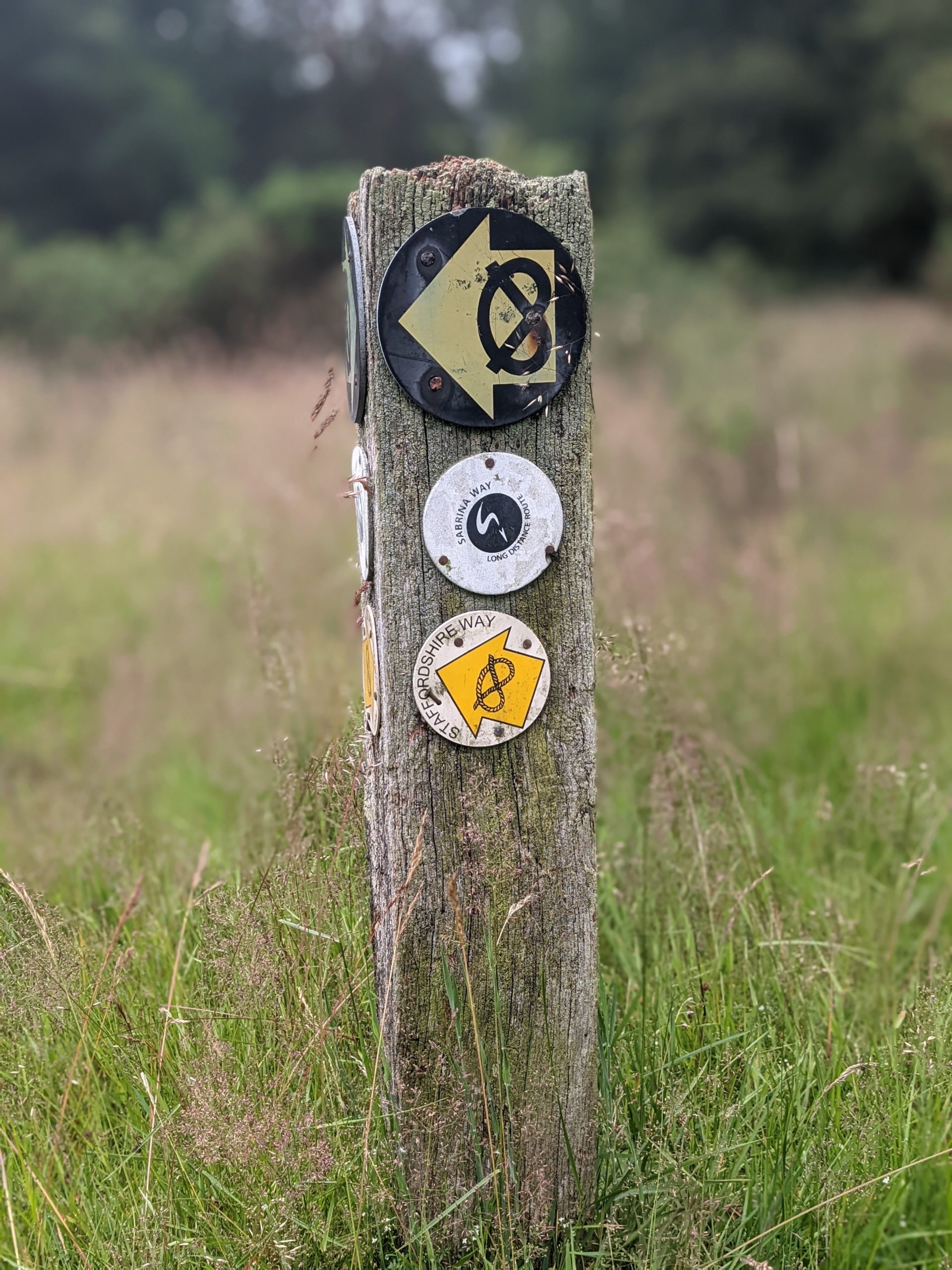
    The rest of the day through field boundaries felt like a battle of thorns and nettles, many of which were as high as us. We were following the Staffordshire way nearly all day but some of the paths were in very poor condition and were a nightmare to walk through and make any kind of progress. We were bashing and stomping and getting stung from nettles and spiked by thorns it was very slow going.

    Seeds in socks

    When we got to Penkridge we stopped in a cafe for a coffee each and shared a cherry scone with jam then cream.
    We stocked up on a lunch from the Co-op and headed on. Sadly the next few fields were just as badly kept and we even had to make a stop to empty shoes picking the seeds and grains from the material of our socks, they somehow get stuck right in the fibres and are a nightmare to remove, very much like a splinter. We ate our lunch by a small river and cherry tree crop which on reflection was probably not the best idea as we later discovered we had been bitten a lot by mosquitoes.

    Today is another wild camp day and we found a corner of a meadow field that was nice and hidden. Apart from someone racing around the land nearby on a small engine motor bike we were not disturbed, but we were feeling rather beaten up by the land and it’s insects.

    Just put the tent up around me

    Day 57: The Meadow Field, Kiddemore Green to Pool View Caravan Park

    ? 32km

    ?448m

    Didn’t sleep the best and was dreaming of the grand national when the alarm went at 05:30, we had a quick 10 mins snooze then got up to pack stuff and the very soggy (from dew not rain) tent. It was a perfect blue sky morning and the start of a great day.

    We walked down nicely clear marked tracks and field boundaries in the cool morning sun and bumped into Ali and her dog who was delighted with our story, told us that we had some fabulous scenery to come and even offered to call her husband and ask him to get the kettle on. We declined as her home was not quite on route but she was wonderfully kind.

    Our only concern of the morning was actually the lack of water, as it had been hot and we were drinking much more, and with wild camping we need at least a litre of water for dinners as well.
    We had spotted a fuel garage on the map but as always there is no guarantee these places are still open but we were in luck and even though we were at a camp site that evening filled up on 1.5 litres each.

    We joined the Monarch’s Way which continued on down country lanes and well cleared paths. We enjoyed admiring the crops, taking photos of derelict buildings and then smelling a wonderful couple of fields of roses.

    Blue sky & fields of roses

    Here we bumped into a gentlemen who was sort of interested in our trip but more interested in the Monarch’s Way section that we had walked that day, turns out he is the president of the way and therefore explained that the secateurs in his hand. They were not for roses but were for clearing the way on the trail. He told us he had walked 10miles with his strimmer the day before and as the day went on we were very grateful he had.

    The Monarch’s Way is a 625 mile long-distance footpath in England that approximates the escape route taken by King Charles II in 1651 after being defeated in the Battle of Worcester. It runs from Worcester via Bristol and Yeovil to Shoreham, West Sussex.

    Wild flower meadows

    We got to Ironbridge about 14:30, it was much smaller and more beautiful than I had imagined, from one side of the river looking across with the bridge was very cute and sweet. We crossed the bridge and scouted out the ice cream just to get us the half a km to the Co-op where we stocked up on a few supplies. We then stopped off at a beer garden for a beer for Tom and an orange and lemonade for me. Service was frustratingly slow but we got our drinks in the end. We then headed back out of Ironbridge to our site for the evening a caravan site. It was pretty poor, located under some huge power cables and not very clean. The fact that laundry facilities were only in the ladies, presumably on the assumption that they would be doing the washing, really summed it up.

    Ironbridge
  • Teacakes, Thunderstorms and Trail Angels

    Teacakes, Thunderstorms and Trail Angels

    Day 45: Hebden Bridge to Marsden

    ? 24km

    ?756m

    Our camp spot was beautiful, with amazing views of Hebden Bridge and the valley but I didn’t sleep well, the tents next to us and behind were noisy and the pitch was not entirely flat so I kept rolling into Tom. We woke early thinking we would get to Marsden and the pub where we had booked a room with lots of time to enjoy.

    The day however was a bit frustrating, an up hill, down dale day, crossing busy roads with not great scenery and required some navigational focus. As we were not following a particular trail but linking lots of footpaths together we had to keep checking that we were going in the correct direction. It was also another hot day which I am reluctant to complain about but the heat does make going under the motorway (M62) feel particularly disgusting.

    Zoom in to see the poor farm house that is straddled by the M62 ?
    A short, steep climb to leave the M62 behind ?

    A highlight of the day was as we were navigating the over grown footpaths out the back of the residential streets of Marsden we got chatting to a gentlemen tending to his garden and had a good old chat that included the old teacake, bap debate between Yorkshire and Lancashire which made me smile. In West Yorkshire, a large plain white or brown bread roll is called a teacake and is used to make very large sandwiches, something the rest of the country call a bap.

    Nearing Marsden

    We arrived about 15:00 to Marsden and were both shattered. We had to stop ourselves from taking a nap and instead showered, then hit Boots and Co-op, our go to stores at the moment. I needed some more antiseptic wipes for the feet and then we needed food supplies for a few days from the supermarket. We went to the local tap house for a pint before hitting kids tea time at the Italian across the road for pasta and pizza. We were back in our room and practically in bed by 19:30.

    Day 46: Marsden to Langsett

    ? 31km

    ?791m

    We woke about 06:00 after a warm, as we always find sleeping indoors these days, but much better sleep. Heels taped and bags packed up, we ate breakfast in the room and headed out into the drizzle by 07:30. The day started with a steep climb out the back of town passing some derelict mills but then onto a fabulous national trail, Kirklees Way, which was popular with some early dog runners. It was drizzling on and off but really was not that bad. We then turned off the wider track onto a smaller path down into a valley and joined a beautifully straight path which reminded us of the Roman road. It was at this point the heavens really opened and the rain was pouring.

    We descended into Holme and undressed in the door way of the Fleece Inn. We started with a coffee and then decided on a breakfast tea cake (we were just still in Yorkshire) as the rain was due to continue all day and night, so there would not exactly be a picnic spot for lunch. As we left the pub it actually had cleared up a bit and we enjoyed about half an hour of rain free walking along Brownhill reservoir. The rain then came down again as we joined a quiet tarmac road at White Gate. The birds by the road in the moor made me smile, so many different breeds almost playing in the rain, different sizes and colours, it was lovely.

    The final stretch of the day was along the Trans Pennine way which was just a tarmac cycle path, along a disused railway, which was quick but a bit hard going on the feet. By some miracle the rain had also stopped and we reached camp about 16:30 with a bit of blue sky and some sunshine to put the tent up along with an opportunity to dry off waterproofs at least.

    The Don

    Tom went to get a couple of pints and a pie from the Waggon & Horses down the road and I chilled in the sun, mourning the loss of my little toe nail.

    Lost toenail campsite

    We had a fabulous thunderstorm during the second half of England’s 4-0 victory over Ukraine, it was quite scary as we were up on a hill and there was a lot of rain in a short period of time but we survived ?

    Day 47: Langsett to The Fox House

    ? 34km

    ?1025m

    We knew it was going to be at least a 30km day today and we had a time target for a change, a treat at the end of the day was a shower, a bed & laundry along with an evening with my Mum’s best friend from school Mary and her husband Paul.

    We set off down the road and joined a forestry path towards Ladybower & Derwant reservoir noting down that the car park allows overnight stays. We took the main path up and over Mid Hope Moor, meeting a lady who was delighted about our trip, along with a few mountain bikers. I was impressed how many people were up and out so early after a Saturday night England win.

    Enjoying some dry weather

    We descended from the moor to the river and the main walk and cycle path around the reservoir where there were plenty of cyclists and lots of running club runners smashing out fast times, undoubtedly on Strava segments. We hung a left off the main path up the very steep National Trust Abbey Bank to get back up high and followed one of the many paths across Derwent Edge which had all its quirky stones. We ate our lunch at The Wheel Stone before cutting cross country towards Stanage Edge.

    As we joined the main path from the road the weather started to turn moody and the views back towards Mam Tor and down to Hathersage were incredible.
    The thunder rolled and rumbled and Tom was loving life, but I was a bit nervous. The heavens did eventually open and we waterproofed up for the final section at the top before descending down for our cross country route towards the pub.

    Watching Castleton being consumed by the storm
    Glad to be watching the worst of it from a distance!

    We got chatting to three young lads as we were going down who asked where we were walking to, and I think I shocked them with our story as they ascended up onto the edge in thier pristine white JD gear. Our cross country route was a bit slower than expected and we just made it to the pub in time for our 16:00 meet up with Mary & Paul.

    We had a dreamy evening at their beautiful cottage down the road in Eyam, showered, washed our clothes and had a stunning lasagne with am incredible salad, coleslaw and garlic bread, then a beautiful summer pud and Mackie’s ice cream.
    It was a fabulous evening and we even got to make up some sandwiches with home made bread, best packed lunch on trail yet.

  • If we can walk 1000km, then we can walk 1000 more

    If we can walk 1000km, then we can walk 1000 more

    Day 39: Kirkby Stephen to Keld

    ? 17km

    ?489m

    It took a while to get to sleep last night with it being a Friday night and we were at a campsite where big family groups were enjoying beers and BBQ’s.

    As a result we ended up sleeping in until about 07:00 and had a slow start to the day taking our time packing up. We checked the weather and to our disappointment, the off road route we had mapped out the day before was going to be in the cloud all day and therefore to reduce the chances of our stuff getting wet again and increase the chance of actually getting a view we went back to plan A and took the road route.

    We nearly failed at the first hurdle by missing the left turn and so had to walk back on ourselves 200m or so. Then not too soon after that I managed to loose my hat out the front of my fanny pack so Tom jogged back down the hill to find it. We then continued to gradually ascend the road, passing loads of cyclists whizzing down passed us. We got decent views looking back where we had come from and then ascended further into the cloud, putting on full waterproofs for the rest of the hike.

    We arrived in Keld by 14:30 where we were back under the cloud and it was so nice to put the tent up in the dry and for it to be dry.

    Looking back towards Kirkby Stephen

    Keld was a beautiful little village, with walkers being the centre of its activity. The farm and the farm house had toilets, showers, car park and a café run from the main house. It was busy with day visitors as well as a few fellow campers.
    We bought a tea and a beer and sat at the picnic benches in the garden of the farm house to enjoy. Tom got a second beer to take away, I cracked open an avocado that I had carried for a day and sprinkled my crushed black pepper crisps on it, what a surprisingly good combo, we then cooked noodles and couscous for dinner.

    Day 40: Keld to Hardraw

    ? 18km

    ?618m

    Today is the beginning of a few shorter days for us on the Pennine Way, which started with a lush traverse around Kiddon from Keld to Thwaite.
    Just as we were passing through the village so were a convoy of expensive looking cars on a bit of a Sunday road trip. It was a cute place with a few holiday cottages, a hotel and a cake shop, none of which were open. We left the road through the village to take the main gravel track which narrowed to a flag stone path to take us up and over Great Shunner Fell. We met a lovely older couple from London who quizzed us about the trip, asking about the finance side of things and we left agreeing that many people don’t make the most of the choices that they have available to them.

    The descent down was a bit in the clag but the sun tried it’s best to shine and we took the opportunity when it did show itself to eat our lunch rolls, scotch baps, with salami, lettuce and edam, a combination we have been putting together for most lunches since we left the West Highland Way, as we go past some sort of supermarket every 2 to 3 days.

    Yorkshire Dales
    Not quite in the cloud

    We arrived at The Old Hall Cottage Campsite, Hardraw by 13:30 and were pitched up in their field for £7 each. It felt like an easy day, but we wanted to give feet and bodies a bit of a rest and there are only so many ways you can split the Pennine Way.
    We settled in the pub with a pint, the WiFi and the F1, then caught up on blogs and started ordering a few bits to be delivered for our next zero day.

    We reached 1,000KM!
    Beer Moustache

    To give you an idea, our socks are a bit worse for wear being worn every day, so we ordered another pair each, my t-shirt has worn thin on the back from my back pack so I ordered a new one and “operation blister” means I have been getting through KT tape at an expensive rate, so ordered more to keep the supply up. Also my sleeping mat has needed two repairs already and there is definitely a third hole in there somewhere so I took the hit and invested in a new one for the final month or so and hopefully many more adventures to come. Tom broke a trekking pole near the beginning and has been making do with a repair job, but now ordered a replacement pair, again hopefully for many more adventures to come.

    Day 41: Hardraw to Horton In Ribblesdale

    ? 26km

    ?521m

    We were woken in the night by a furry visitor to the empty rubbish packets that were outside the tent, so we scared it away and went for a wee. We then woke at 06:30 and snoozed until just before 07:00, packing up the tent again in the dry with only a few midges and were on the road by 08:00. 3km down the road was the small town of Hawes where we raided the well stocked Spa (supermarket) for 4 days worth of supplies as we would not be passing much until Hebdon Bridge. With our bags heavier we headed for a café as Tom had not had breakfast and we decided as we had a shorter day and the weather looked clear we didn’t need to rush. I had eggs benedict and coffee and Tom had a full English. We then set off to the outdoor shop for gas but they had sold out, so we carried on and started a nice ascent up from the beautiful church in Hawes. We passed through the fields belonging to Gaudy Farm House which looked like it was being beautifully renovated.

    At the top we let a couple of cyclists on e-bikes pass and also met William, who then joined us for the rest of the day. He had quit his job, gone to visit his parents in Newcastle and decided he was going to walk back home to Huddersfield via the Pennine Way. He had definitely got his hill walking mojo back after a tricky first couple of days and we were all grateful for each others company for what was a scorcher of a day. We walked at a manageable pace, grateful for the rare gust of wind and shared stories as we made our way towards Horton.

    We saw loads of cars ahead in a field and wondered what was going on. As we reached the top of the hill it became clear they belonged to a big group hoping to fly off the top in thier microlights. The views were beautiful, classic Yorkshire Dales like you see in the tea adverts, and as we decended we bumped into a guy who had retired and was doing the Pennine Way 10 years after his first trip, he insisted that it had got steeper.

    He recommended some pubs for Tom, and an ideal swim pool just around the corner, we gave him a Tunnocks in return for his tips as he said he had not had any chocolate since been on the trail.
    Tom couldn’t resist taking a dip in the recommended spot, the water was a bit on the orange side with a slimy bottom but he insisted it was worth the cool dip.

    Tango Pool

    We carried on down into the town and the first building we came to was the Crown Pub so I had a Coke and the boys had an Orange and Lemonade. We said our goodbyes to William and headed to our campsite, but not without stopping for an ice cream at a small shop on the way. The man running the campsite was very particular about how he ran the place but it’s a nice local farm so was quiet and pretty chilled.

    Tom had a bit of an icky tummy and as a result didn’t finish his dinner and nibbled on bread, I think we were both a bit dehydrated. It was warm going to bed and then the rain came, but the thundery drops soon sent me to sleep.

  • Hiker Havens

    Hiker Havens

    Day 33: Jedburgh to Forest View

    ? 33km

    ?974m

    Today’s the day we enter England and leave beautiful Scotland behind us. We woke at 04:00 with the crows, as Spence the campsite manager had told us we would, but did manage to snooze until 05:30. It had rained at various points throughout the night, the tent was wet, and it felt cold so it was a bit of struggle to get out the sleeping bag.

    We started the day by re-joining the Roman Road which was a lot more like we had expected it to be the day before, a little wider and more gravel under foot.

    The Roman Road

    We descended into a valley by some farm buildings and an old outdoor centre, then ascended up a lush green hill side. When we got to the top we followed the path around the edge of a bowl like valley with grasses, summer meadow flowers and the famous Scottish thistle not quite in full flower. We crossed a short piece of moorland and then clambered over a tatty piece of fence work to enter England.

    In two places at once

    We turn right onto the Pennine Way and almost immediately started passing people. The Pennine Way is a National Trail that stretches for 268 miles from Edale, in the northern Derbyshire Peak District, north through the Yorkshire Dales and Northumberland National Park and ends at Kirk Yetholm, just inside the Scottish border. Most people hike it in that direction (northbound) and therefore the people we were approaching were on their last day. We had some great conversations, noting down places to eat and camp. The last few km of the day was a sharp descent through the forest into Byrness towards The Forest View Walkers Inn.

    Joining the Pennine Way

    Located in a small cul-de-sac of houses and recently taken over by Oliver and Laura, Forest View is the ultimate hiker haven, a home from home, and a pure delight.

    We camped in the garden for free with access to a shower, toilet and drying room. We drank and chatted in the conservatory with the other guests, Oliver bringing out drinks just as if he was hosting a party. We all ate Laura’s home cooked menu in the dining room at our allocated tables and everyone was in bed by 10pm.

    Day 34: Forest View to Bellingham

    ? 25km

    ?495m

    It was raining when woke so we snoozed until it passed, then packed up our stuff, ate breakfast with a cup of tea in the conservatory, and then put the tent down in record time. We left, after having our photo taken for the Facebook page, a bit later than planned but with huge smiles on our faces. What a place run by such wonderful people!

    Big smiles at Forest View

    We re-joined the Pennine Way and walked up and through the forest tracks, meaning we made decent time. Things slowed down a bit as we met the moorland to head up Padon Hill and over Lough Shaw. There was the very occasional boggy bit but compared to the terrain we had to cross at the start of our trip it was incredible how much it had dried out. We camped that night at a farm in Bellingham, arriving in the sunshine with plenty of time to get the tent up and dried. There were some basic facilities but we didn’t bother showering and instead walked the 3 minutes to the centre of the beautiful little town.

    Out of the forest, into the moor

    First stop was the Post Office where we had had some maps sent to but unfortunately they had not arrived and apparently it was something that the sorting office would not have delivered even though we got maps sent exactly the same way to the Post Office in Fort William. We then headed to the pub, a pint for Tom and a tea for me to do some planning and then finally the Co-op to stock up on supplies. We ate a noodle and couscous combination for dinner and caught up on the weekend’s exciting F1 as we had managed to avoid the result.

    Day 35: Bellingham to Greenhead

    ? 38km

    ?1164m

    We both woke in the early hours freezing, so had to put extra layers on. When the alarm did go off at 05:30 there was a thin layer of ground frost. We did a decent job of getting up and out considering it was so cold and I ate a massive breakfast of both the pastries I had bought the day before.

    Frosty Feet

    The first half of the day was a little boring weaving through fields and farms The highlights being a beautiful garden in a gorgeous location complete with veg patch, orchard and ice water in a flask for hikers, and also The Pit Stop, a small area of a farm barn kept by PCT hikers that contained a toilet, shower, sofa and treats for anyone passing through to help themselves.

    Signing the book at The Pit Stop

    We then passed the first male and female runners of The Spine Race before we avoided a couple of rather scary looking bulls to hike up to Hadrian’s wall. Here we joined the crowds, and after stopping to eat sandwiches, made our way a few km along the trail that follows the wall, before temporarily leaving the trail to visit the Twice Brewed Tap Room and Pub in Once Brewed.

    Twice Brewed Smile

    After a pint of Twice Brewed Lares (a double dry-hopped Pale Ale) for Tom and a Coke for me we re-joined the wall and navigated its ups and downs. It was slow and much tougher going than we had anticipated, the last 5km were slow and painful, something that is becoming quite common on our longer days walking, and we finally made it to Greenhead and the honesty box camping next door to the guest house by 18:30. There was a basic toilet and shower in the same little hut which we took advantage of as the day had heated up and we were rather sweaty. We prepped and boiled water on the picnic bench but the midges got the better of us and we ate inside the tent with the football. We were joined about 21:00 by 3 other tents but never got to see the faces that they belonged to. We slept well after our biggest day of ascent so far.

    Honesty Camp Spot
  • Tow paths, viaducts & old railways.

    Tow paths, viaducts & old railways.

    Day 27: Drymen Campsite to Bar Hill

    ? 36km

    ?466m

    It rained very heavily throughout the night, I woke needing a wee and waited for the rain to lighten up before dashing to the farm barn where the toilets were.

    We set the alarm for 06:00 and when it woke us thankfully the rain had stopped. There was the occasional ray of sunshine through the very dark clouds. We packed up bags, eating breakfast inside the tent, and then took the opportunity to get the tent down in the dry. It was not due to rain again until about 09:00 so we risked it and left camp with waterproofs to hand but not on.

    There was a small section of road to start with then field hopping via a nice dry path, we had the Campsie Fells to our left all the way and it was beautifully green with meadow flowers lining the path but we were definitely leaving the Highlands of Scotland.

    We met a big group of lads who had started the West Highland Way early, hoping to get to Balmaha for the Scotland game. They had matching outfits, were doing the 96 mile walk for charity and were in good spirits.

    About 5 minutes after we left the gang the heavens opened for a short shower, so we scrambled on the waterproof gear, left it on as long as we could to try and get it dry and then it was off again for the rest of the day.

    We continued on, leaving the West Highland Way, just as it gets boring, to join the John Muir Trail. About half a km in a runner checked in with us to make sure we were not lost, turns out he was an ultra runner and we got chatting and explained what we were up to. He was super chuffed for us and reassured us that we were sensible to have started off with lower distances. Soon we were skirting the outskirts of Strathblane and I was craving a coffee, luckily we walked straight passed the Kirkhouse Inn where the lovely lady inside made me a gorgeous takeaway latte which I dipped my Twix into and away we went.

    The John Muir Way

    We joined a tarmac path which ran along the river and within 500m we met Chris a fellow End to Ender he was heading north and told us a bit about his trip so far including that we were the 7th and 8th people he had met doing the same thing. We exchanged photos and social details and went our separate ways.

    Chris

    We were very excited to have finally met someone else doing the same trip as us and this boosted our mood along the tarmac that would be our trail for the next 2 and a bit days. A few runners and cyclists passed us by but it was a relatively quiet path, we stopped at one of the many benches to eat our sandwiches for lunch and then carried on. We managed to dodge the rain for the rest of the day and kept plodding along the tarmac path through Lennox Town and Milton of Campsie.

    Milton of Campsie

    We picked up some water and sweet treats in Lidl in Kirkintilloch before joining the canal path to Kilsyth. We made our way up to the Bar Hill and the Roman Fort, hanging around for a bit, but it started to looked a bit showery in the distance so pitched the tent. We were not exactly subtle but it was a good spot and there were no signs saying we could not camp there. A couple of hours later a group of 4 ladies arrived to do the same so we committed to the spot, unpacked our bags and cooked noodles for dinner.  

    Day 28: Bar Hill to Loch Farm Campsite (Linlithgow)

    ? 38km

    ?194m

    We woke early at 05:30 and I found it hard to wake up, I had not slept well, I think because our wild camp spot had not been very wild, so was a little on the sleepy side.

    I eventually got going, we packed up and were on the road by 07:00. We passed a runner with his walking sticks coming up the hill, but apart from that saw no one else, we made our way down to the road to re-join the canal. Tom at least made the most of the flat ground and walked without his knee brace, trying to even up the dodgy tan lines on his left leg. ?

    Our view for nearly 3 days

    Just as we joined we saw an elderly gentlemen with a sizeable pack so could have been our second End to Ender but he avoided eye contact and marched straight passed. We then spent the rest of the day on the tow path, leaving it to change canals from the Forth and Clyde to them Union.

    This section of the canal wasn’t actually too bad aside from the tarmac.  There was less rubbish, the scenery was much nicer, there were herons and ducks with ducklings.  It was quite busy to start with, people on early morning walks or commutes, and when it quietened down a bit, we both listened to a couple of Desert Island Discs podcasts, one with Ian Wright, the other with Brian Cox (actor, not astronomer).  This was the first time we have listened to music, or anything for that matter, on trail.  There is normally plenty to keep you entertained/concentrate on and neither of us have felt the need so far.  Today on the canal path, there wasn’t much of interest or to concentrate on.  It certainly helped the day go by and was nice to listen to some tunes!

    This was a fun junction because the Union Canal is higher so there is a wheel at Falkirk by a visitor’s centre that takes the boats up, we watched the magic happen and had a cup of tea and a wee at the visitors centre.

    We ate lunch sat on the seats in Polmont train station because we were desperate to rest our feet and couldn’t find a bench anywhere.

    We travelled through 2 tunnels one right at the start of the canal with rainbow lights the other The Falkirk Tunnel, located just behind Falkirk High Station, was created nearly 200 years ago and was originally used for transporting coal, today it carries the Union Canal beneath Prospect Hill in Falkirk and connects Falkirk to the heart of Edinburgh. The Falkirk Tunnel is 630 meters long and really fun to walk through. It was dripping water through and two little girls laughed at us for putting on our waterproofs and hoods up to go through but the 2 old ladies we met in there were jealous.

    Falkirk Tunnel

    We finally got to Linlithgow, Tom picked up some treats from the shop and then headed to the campsite which was next to the motorway and as we feared was rather run down and far from ideal.
    Toilets and showers were basic, a bit broken and dirty. But we did what we needed to do and showered but also got to do laundry which was one of the main reasons for staying there.

    About 18:00 we heard some music and after a few songs of listening more carefully realised it was the sound of a full on cheesy wedding disco straight out of Phoenix Nights. We never worked our exactly where it was coming from and if there was anyone in a crowd somewhere but it was all over by 21:00. We also ordered pizza to be delivered to the campsite, we have been eating about 18:30 most nights so when they said it could not be delivered until 19:30 and then actually arrived at 19:50 it’s safe to say we were qualified to eat the 18″ each that we had ordered.

    Worth the wait Nero’s Pizza

    It was a muggy night and we both woke in the middle of the night a bit on the sweaty side.
    The downer of the day for me, no doubt irritated by the long day on the tarmac, was that my blisters had doubled in size and the plasters useless. Now too big and painful we opted to burst, antiseptic and cover with new plasters.

    Day 29: Loch Farm Campsite to Baddinsgill Reservoir (West Linton)

    ? 42km

    ?683m

    Today was always going to be a big day distance wise so we woke at 05:30 in the rain and got cracking.
    It continued to drizzle all morning but it was not too bad as we were back on the tow path so it was easy cruising.

    Tired of the tow yet?

    We kept going until bridge 27 where we were advised to take the town route and were at first disappointed that the Lidl had moved location, but then had fun in a posh Co-op instead, getting a pastry each for second breakfast, Costa coffee from the machine, more breakfasts for the next few days and what we went in for, water. We then continued through the town and along Station Road to rejoin the canal at bridge 23. We got to a viaduct where a group were SUPing and passed back under it to join a country park walk along a river and a bisse. It was great to be off the tow path and the trail was great fun through trees and by the water.

    Drip Protection

    We stopped for lunch and a either stupidly or luckily checked my blisters. The plasters had swollen up with liquid and I was getting another blister on the other side of one foot so a bit further on when it started to rain again we hid in a tunnel under a road to sort out stuff including putting on an extra blister plaster. I was a bit upset and panicky now about the seriousness of the blisters but ultimately there was not much I could do but plaster up, drug up, and keep walking.

    We continued up a road and then up and over Corston Hill (348m). This was particularly painful on the heels as we were climbing on not that much of a path but the reward was seeing Edinburgh in the distance and spotting all the key landmarks, The Forth Bridge, Edinburgh Castle and Arthur’s Seat.

    Corston Hill Trig


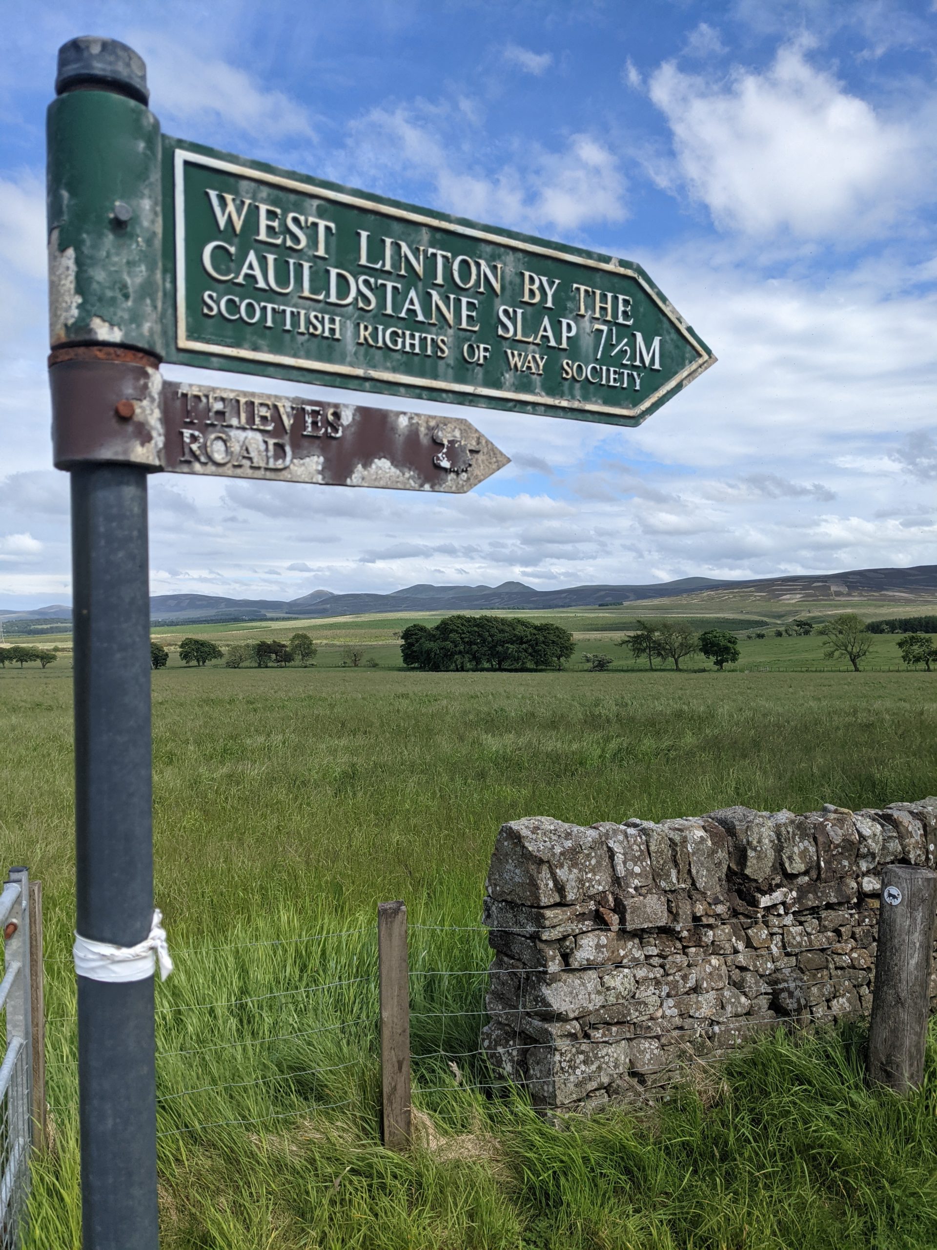
    We then descended to a car park to join the start of the Cross Borders Drove Road which took us back up and over Cauldstane Slap.

    By this point I was tired and in some pain from the blisters, but we completed our first marathon day pitching up to wild camp just at the top of thieves road in a field. It did not take long for the midges to sniff us out and this would be the start of our second serious midge encounter.

  • “Oh you’re one of those”

    “Oh you’re one of those”

    Day 21: Fort William to Kinlochleven

    ? 22km

    ?167m

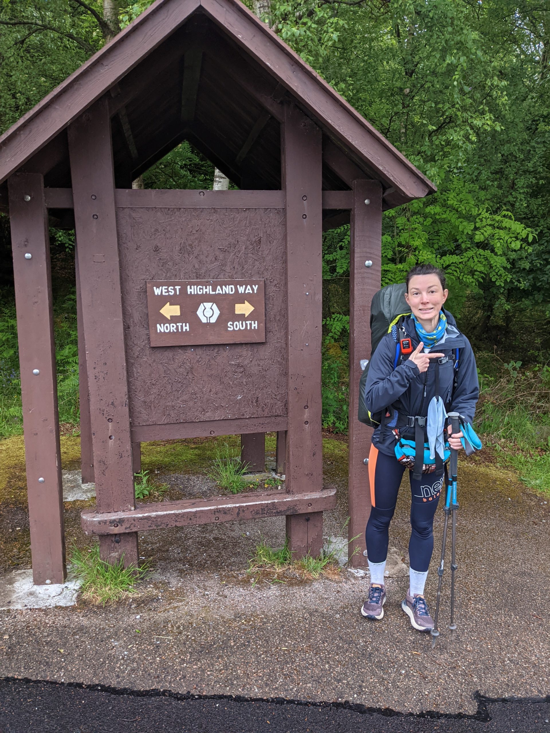
    Today we started the West Highland Way going southbound. Established in 1980, it starts in Milgavie, north west of Glasgow, and finishes in Fort William and is 96 miles long. It is a well established route and very popular, but we would be walking against the crowds.

    The West Highland Way

    We woke early and snuck in a last shower before heading out the campsite. Despite knowing we will be going through towns fairly frequently from now on we both still got stupidly carried away in Morrisons the day before and my backpack was worryingly heavy.

    We joined the route out the site and followed it’s gradual ascent up through the forests and along the forestry roads. The cloud was very low and soon we were in it, with the light rain upon us, jackets were on but we were a bit late with the waterproof trousers. About 09:00 we came across our first walkers coming towards us who asked us how much longer they had to go until the end. After this there was then a steady stream of people some happy and excited it was the last day, some smiling through gritted teeth and a couple who were obviously not having a great time. The rain got a bit heavier before easing off for the rest of the day. The views through the valley were lovely and we made good pace despite significant ascent as there was zero navigation to be done. 

    Blurry Wet

    We had both picked up new shoes from Fort William so we’re nervous but in the end pleased how they were doing for us after 23KM.

    We stopped just before town to eat our lunch, some left over pizza from the day before, and then decended into the town passing some late starters and mountain bikers on our way down.

    We arrived about 14:30 to the wooden hut we had booked. Basically a shed with bunk beds in, that you put your own sleeping bag on but it was the power sockets that you really pay for. We showered because we could, and it was quiet, then headed to The Bothy Bar to update the blog and read about what was to come ahead on the route.

    We had the best burger yet for dinner and another sticky toffee pudding. Time to start a sticky toffee leader board, another column in Tom’s spreadsheet added. ?

    Day 22: Kinlochleven to Inveroran

    ? 32km

    ?902m

    Leaving our pod it was dry, but the mist was looming. We left Kinlochleven via a big service road parallel with some hydro power pipes. About 10 vehicles, a mixture of trucks and land rovers, passed us on the way up to start their day but we never saw where they ended up as we then came off the road onto a much nicer trail. By this point it had started to rain quite heavily and was blowing into our right side. We were basically in the cloud, but walking along a decent path towards devil’s staircase.
    We put an extra layer on just before popping over the top where a group of 4 ladies were celebrating reaching the top from the other side.

    The rain had eased off a bit and we descended devil’s staircase carefully as we met a few people coming up. They were from all over and all abilities including a lady carrying a bike.
    We then reached the main road and the path traversed nicely along it so we didn’t have to contend with any traffic, it was narrow here however and we had to wait for several people to pass by. As with the day before there was such a variety of enjoyment on the faces that came towards us. We followed the road for quite a way and stopped at the super plush Kingshouse, for a tea and hot chocolate.

    Before Descending Devil’s Staircase

    Then we set off out into the drizzle and it didn’t stop, I was fully waterproofed up Tom had opted for shorts and waterproof top because it was not actually that cold temperature wise.
    We walked almost up to Glen Coe ski resort and then followed a very boring cobbly road that ran through Rannock Moor, we were head on into the wind so the rain felt worse than it probably was but it was safe to say we were pretty soggy, and after several km’s I finally figured out that the funny taste was the smidge being washed off my face by the rain. We passed several soggy faces on the way through, including a lovely lady in her late sixties who joked about how boring it would be to hike in the sunshine and when we told her what we were up to she said ‘oh you are one of those’, she was absolutely delightful.
    We approached the Inveroran Hotel, and set the tent up in the dedicated ‘wild camping’ spot before continuing with our bags to the bar. We were drenched and glad for a chance to dry out which kept the barman busy mopping up our puddles. We sat with a cuppa for me and a pint for Tom before pre ordering beef and Guinness pie for supper, which was amazing!!

    Day 23: Inveroran to Strathfillan

    ? 21km

    ?438m

    We were rudely woken in the night by some car horn honking and more rain but generally had a good night’s sleep in our ‘wild camping’ spot.
    Next door a young group of 4 had set an early 05:45 alarm and were up negotiating thier morning logistics soon after. We snoozed our 06:00 alarm since it was raining, and started to get ready just before 07:00. Wrapping up in waterproofs expecting the worst, we packed up our tent and were first out of camp and pleased to find it was actually windy and dry.

    Cloud Slowly Lifting

    We made our way back passed the hotel that we had dinner at and climbed a steady up and over to avoid the road, reaching Bridge of Orchy where there was nothing much but a big hotel and the railway station. We went under the railway and then continued on a wide gravel track along the tracks, passing those who had started the day early as well. The path was very similar most of the way and we just avoided ascending into the cloud and therefore even though the wind was in our faces we stayed dry.
    After about 14km of very similar path with unfortunately little view, because of the low cloud, we arrived at Tydrumn. We couldn’t resist a cup of tea and hot chocolate at the Green Wellie Stop, an American style service station with toilets and gift shop. We have visited one before on a previous trip to Loch Ness and thought they were hilariously great.

    We then looked at our next few days and the food we had available, booked Sunday Roast in Dryman and decided to have lunch down the road and save our waffle and jam lunches for our big day along Loch Lomond on Saturday. So we made the 500m journey down the road to The Real Food Cafe for a burger, after which we headed out again arrived at our camp spot within the hour and got the tent up minutes before the first rain of the day came down.

    When I took my shoes off I fustratingly found a blister on each heel, lower down than where I was getting pain before and wondered if the new shoes had a different pinch point. Looks like the Compeed will be on for the next few days and hope it won’t make the harder ground to come more painful than it already will be. Tonight is our first DIY evening meal and we have a combination of Pot Noodle with Broccoli, then Tea Loaf and custard for pudding.
    Beautiful Evening Sun